Estimated Value: $282,000 - $331,000
2
Beds
2
Baths
1,327
Sq Ft
$225/Sq Ft
Est. Value
About This Home
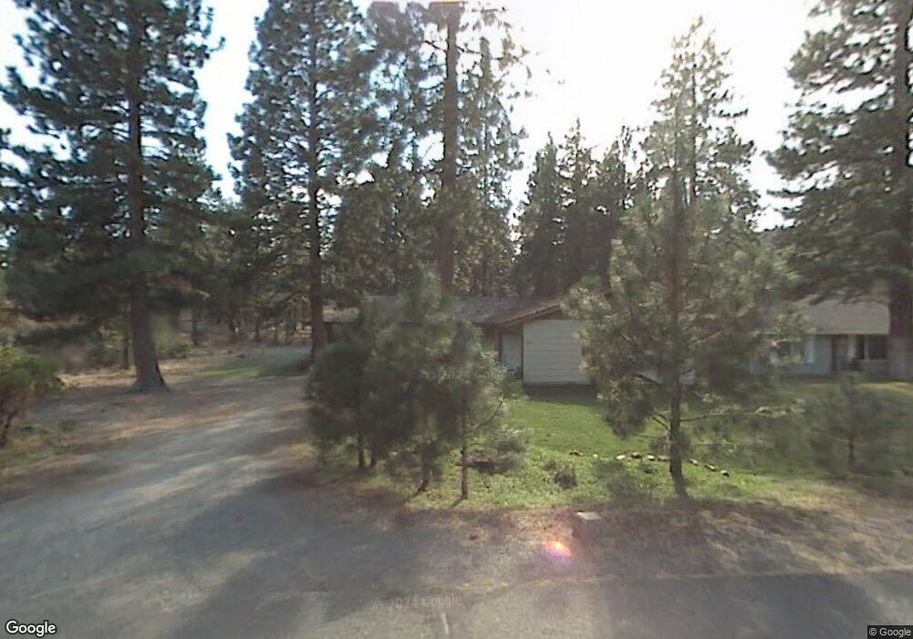
This home is located at 5917 Brown Ct, Weed, CA 96094 and is currently estimated at $298,723, approximately $225 per square foot. 5917 Brown Ct is a home located in Siskiyou County with nearby schools including Butteville Elementary School and Weed High School.
Ownership History
Date
Name
Owned For
Owner Type
Purchase Details
Closed on
Mar 9, 2023
Sold by
Lomonaco Sharon Ann
Bought by
Sharon Ann Lomonaco 2023 Revocable Trust
Current Estimated Value
Purchase Details
Closed on
Nov 23, 2004
Sold by
Forslund Eleanor J
Bought by
Forslund Sharon
Home Financials for this Owner
Home Financials are based on the most recent Mortgage that was taken out on this home.
Original Mortgage
$81,250
Interest Rate
5.7%
Mortgage Type
Seller Take Back
Purchase Details
Closed on
May 17, 2004
Sold by
Nielsen Eleanor J
Bought by
Forslund Eleanor J
Create a Home Valuation Report for This Property
The Home Valuation Report is an in-depth analysis detailing your home's value as well as a comparison with similar homes in the area
Home Values in the Area
Average Home Value in this Area
Purchase History
| Date | Buyer | Sale Price | Title Company |
|---|---|---|---|
| Sharon Ann Lomonaco 2023 Revocable Trust | -- | -- | |
| Forslund Sharon | $101,500 | Mount Shasta Title & Escrow | |
| Forslund Eleanor J | -- | -- |
Source: Public Records
Mortgage History
| Date | Status | Borrower | Loan Amount |
|---|---|---|---|
| Previous Owner | Forslund Sharon | $81,250 |
Source: Public Records
Tax History Compared to Growth
Tax History
| Year | Tax Paid | Tax Assessment Tax Assessment Total Assessment is a certain percentage of the fair market value that is determined by local assessors to be the total taxable value of land and additions on the property. | Land | Improvement |
|---|---|---|---|---|
| 2025 | $1,454 | $141,110 | $27,867 | $113,243 |
| 2023 | $1,454 | $135,633 | $26,786 | $108,847 |
| 2022 | $1,397 | $132,974 | $26,261 | $106,713 |
| 2021 | $1,373 | $130,368 | $25,747 | $104,621 |
| 2020 | $1,362 | $129,032 | $25,483 | $103,549 |
| 2019 | $1,335 | $126,503 | $24,984 | $101,519 |
| 2018 | $1,308 | $124,024 | $24,495 | $99,529 |
| 2017 | $1,285 | $121,593 | $24,015 | $97,578 |
| 2016 | $1,260 | $119,210 | $23,545 | $95,665 |
| 2015 | $1,243 | $117,421 | $23,192 | $94,229 |
| 2014 | $1,219 | $115,122 | $22,738 | $92,384 |
Source: Public Records
Map
Nearby Homes
- Unit 5-3 Lot 46 Brown Ct Unit 5-3
- 5-3/277 Palmer Dr Unit 5-3
- 5-3/276 Palmer Dr Unit 5-3
- Unit 5 Lot 12 Palmer Dr Unit 5
- 5845 Floyd Ct
- Lot 8 - 9 Harney Ct
- Unit 5-3 Lot 7 Wood Ct Unit 5-3
- 0 Zen Mountain Unit 20250745
- 17344 Harney Ct
- 7-3/37 & 38 Possum Ct Unit 7-3
- 17309 Blocker Ct
- 17325 Nicklaus Ct
- 17406 Possum Way Unit 7-3
- 17330 Gilbert Ct
- 5318 Muskrat Rd
- 5-3 Lot 141 Hogan Dr Unit 5-3
- 5-3 Lot 162 Hogan Dr Unit 5-3
- Lots 186/187 Hogan Dr Unit 5-3
- Lot 88 Hogan Dr Unit 7-1
- 5720 Snead Ct
- 5911 Brown Ct
- 0 Brown Ct
- 5-3/43 Brown Ct Unit 5-3
- 5918 Brown Ct
- 5930 Brown Ct
- Unit 5-4 L Palmer Dr
- Unit 5-4 L Palmer Dr Unit 5-4
- Unit 5-3 Lot 277 Palmer Unit 5-3
- Lot 277 Palmer Dr Unit 5-3
- Lot 41 Palmer Dr
- lot 26 Palmer Dr Unit 5
- Unit 7-3 Lot 2 Palmer Dr
- 0 Palmer Dr Unit 98-57574
- 0 Palmer Dr Unit 98-57572
- 0 Palmer Dr Unit OC24162132
- 0 Palmer Dr Unit OC23197930
- 0 Palmer Dr Unit 20230255
- 5/34 Palmer Dr Unit 3
- Unit 5-4 Lot 77 Palmer Dr
- 0 Palmer Dr Unit 7-3