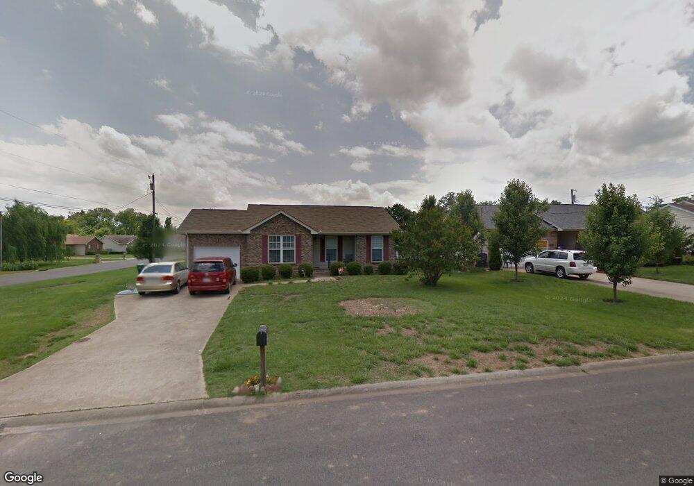
592 Cory Dr Clarksville, TN 37040
Estimated Value: $228,000 - $253,000
Studio
2
Baths
1,160
Sq Ft
$206/Sq Ft
Est. Value
About This Home
This home is located at 592 Cory Dr, Clarksville, TN 37040 and is currently estimated at $239,353, approximately $206 per square foot. 592 Cory Dr is a home located in Montgomery County with nearby schools including Glenellen Elementary School, Northeast Middle School, and Northeast High School.
Ownership History
Date
Name
Owned For
Owner Type
Purchase Details
Closed on
Aug 24, 2012
Sold by
Mumma Frank E
Bought by
Romero Juan R and Romero Starla G
Current Estimated Value
Home Financials for this Owner
Home Financials are based on the most recent Mortgage that was taken out on this home.
Original Mortgage
$112,313
Outstanding Balance
$77,291
Interest Rate
3.53%
Mortgage Type
VA
Estimated Equity
$162,062
Purchase Details
Closed on
Oct 31, 1997
Sold by
Randall Hargis
Bought by
Mumma Frank E
Create a Home Valuation Report for This Property
The Home Valuation Report is an in-depth analysis detailing your home's value as well as a comparison with similar homes in the area
Purchase History
| Date | Buyer | Sale Price | Title Company |
|---|---|---|---|
| Romero Juan R | $109,950 | -- | |
| Mumma Frank E | $73,500 | -- |
Source: Public Records
Mortgage History
| Date | Status | Borrower | Loan Amount |
|---|---|---|---|
| Open | Romero Juan R | $112,313 |
Source: Public Records
Tax History
| Year | Tax Paid | Tax Assessment Tax Assessment Total Assessment is a certain percentage of the fair market value that is determined by local assessors to be the total taxable value of land and additions on the property. | Land | Improvement |
|---|---|---|---|---|
| 2024 | $1,651 | $54,650 | $0 | $0 |
| 2023 | $1,629 | $30,875 | $0 | $0 |
| 2022 | $1,303 | $30,875 | $0 | $0 |
| 2021 | $1,303 | $30,875 | $0 | $0 |
| 2020 | $1,241 | $30,875 | $0 | $0 |
| 2019 | $1,241 | $30,875 | $0 | $0 |
| 2018 | $1,171 | $23,175 | $0 | $0 |
| 2017 | $337 | $27,175 | $0 | $0 |
| 2016 | $834 | $27,175 | $0 | $0 |
| 2015 | $834 | $27,175 | $0 | $0 |
| 2014 | $1,130 | $27,175 | $0 | $0 |
| 2013 | $1,148 | $26,200 | $0 | $0 |
Source: Public Records
Map
Nearby Homes
- 2714 Turner Ln
- 792 Cherrybark Ln
- 2809 Sparrow Dr
- 2722 Ann Dr
- 759 Needmore Rd
- 508 Ruby Dr
- 2819 Sparrow Dr
- 0 Ann Dr
- 291 Smithson Ln
- 287 Smithson Ln
- 171 Sambar Dr
- 2808 Thrush Dr
- 267 Smithson Ln
- 455 Needmore Rd Unit 2
- 405 Andean Ct
- 2758 N Whitfield Rd
- 2329 Spike Ct
- 2413 Pea Ridge Rd
- 905 Applegrove Cir
- 2397 Pea Ridge Rd
- 594 Cory Dr
- 2678 Derby Dr
- 596 Cory Dr
- 586 Cory Dr
- 2676 Derby Dr
- 593 Cory Dr
- 595 Cory Dr
- 591 Cory Dr
- 2679 Derby Dr
- 597 Cory Dr
- 0 Trenton Unit 1392727
- 0 Trenton Unit 1621155
- 0 Trenton Unit 1666272
- 0 Trenton Unit 1392789
- 0 Trenton Unit 1694695
- 0 Trenton Unit 1753750
- 0 Trenton Unit 1770018
- 0 Trenton Unit 2264248
- 0 Trenton Unit 2114924
- 0 Trenton Unit 2049790
Your Personal Tour Guide
Ask me questions while you tour the home.