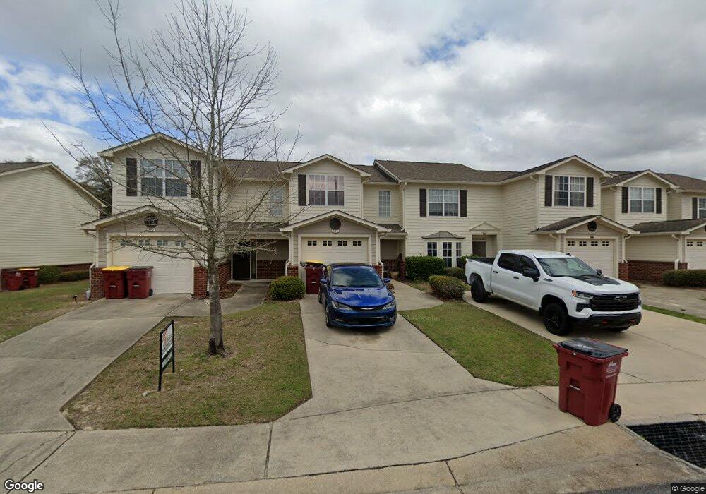
592 Wingspan Way Crestview, FL 32536
Estimated Value: $177,000 - $206,000
2
Beds
3
Baths
1,264
Sq Ft
$154/Sq Ft
Est. Value
About This Home
This home is located at 592 Wingspan Way, Crestview, FL 32536 and is currently estimated at $194,907, approximately $154 per square foot. 592 Wingspan Way is a home located in Okaloosa County with nearby schools including Antioch Elementary School, Shoal River Middle School, and Crestview High School.
Ownership History
Date
Name
Owned For
Owner Type
Purchase Details
Closed on
Mar 27, 2018
Sold by
Eagles Landign Community Association Inc
Bought by
Censabella Kimberly M
Current Estimated Value
Purchase Details
Closed on
Jul 24, 2012
Sold by
The Fidelity Land Trust Company Llc
Bought by
The Sunshine State Land Trust Company Ll and Trust #000137
Purchase Details
Closed on
Apr 13, 2012
Sold by
Grant Robert E and Grant Peggy J
Bought by
The Fidelity Land Trust Company Llc and Trust #000137
Purchase Details
Closed on
May 11, 2007
Sold by
Eagles Landing Development Co Llc
Bought by
Grant Robert E and Grant Peggy J
Home Financials for this Owner
Home Financials are based on the most recent Mortgage that was taken out on this home.
Original Mortgage
$144,900
Interest Rate
6.12%
Mortgage Type
Unknown
Create a Home Valuation Report for This Property
The Home Valuation Report is an in-depth analysis detailing your home's value as well as a comparison with similar homes in the area
Home Values in the Area
Average Home Value in this Area
Purchase History
| Date | Buyer | Sale Price | Title Company |
|---|---|---|---|
| Censabella Kimberly M | $82,100 | Attorney | |
| The Sunshine State Land Trust Company Ll | -- | None Available | |
| The Fidelity Land Trust Company Llc | -- | None Available | |
| Grant Robert E | $144,900 | Attorney |
Source: Public Records
Mortgage History
| Date | Status | Borrower | Loan Amount |
|---|---|---|---|
| Previous Owner | Grant Robert E | $144,900 |
Source: Public Records
Tax History Compared to Growth
Tax History
| Year | Tax Paid | Tax Assessment Tax Assessment Total Assessment is a certain percentage of the fair market value that is determined by local assessors to be the total taxable value of land and additions on the property. | Land | Improvement |
|---|---|---|---|---|
| 2024 | $2,324 | $179,979 | $20,000 | $159,979 |
| 2023 | $2,324 | $174,839 | $20,000 | $154,839 |
| 2022 | $2,084 | $150,745 | $20,000 | $130,745 |
| 2021 | $1,768 | $105,545 | $10,000 | $95,545 |
| 2020 | $1,678 | $100,912 | $10,000 | $90,912 |
| 2019 | $1,529 | $89,879 | $10,000 | $79,879 |
| 2018 | $1,392 | $81,041 | $0 | $0 |
| 2017 | $1,295 | $74,432 | $0 | $0 |
| 2016 | $570 | $69,808 | $0 | $0 |
| 2015 | $583 | $69,323 | $0 | $0 |
| 2014 | $1,159 | $69,169 | $0 | $0 |
Source: Public Records
Map
Nearby Homes
- 552 Wingspan Way
- 800 Majestic Dr
- 731 Majestic Dr
- 727 Majestic Dr
- 729 Majestic Dr
- 537 Wingspan Way
- 789 Majestic Dr
- 512 Wingspan Way
- 903 Twain Ln
- 133 Wild Horse Dr
- 394 Riverchase Blvd
- 407 Apple Dr
- 217 Lustan Dr
- 312 Apple Dr
- 527 Tom Sawyer Ln
- 4446 Antioch Rd
- 203 Riverchase Blvd
- 111 Paddle Wheel Cove
- 321 Apple
- 2801 Tallgrass Ct
- 594 Wingspan Way
- 590 Wingspan Way
- 596 Wingspan Way
- 598 Wingspan Way
- 586 Wingspan Way
- 600 Wingspan Way
- 584 Wingspan Way
- 582 Wingspan Way
- 606 Wingspan Way
- 580 Wingspan Way
- 593 Wingspan Way
- 595 Wingspan Way
- 591 Wingspan Way
- 597 Wingspan Way
- 599 Wingspan Way
- 608 Wingspan Way
- 608 Wingspan Way Unit 608
- 578 Wingspan Way
- 589 Wingspan Way
- 601 Wingspan Way