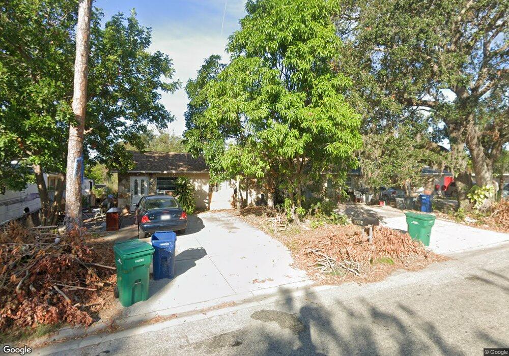
5920 1st St E Unit A Bradenton, FL 34203
Oneco NeighborhoodEstimated Value: $302,000 - $445,000
3
Beds
4
Baths
2,072
Sq Ft
$168/Sq Ft
Est. Value
About This Home
This home is located at 5920 1st St E Unit A, Bradenton, FL 34203 and is currently estimated at $347,294, approximately $167 per square foot. 5920 1st St E Unit A is a home located in Manatee County with nearby schools including Blanche H. Daughtrey Elementary School, W. D. Sugg Middle School, and Bayshore High School.
Ownership History
Date
Name
Owned For
Owner Type
Purchase Details
Closed on
Aug 16, 1999
Sold by
Seeds Clifton
Bought by
Robinson Susan
Current Estimated Value
Purchase Details
Closed on
Jun 29, 1998
Sold by
Jacob Ernst Erich Oscar and Jacob Ulrike Jutta Elise
Bought by
Covenant Prop Inc
Home Financials for this Owner
Home Financials are based on the most recent Mortgage that was taken out on this home.
Original Mortgage
$110,000
Interest Rate
6.92%
Create a Home Valuation Report for This Property
The Home Valuation Report is an in-depth analysis detailing your home's value as well as a comparison with similar homes in the area
Home Values in the Area
Average Home Value in this Area
Purchase History
| Date | Buyer | Sale Price | Title Company |
|---|---|---|---|
| Robinson Susan | -- | -- | |
| Covenant Prop Inc | $45,000 | -- | |
| Covenant Prop Inc | $90,000 | -- |
Source: Public Records
Mortgage History
| Date | Status | Borrower | Loan Amount |
|---|---|---|---|
| Open | Robinson Susan | $101,943 | |
| Previous Owner | Covenant Prop Inc | $110,000 | |
| Previous Owner | Covenant Prop Inc | $55,000 |
Source: Public Records
Tax History Compared to Growth
Tax History
| Year | Tax Paid | Tax Assessment Tax Assessment Total Assessment is a certain percentage of the fair market value that is determined by local assessors to be the total taxable value of land and additions on the property. | Land | Improvement |
|---|---|---|---|---|
| 2025 | $3,159 | $194,857 | -- | -- |
| 2024 | $3,159 | $245,967 | -- | -- |
| 2023 | $2,969 | $230,585 | $0 | $0 |
| 2022 | $2,560 | $185,069 | $0 | $0 |
| 2021 | $2,223 | $156,509 | $0 | $0 |
| 2020 | $2,144 | $145,307 | $22,000 | $123,307 |
| 2019 | $2,128 | $142,328 | $30,000 | $112,328 |
| 2018 | $1,987 | $131,112 | $25,000 | $106,112 |
| 2017 | $1,582 | $96,000 | $0 | $0 |
Source: Public Records
Map
Nearby Homes
- 408 60th Avenue Dr W
- 165 Guava Cir
- 175 Guava Cir Unit 181
- 20 Peach Ave Unit 288
- 188 Guava Cir Unit 194
- 3 Date Ave
- 18 Date Ave Unit 163
- 267 Coconut St
- 300 Apricot St
- 331 Avocado St Unit 73
- 27 Harvest St
- 316 Avacado St
- 270 Coconut St
- 5723 5th St E
- 5719 5th St E Unit A or B
- 256 Coconut St
- 603 63rd Ave W Unit E-1
- 603 63rd Ave W Unit L6
- 603 63rd Ave W Unit S 10
- 603 63rd Ave W Unit Q018
- 5924 1st St E Unit A B
- 5924 1st St E Unit A
- 5916 1st St E Unit A
- 104 59th Avenue Dr E
- 5912 1st St E Unit A
- 5928 1st St E Unit A
- 5923 1st St E Unit A
- 5911 2nd St W
- 5913 2nd St W
- 5932 1st St E Unit A
- 5908 1st St E Unit A
- 5907 2nd St W
- 5927 1st St E Unit A
- 5907 1st St E
- 115 60th Ave W
- 5931 1st St E
- 5931 1st St E Unit A
- 5931 1st St E Unit B
- 107 59th Avenue Dr E
- 107 59th Avenue Dr E Unit A & B