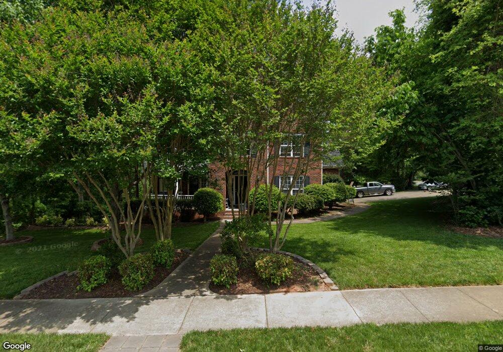
5926 Crown Hill Dr Mint Hill, NC 28227
Estimated Value: $637,711 - $693,000
3
Beds
4
Baths
3,898
Sq Ft
$171/Sq Ft
Est. Value
About This Home
This home is located at 5926 Crown Hill Dr, Mint Hill, NC 28227 and is currently estimated at $664,678, approximately $170 per square foot. 5926 Crown Hill Dr is a home located in Mecklenburg County with nearby schools including Clear Creek Elementary, Northeast Middle, and Independence High.
Ownership History
Date
Name
Owned For
Owner Type
Purchase Details
Closed on
Jun 28, 2001
Sold by
The Dublin Building Group Ltd
Bought by
Fisher Samuel L and Fisher Virginia D
Current Estimated Value
Home Financials for this Owner
Home Financials are based on the most recent Mortgage that was taken out on this home.
Original Mortgage
$244,000
Outstanding Balance
$94,031
Interest Rate
7.14%
Estimated Equity
$570,647
Create a Home Valuation Report for This Property
The Home Valuation Report is an in-depth analysis detailing your home's value as well as a comparison with similar homes in the area
Home Values in the Area
Average Home Value in this Area
Purchase History
| Date | Buyer | Sale Price | Title Company |
|---|---|---|---|
| Fisher Samuel L | $305,000 | -- |
Source: Public Records
Mortgage History
| Date | Status | Borrower | Loan Amount |
|---|---|---|---|
| Open | Fisher Samuel L | $244,000 |
Source: Public Records
Tax History Compared to Growth
Tax History
| Year | Tax Paid | Tax Assessment Tax Assessment Total Assessment is a certain percentage of the fair market value that is determined by local assessors to be the total taxable value of land and additions on the property. | Land | Improvement |
|---|---|---|---|---|
| 2025 | -- | $538,300 | $110,000 | $428,300 |
| 2024 | -- | $538,300 | $110,000 | $428,300 |
| 2023 | $3,061 | $538,300 | $110,000 | $428,300 |
| 2022 | $3,061 | $351,100 | $65,000 | $286,100 |
| 2021 | $3,101 | $351,100 | $65,000 | $286,100 |
| 2020 | $3,101 | $351,100 | $65,000 | $286,100 |
| 2019 | $3,095 | $351,100 | $65,000 | $286,100 |
| 2018 | $3,232 | $293,100 | $39,200 | $253,900 |
| 2017 | $3,206 | $293,100 | $39,200 | $253,900 |
| 2016 | $3,203 | $293,100 | $39,200 | $253,900 |
| 2015 | $3,199 | $293,100 | $39,200 | $253,900 |
| 2014 | $3,401 | $311,900 | $58,000 | $253,900 |
Source: Public Records
Map
Nearby Homes
- 9721 Julliard Dr
- 9601 Twin Falls Ct
- 9901 Candlehill Dr
- 8531 Willhill Rd
- 9450 Surface Hill Rd
- 8416 Olde Stonegate Ln
- 8409 Olde Stonegate Ln
- 6040 Wilgrove Mint Hill Rd
- 6141 Wilgrove Mint Hill Rd
- 1565 Nia Rd
- 8524 Anette Ave
- 10100 Cromarty Ln
- 9526 Goldsmith Ln
- 7528 Lancashire Dr
- 1216 Nia Rd
- 7717 Davis Rd
- 9637 Haying Place
- 1157 Nia Rd
- 9703 Ardley Park Way Unit 23
- 18221 Middle Springs Ln
- 5918 Crown Hill Dr
- 8721 Willhill Rd
- 6012 Crown Hill Dr
- 6001 Crown Hill Dr
- 8709 Willhill Rd
- 5910 Crown Hill Dr
- 9620 Broken Arrow Ct
- 6013 Crown Hill Dr
- 9716 Julliard Dr
- 9700 Blackbird Hill Ln
- 8700 Willhill Rd
- 8700 Willhill Rd Unit 53
- 5900 Crown Hill Dr
- 6023 Crown Hill Dr
- 5901 Crown Hill Dr
- 9607 Broken Arrow Ct
- 9612 Broken Arrow Ct
- 9800 Julliard Dr
- 9710 Blackbird Hill Ln
- 9711 Julliard Dr