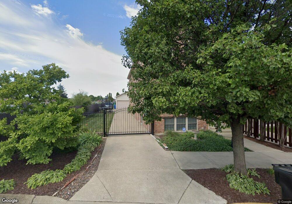
5926 S Menard Ave Chicago, IL 60638
Garfield Ridge NeighborhoodEstimated Value: $443,000 - $529,000
3
Beds
3
Baths
2,474
Sq Ft
$197/Sq Ft
Est. Value
About This Home
This home is located at 5926 S Menard Ave, Chicago, IL 60638 and is currently estimated at $486,360, approximately $196 per square foot. 5926 S Menard Ave is a home located in Cook County with nearby schools including Kinzie Elementary School, Kennedy High School, and St. Symphorosa Catholic School.
Ownership History
Date
Name
Owned For
Owner Type
Purchase Details
Closed on
Feb 10, 2025
Sold by
Skol Larry Wayne and Skol Catherine
Bought by
Larry Wayne Skol And Catherine Skol Trust and Skol
Current Estimated Value
Purchase Details
Closed on
Apr 20, 2017
Sold by
Skol Larry Wayne and Skol Catherine
Bought by
Skol Larry Wayne and Skol Catherine
Purchase Details
Closed on
Jan 17, 2017
Sold by
Skol Larry and Skol Cate
Bought by
Skol Larry Wayne and Skol Catherine
Create a Home Valuation Report for This Property
The Home Valuation Report is an in-depth analysis detailing your home's value as well as a comparison with similar homes in the area
Home Values in the Area
Average Home Value in this Area
Purchase History
| Date | Buyer | Sale Price | Title Company |
|---|---|---|---|
| Larry Wayne Skol And Catherine Skol Trust | -- | None Listed On Document | |
| Skol Larry Wayne | -- | Attorney | |
| Skol Larry Wayne | -- | Attorney |
Source: Public Records
Tax History Compared to Growth
Tax History
| Year | Tax Paid | Tax Assessment Tax Assessment Total Assessment is a certain percentage of the fair market value that is determined by local assessors to be the total taxable value of land and additions on the property. | Land | Improvement |
|---|---|---|---|---|
| 2024 | $6,182 | $45,631 | $6,517 | $39,114 |
| 2023 | $6,355 | $33,281 | $5,819 | $27,462 |
| 2022 | $6,355 | $35,000 | $5,819 | $29,181 |
| 2021 | $6,234 | $34,999 | $5,818 | $29,181 |
| 2020 | $6,314 | $32,067 | $4,655 | $27,412 |
| 2019 | $6,894 | $38,430 | $4,655 | $33,775 |
| 2018 | $6,777 | $38,430 | $4,655 | $33,775 |
| 2017 | $6,528 | $34,373 | $4,189 | $30,184 |
| 2016 | $6,241 | $34,373 | $4,189 | $30,184 |
| 2015 | $5,681 | $34,373 | $4,189 | $30,184 |
| 2014 | $5,449 | $32,669 | $3,956 | $28,713 |
| 2013 | $5,327 | $32,669 | $3,956 | $28,713 |
Source: Public Records
Map
Nearby Homes
- 6005 S Menard Ave
- 5917 W 59th St
- 6016 S Mayfield Ave
- 5814 S Massasoit Ave
- 6058 S Massasoit Ave
- 6037 S Mason Ave
- 6109 S Monitor Ave
- 6111 S Menard Ave
- 5810 S Austin Ave
- 5700 S Monitor Ave
- 6212 S Major Ave
- 5914 S Meade Ave
- 6152 S Austin Ave
- 6122 W 59th St
- 5727 S Meade Ave
- 6004 S Moody Ave
- 6204 S Mcvicker Ave
- 6252 S Mason Ave Unit 3B
- 6201 S Meade Ave
- 6220 S Mcvicker Ave
- 5924 S Menard Ave
- 5922 S Menard Ave
- 5918 S Menard Ave
- 5929 S Monitor Ave
- 5914 S Menard Ave
- 5923 S Monitor Ave
- 5921 S Monitor Ave
- 5919 S Monitor Ave
- 5915 S Monitor Ave
- 5803 W 59th St
- 5807 W 59th St
- 5809 W 59th St
- 5801 W 59th St
- 5811 W 59th St
- 5802 W 60th St
- 5806 W 60th St
- 5815 W 59th St
- 5800 W 60th St
- 5810 W 60th St
- 5812 W 60th St