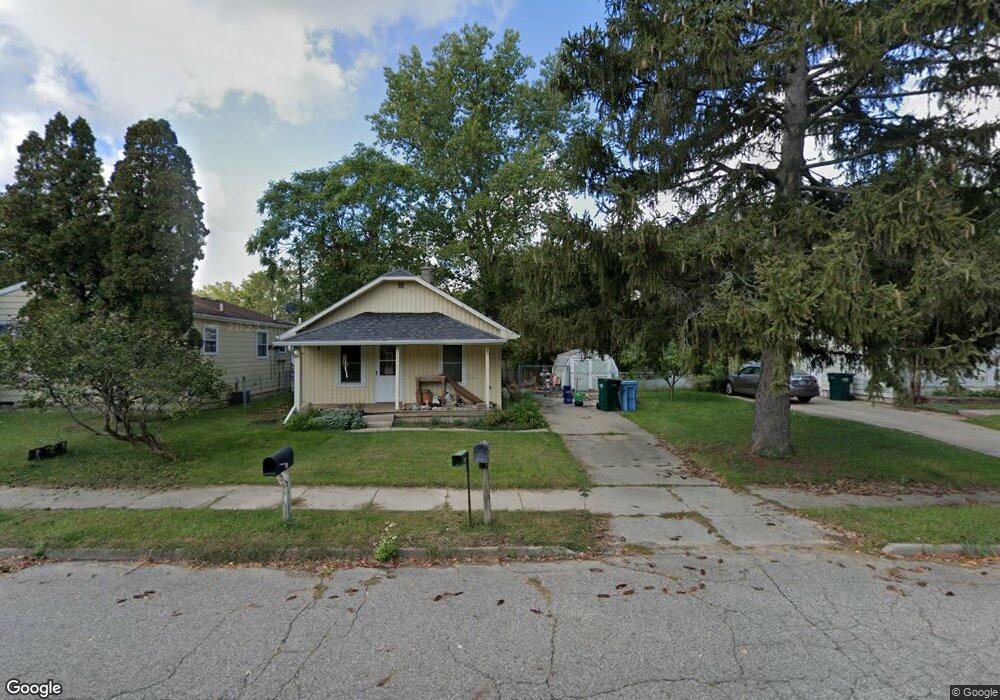
5928 Pheasant Ave Lansing, MI 48911
Southern Lansing NeighborhoodEstimated Value: $80,951 - $139,000
2
Beds
1
Bath
1,219
Sq Ft
$87/Sq Ft
Est. Value
About This Home
This home is located at 5928 Pheasant Ave, Lansing, MI 48911 and is currently estimated at $106,238, approximately $87 per square foot. 5928 Pheasant Ave is a home located in Ingham County with nearby schools including Reo Elementary School, Attwood School, and Everett High School.
Ownership History
Date
Name
Owned For
Owner Type
Purchase Details
Closed on
Mar 21, 2007
Sold by
Berthold Alana M and Timmons Alana M
Bought by
Beck Erica L
Current Estimated Value
Home Financials for this Owner
Home Financials are based on the most recent Mortgage that was taken out on this home.
Original Mortgage
$34,320
Outstanding Balance
$20,830
Interest Rate
6.31%
Mortgage Type
Purchase Money Mortgage
Estimated Equity
$85,408
Purchase Details
Closed on
May 6, 1997
Sold by
Barber Warren L and Barber Dora E
Bought by
Timmons Alana
Create a Home Valuation Report for This Property
The Home Valuation Report is an in-depth analysis detailing your home's value as well as a comparison with similar homes in the area
Home Values in the Area
Average Home Value in this Area
Purchase History
| Date | Buyer | Sale Price | Title Company |
|---|---|---|---|
| Beck Erica L | $42,900 | Metropolitan Title Company | |
| Timmons Alana | $33,000 | -- |
Source: Public Records
Mortgage History
| Date | Status | Borrower | Loan Amount |
|---|---|---|---|
| Open | Beck Erica L | $34,320 |
Source: Public Records
Tax History
| Year | Tax Paid | Tax Assessment Tax Assessment Total Assessment is a certain percentage of the fair market value that is determined by local assessors to be the total taxable value of land and additions on the property. | Land | Improvement |
|---|---|---|---|---|
| 2025 | $1,266 | $45,400 | $5,800 | $39,600 |
| 2024 | $9 | $36,200 | $5,800 | $30,400 |
| 2023 | $1,190 | $31,000 | $5,800 | $25,200 |
| 2022 | $1,078 | $26,400 | $4,100 | $22,300 |
| 2021 | $1,056 | $23,300 | $4,100 | $19,200 |
| 2020 | $1,049 | $21,400 | $4,100 | $17,300 |
| 2019 | $1,002 | $19,000 | $4,100 | $14,900 |
| 2018 | $943 | $15,800 | $4,100 | $11,700 |
| 2017 | $902 | $15,800 | $4,100 | $11,700 |
| 2016 | $875 | $15,200 | $4,100 | $11,100 |
| 2015 | $875 | $14,500 | $8,111 | $6,389 |
| 2014 | $875 | $14,500 | $12,617 | $1,883 |
Source: Public Records
Map
Nearby Homes
- 2411 Bliesener St
- 5838 S Martin Luther King Junior Blvd
- 5650 Hughes Rd
- 6037 Hughes Rd
- 3220 W Miller Rd
- 5902 Haag Rd
- 2918 Midwood St
- 2416 Midwood St
- 1406 Weymouth Ct
- 1309 Penrod Ct
- 0 Midwood St
- 5641 Ashley Dr
- 2706 W Jolly Rd
- 1020 R G Curtiss Ave
- 4927 Starr Ave
- 4928 Hughes Rd
- 5017 Christiansen Rd
- 1006 Attwood Dr
- 5129 Wexford Rd
- 2700 Eaton Rapids Road #193 Rd
- 2300 Newark Ave
- 5918 Pheasant Ave
- 2314 Newark Ave
- 5931 Pheasant Ave
- 5914 Pheasant Ave
- 2220 Newark Ave
- 5921 Pheasant Ave
- 2320 Newark Ave
- 6006 Pheasant Ave
- 2317 Newark Ave
- 2219 Newark Ave
- 2315 Webster St
- 5907 Pheasant Ave
- 2321 Webster St
- 5900 Pheasant Ave
- 6014 Pheasant Ave
- 5926 Piper Ave
- 5920 Piper Ave
- 6013 Pheasant Ave
Your Personal Tour Guide
Ask me questions while you tour the home.