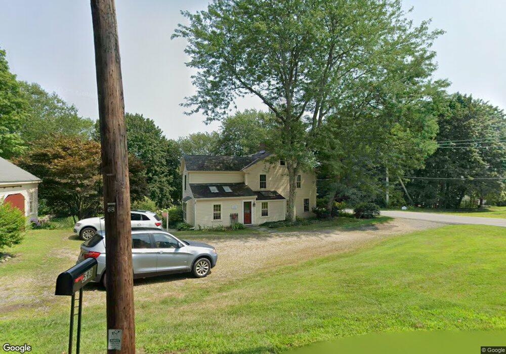
593 Middle Rd Boxborough, MA 01719
Estimated Value: $932,000 - $1,014,000
3
Beds
3
Baths
2,550
Sq Ft
$383/Sq Ft
Est. Value
About This Home
This home is located at 593 Middle Rd, Boxborough, MA 01719 and is currently estimated at $976,180, approximately $382 per square foot. 593 Middle Rd is a home located in Middlesex County with nearby schools including Acton-Boxborough Regional High School.
Ownership History
Date
Name
Owned For
Owner Type
Purchase Details
Closed on
Oct 11, 2017
Sold by
Bernard Andrew D and Minudri Trena M
Bought by
2017 Bernard-Minudri F
Current Estimated Value
Purchase Details
Closed on
Oct 6, 2008
Sold by
Behrstock David P and Behrstock Coolidge-Behrstock E
Bought by
Bernard Andrew D and Minudri Trena M
Home Financials for this Owner
Home Financials are based on the most recent Mortgage that was taken out on this home.
Original Mortgage
$388,000
Interest Rate
6.54%
Mortgage Type
Purchase Money Mortgage
Purchase Details
Closed on
Aug 24, 1999
Sold by
Hood Christopher I and Hood Sharon R
Bought by
Behrstock David P and Behrstock Coolidge-Behrstock E
Create a Home Valuation Report for This Property
The Home Valuation Report is an in-depth analysis detailing your home's value as well as a comparison with similar homes in the area
Home Values in the Area
Average Home Value in this Area
Purchase History
| Date | Buyer | Sale Price | Title Company |
|---|---|---|---|
| 2017 Bernard-Minudri F | -- | -- | |
| Bernard Andrew D | $485,000 | -- | |
| Behrstock David P | $383,000 | -- |
Source: Public Records
Mortgage History
| Date | Status | Borrower | Loan Amount |
|---|---|---|---|
| Previous Owner | Behrstock David P | $391,500 | |
| Previous Owner | Behrstock David P | $396,000 | |
| Previous Owner | Bernard Andrew D | $388,000 |
Source: Public Records
Tax History
| Year | Tax Paid | Tax Assessment Tax Assessment Total Assessment is a certain percentage of the fair market value that is determined by local assessors to be the total taxable value of land and additions on the property. | Land | Improvement |
|---|---|---|---|---|
| 2025 | $12,616 | $833,300 | $275,100 | $558,200 |
| 2024 | $11,698 | $780,400 | $264,400 | $516,000 |
| 2023 | $10,721 | $690,800 | $217,900 | $472,900 |
| 2022 | $11,246 | $645,600 | $217,900 | $427,700 |
| 2020 | $10,161 | $607,700 | $217,900 | $389,800 |
| 2019 | $9,978 | $607,700 | $217,900 | $389,800 |
| 2018 | $4,036 | $568,400 | $207,800 | $360,600 |
| 2017 | $9,294 | $552,900 | $207,800 | $345,100 |
| 2016 | $8,798 | $537,800 | $207,800 | $330,000 |
| 2015 | $8,320 | $499,700 | $187,100 | $312,600 |
| 2014 | $8,433 | $476,700 | $181,600 | $295,100 |
Source: Public Records
Map
Nearby Homes
- 79 Old Orchard Ln
- 50 Spencer Rd Unit 12L
- 15 Spencer Rd Unit 12E
- 53 Swanson Ct Unit 24C
- 959 Hill Rd
- 220 Swanson Rd Unit 605
- 220 Swanson Rd Unit 606
- 220 Swanson Rd Unit 604
- 20 Lyons Ln Unit 20
- 77 Wheeler Dr Unit 77
- 36 Leonard Rd
- 276 Codman Hill Rd Unit 36A
- 310 Codman Hill Rd Unit 35D
- 40 Fifers Ln
- 4 Old Meadow Ln
- 8 Woodchuck Hill Rd
- 4 Littlefield Rd
- 13 Pine Hill Way
- 14 Pine Hill Way
- 119 Taylor St
Your Personal Tour Guide
Ask me questions while you tour the home.