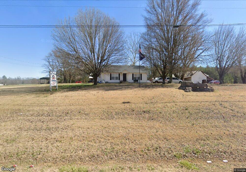
5930 Highway 128 Savannah, TN 38372
Estimated Value: $176,000 - $286,000
--
Bed
1
Bath
1,026
Sq Ft
$228/Sq Ft
Est. Value
About This Home
This home is located at 5930 Highway 128, Savannah, TN 38372 and is currently estimated at $234,155, approximately $228 per square foot. 5930 Highway 128 is a home located in Hardin County with nearby schools including Hardin County High School.
Ownership History
Date
Name
Owned For
Owner Type
Purchase Details
Closed on
Dec 13, 2012
Sold by
American Forestry Llc
Bought by
Jones Chris
Current Estimated Value
Purchase Details
Closed on
Apr 1, 2005
Sold by
Lewis James A
Bought by
American Forestry Llc
Purchase Details
Closed on
Aug 23, 2000
Bought by
Lewis James Allen
Purchase Details
Closed on
Aug 17, 1999
Sold by
Marshall Lewis James
Bought by
Lewis James A
Home Financials for this Owner
Home Financials are based on the most recent Mortgage that was taken out on this home.
Original Mortgage
$30,494
Interest Rate
7.5%
Purchase Details
Closed on
Aug 27, 1997
Bought by
Lewis James Marshall
Purchase Details
Closed on
Aug 4, 1977
Bought by
Crocker Vardaman and Crocker Ruby
Create a Home Valuation Report for This Property
The Home Valuation Report is an in-depth analysis detailing your home's value as well as a comparison with similar homes in the area
Home Values in the Area
Average Home Value in this Area
Purchase History
| Date | Buyer | Sale Price | Title Company |
|---|---|---|---|
| Jones Chris | -- | -- | |
| American Forestry Llc | $80,274 | -- | |
| Lewis James Allen | $10,000 | -- | |
| Lewis James A | $29,951 | -- | |
| Lewis James Marshall | $37,000 | -- | |
| Crocker Vardaman | -- | -- |
Source: Public Records
Mortgage History
| Date | Status | Borrower | Loan Amount |
|---|---|---|---|
| Previous Owner | Crocker Vardaman | $30,494 |
Source: Public Records
Tax History Compared to Growth
Tax History
| Year | Tax Paid | Tax Assessment Tax Assessment Total Assessment is a certain percentage of the fair market value that is determined by local assessors to be the total taxable value of land and additions on the property. | Land | Improvement |
|---|---|---|---|---|
| 2024 | $1,800 | $102,840 | $14,800 | $88,040 |
| 2023 | $1,800 | $102,840 | $14,800 | $88,040 |
| 2022 | $1,452 | $70,480 | $6,680 | $63,800 |
| 2021 | $1,310 | $70,480 | $6,680 | $63,800 |
| 2020 | $1,310 | $63,600 | $6,680 | $56,920 |
| 2019 | $1,310 | $63,600 | $6,680 | $56,920 |
| 2018 | $1,266 | $63,600 | $6,680 | $56,920 |
| 2017 | $1,148 | $55,200 | $6,680 | $48,520 |
| 2016 | $1,148 | $55,200 | $6,680 | $48,520 |
| 2015 | $1,005 | $55,200 | $6,680 | $48,520 |
| 2014 | $1,005 | $55,200 | $6,680 | $48,520 |
Source: Public Records
Map
Nearby Homes
- 61 Tulip Ln
- 865 Sylvan Dr
- 1031 Ridge Rd
- 175 Drake Loop
- 144 Deer Ln
- 480 Dodd Dr
- 160 Clement Dr
- 275 Dodd Dr
- 1910 Hamburg Loop
- LT 138 Bandit Way
- 470 Bandit Way
- 225 Nixon Loop
- 725 One Stop Dr
- 230 Silver Water Ln
- 255 Easley Loop
- 440 Pyburns Dr
- 2870 Highway 226
- 255 Gammill Ln
- 185 Branch Estate Ln
- 255 Rock Pile Ln
- 65 Darlington Dr
- 95 Sunset Dr
- 45 Galloway Cove
- 170 Galloway Cove
- 175 Sunset Dr
- 145 Embassy Cove
- 5745 Highway 128
- 5681 Tennessee 128 Unit Jones hwy 128 nixon
- 5680 Highway 128
- 6190 Highway 128
- 225 Darlington Dr
- 120 Darlington Dr
- 5675 Highway 128
- 0 Sylvan Dr
- 00 Sylvan Dr
- 78 Sylvan Dr
- 255 Embassy Cove
- 305 Sunset Dr
- 275 Embassy Cove
- 320 Darlington Dr
