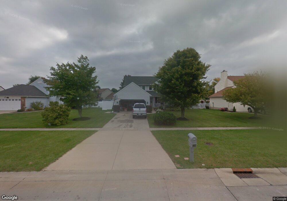
5931 Oak Point Rd Lorain, OH 44053
Estimated Value: $299,395 - $355,000
3
Beds
3
Baths
1,700
Sq Ft
$191/Sq Ft
Est. Value
About This Home
This home is located at 5931 Oak Point Rd, Lorain, OH 44053 and is currently estimated at $325,099, approximately $191 per square foot. 5931 Oak Point Rd is a home located in Lorain County with nearby schools including Powers Elementary School, Walter G. Nord Middle School, and Amherst Junior High School.
Ownership History
Date
Name
Owned For
Owner Type
Purchase Details
Closed on
May 26, 2010
Sold by
Deleon Frank G
Bought by
Mcdougle Kristyne M and Walter Jacob C
Current Estimated Value
Home Financials for this Owner
Home Financials are based on the most recent Mortgage that was taken out on this home.
Original Mortgage
$120,655
Outstanding Balance
$82,936
Interest Rate
5.5%
Mortgage Type
FHA
Estimated Equity
$242,163
Purchase Details
Closed on
Jul 30, 1999
Sold by
Deleon Margaret A
Bought by
Deleon Frank G
Purchase Details
Closed on
Jun 15, 1995
Sold by
Henken John G
Bought by
Deleon Frank G and Deleon Margaret A
Home Financials for this Owner
Home Financials are based on the most recent Mortgage that was taken out on this home.
Original Mortgage
$138,650
Interest Rate
8.27%
Mortgage Type
VA
Create a Home Valuation Report for This Property
The Home Valuation Report is an in-depth analysis detailing your home's value as well as a comparison with similar homes in the area
Home Values in the Area
Average Home Value in this Area
Purchase History
| Date | Buyer | Sale Price | Title Company |
|---|---|---|---|
| Mcdougle Kristyne M | $135,000 | None Available | |
| Deleon Frank G | -- | -- | |
| Deleon Frank G | $135,968 | -- |
Source: Public Records
Mortgage History
| Date | Status | Borrower | Loan Amount |
|---|---|---|---|
| Open | Mcdougle Kristyne M | $120,655 | |
| Closed | Deleon Frank G | $138,650 |
Source: Public Records
Tax History
| Year | Tax Paid | Tax Assessment Tax Assessment Total Assessment is a certain percentage of the fair market value that is determined by local assessors to be the total taxable value of land and additions on the property. | Land | Improvement |
|---|---|---|---|---|
| 2024 | $3,385 | $81,445 | $21,000 | $60,445 |
| 2023 | $2,996 | $60,795 | $13,808 | $46,988 |
| 2022 | $2,875 | $60,795 | $13,808 | $46,988 |
| 2021 | $2,883 | $60,795 | $13,808 | $46,988 |
| 2020 | $2,886 | $53,940 | $12,250 | $41,690 |
| 2019 | $2,831 | $53,940 | $12,250 | $41,690 |
| 2018 | $2,845 | $53,940 | $12,250 | $41,690 |
| 2017 | $2,584 | $46,400 | $9,980 | $36,420 |
| 2016 | $2,565 | $46,400 | $9,980 | $36,420 |
| 2015 | $2,479 | $46,400 | $9,980 | $36,420 |
| 2014 | $2,617 | $48,840 | $10,500 | $38,340 |
| 2013 | $2,625 | $48,840 | $10,500 | $38,340 |
Source: Public Records
Map
Nearby Homes
- 5913 Oak Point Rd
- 6048 Audriana Way
- 5946 N Mayflower Dr
- 6041 Audriana Way
- 6163 Krystina Run
- 6162 James Dr
- 6187 Krystina Run
- 6194 James Dr
- 110 Beaver Creek Trail
- 109 Beaver Creek Trail
- 320 Pebble Creek Ct
- 122 Eagle Cir
- 173 Eagle Cir
- 47785 Cooper Foster Park Rd
- 6215 Hidden Creek Dr Unit 116
- VL Winter Foe Trail
- 6231 Hidden Creek Dr Unit 233
- 110 Habant Dr
- 1011 N Main St
- 703 N Main St
- 5929 Oak Point Rd
- 5933 Oak Point Rd
- 5950 Province Ct
- 5925 Oak Point Rd
- 5937 Oak Point Rd
- 5946 Province Ct
- 5951 Province Ct
- 5939 Oak Point Rd
- 5923 Oak Point Rd
- 5942 Province Ct
- 5947 Province Ct
- 5921 Oak Point Rd
- 6100 S Mayflower Dr
- 5951 Colony Ct
- 5941 Oak Point Rd
- 5980 S Mayflower Dr
- 5922 Oak Point Rd
- 5926 Province Ct
- 5945 Colony Ct
- 5925 Province Ct
Your Personal Tour Guide
Ask me questions while you tour the home.