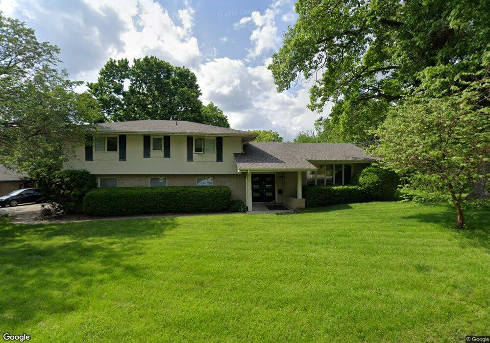
5931 Windsor Dr Des Moines, IA 50312
Waveland Woods NeighborhoodEstimated Value: $428,000 - $477,629
4
Beds
3
Baths
2,483
Sq Ft
$179/Sq Ft
Est. Value
About This Home
This home is located at 5931 Windsor Dr, Des Moines, IA 50312 and is currently estimated at $444,657, approximately $179 per square foot. 5931 Windsor Dr is a home located in Polk County with nearby schools including Windsor Elementary School, Merrill Middle School, and Roosevelt High School.
Ownership History
Date
Name
Owned For
Owner Type
Purchase Details
Closed on
Sep 27, 2011
Sold by
Mccauley Michael C and Mccauley Kristin D
Bought by
Lozier Richard W and Lozier Kathryn G
Current Estimated Value
Home Financials for this Owner
Home Financials are based on the most recent Mortgage that was taken out on this home.
Original Mortgage
$241,300
Outstanding Balance
$164,893
Interest Rate
4.14%
Mortgage Type
New Conventional
Estimated Equity
$279,764
Purchase Details
Closed on
Apr 28, 2007
Sold by
Rabinovitz Rosa B
Bought by
Mccauley Michael C and Mccauley Kristin D
Home Financials for this Owner
Home Financials are based on the most recent Mortgage that was taken out on this home.
Original Mortgage
$214,600
Interest Rate
6.2%
Mortgage Type
Purchase Money Mortgage
Create a Home Valuation Report for This Property
The Home Valuation Report is an in-depth analysis detailing your home's value as well as a comparison with similar homes in the area
Home Values in the Area
Average Home Value in this Area
Purchase History
| Date | Buyer | Sale Price | Title Company |
|---|---|---|---|
| Lozier Richard W | $253,500 | None Available | |
| Mccauley Michael C | $214,500 | None Available |
Source: Public Records
Mortgage History
| Date | Status | Borrower | Loan Amount |
|---|---|---|---|
| Open | Lozier Richard W | $241,300 | |
| Previous Owner | Mccauley Michael C | $214,600 |
Source: Public Records
Tax History Compared to Growth
Tax History
| Year | Tax Paid | Tax Assessment Tax Assessment Total Assessment is a certain percentage of the fair market value that is determined by local assessors to be the total taxable value of land and additions on the property. | Land | Improvement |
|---|---|---|---|---|
| 2024 | $8,278 | $431,300 | $55,400 | $375,900 |
| 2023 | $8,204 | $431,300 | $55,400 | $375,900 |
| 2022 | $8,140 | $357,000 | $47,600 | $309,400 |
| 2021 | $8,082 | $357,000 | $47,600 | $309,400 |
| 2020 | $8,392 | $332,500 | $44,100 | $288,400 |
| 2019 | $7,884 | $332,500 | $44,100 | $288,400 |
| 2018 | $7,800 | $301,900 | $39,100 | $262,800 |
| 2017 | $7,000 | $301,900 | $39,100 | $262,800 |
| 2016 | $6,814 | $267,300 | $34,100 | $233,200 |
| 2015 | $6,814 | $267,300 | $34,100 | $233,200 |
| 2014 | $6,288 | $254,500 | $31,200 | $223,300 |
Source: Public Records
Map
Nearby Homes
- 1050 57th St
- 1117 63rd St
- 1010 56th St
- 720 63rd St
- 1064 56th St
- 1129 57th St
- 6420 Center St
- 686 63rd St
- 6750 School St Unit 205
- 6750 School St Unit 851
- 6750 School St Unit 206
- 731 56th St
- 5610 University Ave
- 1142 65th St
- 1236 63rd St
- 1003 68th St
- 6423 Carpenter Ave
- 1333 Cummins Pkwy
- 5723 Waterbury Cir
- 6015 Waterbury Cir
- 943 Cummins Pkwy
- 949 Cummins Pkwy
- 5915 Windsor Dr
- 5918 Windsor Dr
- 955 Cummins Pkwy
- 5932 Windsor Dr
- 961 Cummins Pkwy
- 5907 Windsor Dr
- 919 Cummins Pkwy
- 1001 Cummins Pkwy
- 932 59th St
- 5900 Windsor Dr
- 5901 Windsor Dr
- 1009 Cummins Pkwy
- 930 59th St
- 926 59th St
- 913 Cummins Pkwy
- 1010 59th St
- 1015 Cummins Pkwy
- 918 59th St