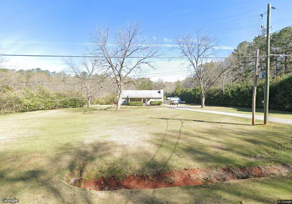
594 Vernon Ferry Rd Lagrange, GA 30240
Estimated Value: $211,000 - $241,000
3
Beds
2
Baths
1,429
Sq Ft
$158/Sq Ft
Est. Value
About This Home
This home is located at 594 Vernon Ferry Rd, Lagrange, GA 30240 and is currently estimated at $225,759, approximately $157 per square foot. 594 Vernon Ferry Rd is a home located in Troup County with nearby schools including Ethel W. Kight Elementary School, Hollis Hand Elementary School, and Franklin Forest Elementary School.
Ownership History
Date
Name
Owned For
Owner Type
Purchase Details
Closed on
Apr 22, 2004
Sold by
Arthur C Pettus
Bought by
Pettus Arthur C and Pettus Kari K
Current Estimated Value
Purchase Details
Closed on
Sep 9, 1992
Sold by
Jackie E Nix
Bought by
Arthur C Pettus
Purchase Details
Closed on
Jul 28, 1992
Sold by
Pettus Arthur Clarence
Bought by
Jackie E Nix
Purchase Details
Closed on
Dec 5, 1991
Sold by
Pettus Morgan
Bought by
Pettus Arthur Clarence
Purchase Details
Closed on
Oct 1, 1986
Sold by
Albie E Pettus
Bought by
Pettus Morgan
Purchase Details
Closed on
Aug 1, 1986
Sold by
Morgan Earl Pettus
Bought by
Albie E Pettus
Purchase Details
Closed on
Jan 1, 1970
Sold by
Hoyt V Strickland
Bought by
Morgan Earl Pettus
Create a Home Valuation Report for This Property
The Home Valuation Report is an in-depth analysis detailing your home's value as well as a comparison with similar homes in the area
Home Values in the Area
Average Home Value in this Area
Purchase History
| Date | Buyer | Sale Price | Title Company |
|---|---|---|---|
| Pettus Arthur C | -- | -- | |
| Arthur C Pettus | -- | -- | |
| Jackie E Nix | -- | -- | |
| Pettus Arthur Clarence | -- | -- | |
| Pettus Morgan | -- | -- | |
| Albie E Pettus | -- | -- | |
| Morgan Earl Pettus | -- | -- |
Source: Public Records
Tax History Compared to Growth
Tax History
| Year | Tax Paid | Tax Assessment Tax Assessment Total Assessment is a certain percentage of the fair market value that is determined by local assessors to be the total taxable value of land and additions on the property. | Land | Improvement |
|---|---|---|---|---|
| 2024 | $1,582 | $58,000 | $9,680 | $48,320 |
| 2023 | $1,581 | $57,960 | $9,680 | $48,280 |
| 2022 | $1,540 | $55,160 | $9,680 | $45,480 |
| 2021 | $1,460 | $48,400 | $9,600 | $38,800 |
| 2020 | $1,460 | $48,400 | $9,600 | $38,800 |
| 2019 | $1,432 | $47,480 | $8,000 | $39,480 |
| 2018 | $1,432 | $47,480 | $8,000 | $39,480 |
| 2017 | $1,432 | $47,480 | $8,000 | $39,480 |
| 2016 | $1,405 | $46,576 | $8,020 | $38,556 |
| 2015 | $1,300 | $43,048 | $8,020 | $35,028 |
| 2014 | $1,009 | $33,331 | $8,020 | $25,311 |
| 2013 | -- | $35,340 | $8,020 | $27,320 |
Source: Public Records
Map
Nearby Homes
- 709 Vernon Ferry Rd
- 0 Deming St Unit 10550189
- 103 Dogwood Ct
- LOT 4 Angela Dr
- E Angela Dr
- 104 Dogwood Point
- 4004 White Oak Ln
- 226 Linda Ln
- 135 Planters Ridge Dr
- 124 Foxdale Dr
- 200 Cheyenne Dr
- 190 Hill Rd
- 243 Oak Dr
- 102 Foxdale Dr
- 208 Highland Trail
- 146 Whitaker Rd
- 104 Spring Valley Dr
- 108 Spring Valley Dr
- 641 Whitaker Rd
- 117 Brookwood Dr
- 612 Vernon Ferry Rd
- 564 Vernon Ferry Rd
- 0 Bailey Rd Unit 7374388
- 599 Vernon Ferry Rd
- 626 Vernon Ferry Rd
- 609 Vernon Ferry Rd
- 169 Bailey Rd
- 500 River Club Dr
- 500 Riverside Dr
- 636 Vernon Ferry Rd
- 646 Vernon Ferry Rd
- 545 Vernon Ferry Rd
- 100 Bonny Oaks Dr
- 501 Riverside Dr
- 530 Vernon Ferry Rd
- 149 Bailey Rd
- 156 Bailey Rd
- 502 Riverside Dr
- 102 Bonny Oaks Dr Unit Lot 2
- 98 N Lake Dr