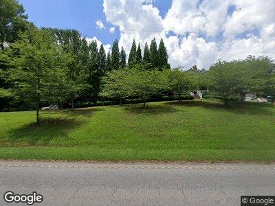
5943 N Highway 14 Landrum, SC 29356
Estimated Value: $569,000 - $869,000
3
Beds
3
Baths
3,135
Sq Ft
$222/Sq Ft
Est. Value
About This Home
This home is located at 5943 N Highway 14, Landrum, SC 29356 and is currently estimated at $696,538, approximately $222 per square foot. 5943 N Highway 14 is a home located in Greenville County with nearby schools including O.P. Earle Elementary School, Landrum Middle School, and Landrum High School.
Ownership History
Date
Name
Owned For
Owner Type
Purchase Details
Closed on
Oct 27, 2015
Sold by
Solesbee Benny W
Bought by
Solesbee Benny W and Solesbee Rena M
Current Estimated Value
Home Financials for this Owner
Home Financials are based on the most recent Mortgage that was taken out on this home.
Original Mortgage
$40,000
Outstanding Balance
$29,349
Interest Rate
3.89%
Mortgage Type
New Conventional
Estimated Equity
$605,152
Purchase Details
Closed on
Jul 5, 2005
Sold by
Apple Ridge Llc
Bought by
Solesbee Benny W
Purchase Details
Closed on
Jan 28, 2004
Sold by
Beasley Debra
Bought by
Apple Ridge Llc
Create a Home Valuation Report for This Property
The Home Valuation Report is an in-depth analysis detailing your home's value as well as a comparison with similar homes in the area
Home Values in the Area
Average Home Value in this Area
Purchase History
| Date | Buyer | Sale Price | Title Company |
|---|---|---|---|
| Solesbee Benny W | -- | None Available | |
| Solesbee Benny W | $10,000 | -- | |
| Apple Ridge Llc | $16,000 | -- |
Source: Public Records
Mortgage History
| Date | Status | Borrower | Loan Amount |
|---|---|---|---|
| Open | Solesbee Benny W | $40,000 | |
| Open | Solesbee Benny W | $221,500 | |
| Closed | Solesbee Benny W | $175,000 |
Source: Public Records
Tax History Compared to Growth
Tax History
| Year | Tax Paid | Tax Assessment Tax Assessment Total Assessment is a certain percentage of the fair market value that is determined by local assessors to be the total taxable value of land and additions on the property. | Land | Improvement |
|---|---|---|---|---|
| 2024 | $2,193 | $13,960 | $880 | $13,080 |
| 2023 | $2,193 | $13,960 | $880 | $13,080 |
| 2022 | $2,049 | $13,960 | $880 | $13,080 |
| 2021 | $2,029 | $13,960 | $880 | $13,080 |
| 2020 | $1,950 | $13,080 | $690 | $12,390 |
| 2019 | $1,938 | $13,080 | $690 | $12,390 |
| 2018 | $1,922 | $13,080 | $690 | $12,390 |
| 2017 | $1,891 | $13,080 | $690 | $12,390 |
| 2016 | $1,647 | $293,670 | $17,240 | $276,430 |
| 2015 | $1,642 | $293,670 | $17,240 | $276,430 |
| 2014 | $1,530 | $279,230 | $17,240 | $261,990 |
Source: Public Records
Map
Nearby Homes
- 101 Moccasin Way
- 557 Landseer Dr
- 553 Landseer Dr
- 569 Landseer Dr
- 561 Landseer Dr
- 573 Landseer Dr
- 565 Landseer Dr
- 00 Hawk Springs Dr
- 0 N Blackstock Rd
- 127 Pardo Rd
- 11585 New Cut Rd
- 320 Arledge Rd
- 11573 New Cut Rd
- 323 Arledge Rd
- 1515 S Blackstock Rd
- 226 State Road S-42-2985
- 216 Saint Andrews Blvd
- 140 Clearwater Rd
- 3 Pleasant Hill Rd
- 5943 N Highway 14
- 5939 N Highway 14
- 5989 N Highway 14
- 5960 N Highway 14
- 5923 N Highway 14
- 5923 S Carolina 14
- 5947 N Highway 14
- 5932 N Highway 14
- 100 Laurens Rd
- 5914 N Highway 14
- 5915 N Highway 14
- 000 Belue Mill Rd Unit 6
- 000 Belue Mill Rd Unit 5
- 00 00 Belue Mill Rd
- 00 Belue Mill Rd
- 000 Belue Mill Rd
- 103 Belue Mill Rd
- 118 Laurens Rd
- 1041 Highway 14 W
- 5928 N Highway 14
