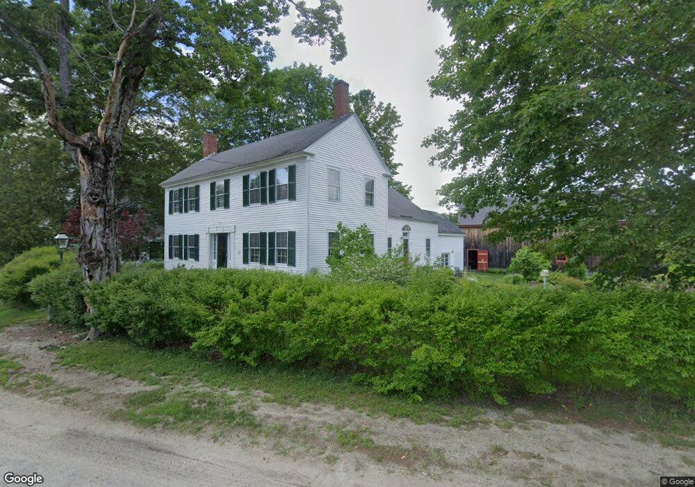
595 Center Rd Hillsborough, NH 03244
Hillsboro NeighborhoodEstimated Value: $536,058 - $582,000
3
Beds
2
Baths
2,785
Sq Ft
$199/Sq Ft
Est. Value
About This Home
This home is located at 595 Center Rd, Hillsborough, NH 03244 and is currently estimated at $555,265, approximately $199 per square foot. 595 Center Rd is a home located in Hillsborough County with nearby schools including Hillsboro-Deering Elementary School, Hillsboro-Deering High School, and Hillsboro Christian School.
Ownership History
Date
Name
Owned For
Owner Type
Purchase Details
Closed on
May 3, 2010
Sold by
Withington Richard W and Withington Robert N
Bought by
Larkin 3Rd James C and Larkin Claudia A
Current Estimated Value
Home Financials for this Owner
Home Financials are based on the most recent Mortgage that was taken out on this home.
Original Mortgage
$324,022
Interest Rate
4.99%
Mortgage Type
Purchase Money Mortgage
Create a Home Valuation Report for This Property
The Home Valuation Report is an in-depth analysis detailing your home's value as well as a comparison with similar homes in the area
Home Values in the Area
Average Home Value in this Area
Purchase History
| Date | Buyer | Sale Price | Title Company |
|---|---|---|---|
| Larkin 3Rd James C | $330,000 | -- |
Source: Public Records
Mortgage History
| Date | Status | Borrower | Loan Amount |
|---|---|---|---|
| Open | Larkin 3Rd James C | $315,928 | |
| Closed | Larkin 3Rd James C | $324,022 |
Source: Public Records
Tax History Compared to Growth
Tax History
| Year | Tax Paid | Tax Assessment Tax Assessment Total Assessment is a certain percentage of the fair market value that is determined by local assessors to be the total taxable value of land and additions on the property. | Land | Improvement |
|---|---|---|---|---|
| 2024 | $11,868 | $354,900 | $86,700 | $268,200 |
| 2023 | $11,080 | $354,900 | $86,700 | $268,200 |
| 2022 | $9,472 | $354,900 | $86,700 | $268,200 |
| 2021 | $10,269 | $355,100 | $86,700 | $268,400 |
| 2020 | $6,612 | $355,100 | $86,700 | $268,400 |
| 2018 | $9,074 | $307,600 | $61,400 | $246,200 |
| 2017 | $6,219 | $307,600 | $61,400 | $246,200 |
| 2016 | $9,080 | $307,600 | $61,400 | $246,200 |
| 2015 | $8,936 | $307,600 | $61,400 | $246,200 |
| 2014 | $8,477 | $307,600 | $61,400 | $246,200 |
| 2013 | $8,631 | $307,600 | $61,400 | $246,200 |
Source: Public Records
Map
Nearby Homes
- 447 Center Rd
- 0 Center Rd
- 32 Deerpoint Dr
- 17 Gould Pond Rd
- 44 Huntington Dr
- Lot 14 Old Mill Farm Rd
- 0 Huntington Dr Unit 373 4855140
- 0 Huntington Dr Unit 307 4855146
- 10 Melody Ln
- 32-33 Red Fox Crossing
- 17 Autumn Rd
- 37 Autumn Rd
- 50 Pine Glen Rd
- 0 Raccoon Alley Unit 86 4855473
- 0 Red Fox Crossing Unit 34 4858470
- 24 Raccoon Alley
- 0 Spring St Unit 178 4855470
- 0 Spring St Unit 178 4855319
- 9 Hillside St
- 11 Hillside St