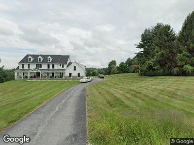
595 Deer Pointe Rd West Chester, PA 19382
Thornbury NeighborhoodEstimated Value: $722,000 - $1,315,000
4
Beds
6
Baths
5,876
Sq Ft
$196/Sq Ft
Est. Value
About This Home
This home is located at 595 Deer Pointe Rd, West Chester, PA 19382 and is currently estimated at $1,154,430, approximately $196 per square foot. 595 Deer Pointe Rd is a home located in Chester County with nearby schools including Westtown-Thornbury Elementary School, Stetson Middle School, and Bayard Rustin High School.
Ownership History
Date
Name
Owned For
Owner Type
Purchase Details
Closed on
Dec 26, 2001
Sold by
Picarelli Mark S and Picarelli Lori D
Bought by
Tague Christopher B and Tague Michele L
Current Estimated Value
Home Financials for this Owner
Home Financials are based on the most recent Mortgage that was taken out on this home.
Original Mortgage
$552,000
Interest Rate
7.04%
Create a Home Valuation Report for This Property
The Home Valuation Report is an in-depth analysis detailing your home's value as well as a comparison with similar homes in the area
Home Values in the Area
Average Home Value in this Area
Purchase History
| Date | Buyer | Sale Price | Title Company |
|---|---|---|---|
| Tague Christopher B | $242,500 | -- |
Source: Public Records
Mortgage History
| Date | Status | Borrower | Loan Amount |
|---|---|---|---|
| Open | Tague Michele L | $50,000 | |
| Open | Tague Michele L | $300,000 | |
| Closed | Tague Michele L | $187,100 | |
| Closed | Tague Christopher B | $220,000 | |
| Closed | Tague Christopher B | $552,000 |
Source: Public Records
Tax History Compared to Growth
Tax History
| Year | Tax Paid | Tax Assessment Tax Assessment Total Assessment is a certain percentage of the fair market value that is determined by local assessors to be the total taxable value of land and additions on the property. | Land | Improvement |
|---|---|---|---|---|
| 2024 | $12,441 | $444,610 | $103,590 | $341,020 |
| 2023 | $12,441 | $444,610 | $103,590 | $341,020 |
| 2022 | $12,006 | $434,890 | $103,590 | $331,300 |
| 2021 | $11,833 | $434,890 | $103,590 | $331,300 |
| 2020 | $11,753 | $434,890 | $103,590 | $331,300 |
| 2019 | $11,584 | $434,890 | $103,590 | $331,300 |
| 2018 | $11,328 | $434,890 | $103,590 | $331,300 |
| 2017 | $11,073 | $434,890 | $103,590 | $331,300 |
| 2016 | $11,826 | $404,150 | $103,590 | $300,560 |
| 2015 | $11,826 | $404,150 | $103,590 | $300,560 |
| 2014 | $11,826 | $404,150 | $103,590 | $300,560 |
Source: Public Records
Map
Nearby Homes
- 603 S Westbourne Rd
- 1275 Southgate Rd
- 3 Zachary Dr
- 1 Huntrise Ln
- 1174 Blenheim Rd
- 222 Green Tree Dr
- 1261 Buck Ln
- 123 E Street Rd
- 855 Meadow Croft Cir
- 1109 Fielding Dr
- 113 Forelock Ct
- 119 Augusta Dr
- 131 Stirrup Cir
- 129 Stirrup Cir
- 235 Caleb Dr Unit 19
- 1030 Carolyn Dr
- 186 Dilworthtown Rd
- 4 Judith Ln
- 1054 Kerwood Rd
- 149 Leadline Ln
- 595 Deer Pointe Rd
- 585 Deer Pointe Rd
- 505 Day Spring Ln
- 580 Deer Pointe Rd
- 515 Day Spring Ln
- 1200 S Concord Rd
- 570 Deer Pointe Rd
- 1260 S Concord Rd
- 575 Deer Pointe Rd
- 560 Deer Pointe Rd
- 1280 S Concord Rd
- 525 Day Spring Ln
- 510 Deer Pointe Rd
- 510 Day Spring Ln
- 440 Deer Pointe Rd
- 520 Day Spring Ln
- 520 Deer Pointe Rd
- 2 Crows Nest Cir
- 1225 Twaddell Dr
- 343 Old Bailey Ln