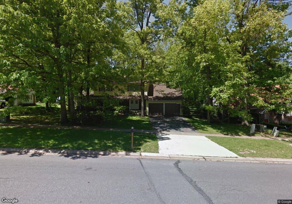
595 Devonshire Dr State College, PA 16803
Patton NeighborhoodEstimated Value: $465,216 - $512,000
4
Beds
3
Baths
2,908
Sq Ft
$167/Sq Ft
Est. Value
About This Home
This home is located at 595 Devonshire Dr, State College, PA 16803 and is currently estimated at $485,054, approximately $166 per square foot. 595 Devonshire Dr is a home located in Centre County with nearby schools including Park Forest Elementary School, Park Forest Middle School, and State College Area High School.
Ownership History
Date
Name
Owned For
Owner Type
Purchase Details
Closed on
Oct 26, 2010
Sold by
Curtis Wendy M
Bought by
Krol Peter J and Krol Erin E
Current Estimated Value
Home Financials for this Owner
Home Financials are based on the most recent Mortgage that was taken out on this home.
Original Mortgage
$225,463
Outstanding Balance
$149,664
Interest Rate
4.39%
Mortgage Type
FHA
Estimated Equity
$335,390
Purchase Details
Closed on
Aug 28, 2009
Sold by
Curtis Douglas A and Curtis Wendy M
Bought by
Curtis Wendy M
Create a Home Valuation Report for This Property
The Home Valuation Report is an in-depth analysis detailing your home's value as well as a comparison with similar homes in the area
Home Values in the Area
Average Home Value in this Area
Purchase History
| Date | Buyer | Sale Price | Title Company |
|---|---|---|---|
| Krol Peter J | $228,500 | None Available | |
| Curtis Wendy M | -- | None Available |
Source: Public Records
Mortgage History
| Date | Status | Borrower | Loan Amount |
|---|---|---|---|
| Open | Krol Peter J | $225,463 |
Source: Public Records
Tax History Compared to Growth
Tax History
| Year | Tax Paid | Tax Assessment Tax Assessment Total Assessment is a certain percentage of the fair market value that is determined by local assessors to be the total taxable value of land and additions on the property. | Land | Improvement |
|---|---|---|---|---|
| 2025 | $4,722 | $67,780 | $14,330 | $53,450 |
| 2024 | $4,405 | $67,780 | $14,330 | $53,450 |
| 2023 | $4,405 | $67,780 | $14,330 | $53,450 |
| 2022 | $4,299 | $67,780 | $14,330 | $53,450 |
| 2021 | $4,299 | $67,780 | $14,330 | $53,450 |
| 2020 | $4,299 | $67,780 | $14,330 | $53,450 |
| 2019 | $3,015 | $67,780 | $14,330 | $53,450 |
| 2018 | $4,168 | $67,780 | $14,330 | $53,450 |
| 2017 | $4,122 | $67,780 | $14,330 | $53,450 |
| 2016 | -- | $67,780 | $14,330 | $53,450 |
| 2015 | -- | $67,780 | $14,330 | $53,450 |
| 2014 | -- | $80,320 | $14,330 | $65,990 |
Source: Public Records
Map
Nearby Homes
- 637 Crandall Dr
- 592 Melissa Ln
- 661 Crandall Dr
- 2292 Oak Leaf Dr
- 1765 Cambridge Dr
- 1131 G W Aaron Dr
- 1141 W Aaron Dr Unit D
- 633 W Hillside Ave
- 234 Amblewood Way Unit 234
- 221 Abercorn St
- 1918 Weaver St Unit 5
- 539 Hillcrest Ave
- 257 Oakwood Ave
- 95 Greenmeadow Ln
- 1442 & 1450 W College Ave
- 2344 Autumnwood Dr
- 435 Ferguson Ave
- 293 Michael Rd
- 171 Manhasset Dr
- 619 Mckee St
- 597 Devonshire Dr
- 593 Devonshire Dr
- 468 Candlewood Dr
- 462 Candlewood Dr
- 448 Canterbury Dr
- 591 Devonshire Dr
- 596 Devonshire Dr
- 592 Devonshire Dr
- 456 Candlewood Dr
- 601 Devonshire Dr
- 467 Canterbury Dr
- 461 Canterbury Dr
- 463 Candlewood Dr
- 598 Devonshire Dr
- 602 Old Farm Ln
- 603 Old Farm Ln
- 442 Canterbury Dr
- 455 Canterbury Dr
- 450 Candlewood Dr
- 447 Candlewood Dr