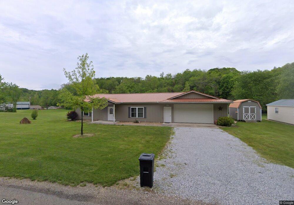
595 Maple Brook Rd New Concord, OH 43762
Estimated Value: $258,000 - $322,000
2
Beds
2
Baths
1,196
Sq Ft
$237/Sq Ft
Est. Value
About This Home
This home is located at 595 Maple Brook Rd, New Concord, OH 43762 and is currently estimated at $282,912, approximately $236 per square foot. 595 Maple Brook Rd is a home with nearby schools including New Concord Elementary School, East Muskingum Middle School, and Larry Miller Intermediate Elementary School.
Ownership History
Date
Name
Owned For
Owner Type
Purchase Details
Closed on
Jul 22, 2022
Sold by
Farrar Paul R and Farrar Helen L
Bought by
Gum Teresa and Gum Scott A
Current Estimated Value
Purchase Details
Closed on
Jun 16, 2004
Sold by
Farrar Paul Robert and Farrar Helen L
Bought by
Farrar Paul R and Farrar Helen L
Purchase Details
Closed on
Aug 15, 2003
Sold by
Ford Harold L and Ford Velma
Bought by
Farrar Paul R and Farrar Helen L
Purchase Details
Closed on
Jan 16, 1996
Sold by
Farrar Paul
Bought by
Ford Harold L and Ford Velma
Create a Home Valuation Report for This Property
The Home Valuation Report is an in-depth analysis detailing your home's value as well as a comparison with similar homes in the area
Home Values in the Area
Average Home Value in this Area
Purchase History
| Date | Buyer | Sale Price | Title Company |
|---|---|---|---|
| Gum Teresa | -- | None Listed On Document | |
| Farrar Paul R | -- | -- | |
| Farrar Paul R | $17,000 | -- | |
| Ford Harold L | $1,000 | -- |
Source: Public Records
Tax History
| Year | Tax Paid | Tax Assessment Tax Assessment Total Assessment is a certain percentage of the fair market value that is determined by local assessors to be the total taxable value of land and additions on the property. | Land | Improvement |
|---|---|---|---|---|
| 2024 | $1,769 | $53,165 | $11,480 | $41,685 |
| 2023 | $1,453 | $40,810 | $6,930 | $33,880 |
| 2022 | $1,419 | $40,670 | $6,790 | $33,880 |
| 2021 | $1,458 | $41,195 | $7,315 | $33,880 |
| 2020 | $1,255 | $34,335 | $6,090 | $28,245 |
| 2019 | $1,249 | $34,335 | $6,090 | $28,245 |
| 2018 | $717 | $35,175 | $6,930 | $28,245 |
| 2017 | $910 | $23,730 | $3,640 | $20,090 |
| 2016 | $570 | $3,080 | $3,080 | $0 |
| 2015 | $126 | $3,080 | $3,080 | $0 |
| 2013 | $139 | $3,080 | $3,080 | $0 |
Source: Public Records
Map
Nearby Homes
- 0 Homestead Dr Unit 11611647
- 0 Homestead Dr Unit 5174212
- 170 Thompson Ave
- 112 Thompson Ave
- 0 Rix Mills Rd
- 0 Maple Ln
- 160 N Liberty St
- 67 E Main St
- 110 Cherry Ln
- 135 S Moose Eye Rd
- 1420 Glenn Hwy
- 101 N Sundale Rd
- 10050 Norwich Dr
- 60999 Greenbriar Dr
- 61220 Kadon Dr
- 100 Linvale Dr
- 60040 Bliss Rd
- 9380 Pidcock Rd
- 515 Norwich Valley Rd
- 62132 Beech Circle Rd
- 0 Maple Brook Rd
- 0 Maplebrook Dr Unit 216028833
- 12330 Mckinley Dr
- 615 Maple Brook Rd
- 12320 Mckinley Dr
- 1060 Andy Dr
- 12340 Mckinley Dr
- 100 Maple Brook Rd
- 12345 Mckinley Dr
- 105 Maple Brook Rd
- 12731 East Pike
- 755 Maple Brook Rd
- 1030 Tammy Cir
- 12300 Tavenner Blvd
- 805 Maple Brook Rd
- 12335 Tavenner Blvd
- 1000 Tammy Cir
- 12735 East Pike
- 1080 Tammy Cir
- 845 Maple Brook Rd
Your Personal Tour Guide
Ask me questions while you tour the home.