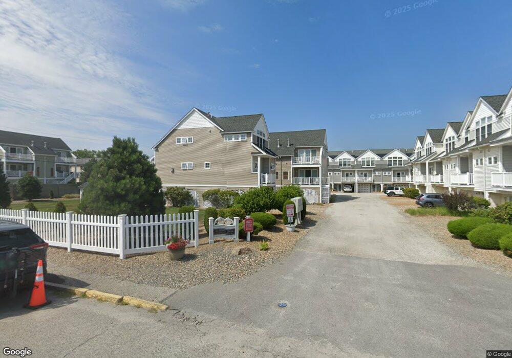
595 N End Blvd Unit 14 Salisbury, MA 01952
Estimated Value: $609,000 - $713,000
2
Beds
2
Baths
1,200
Sq Ft
$537/Sq Ft
Est. Value
About This Home
This home is located at 595 N End Blvd Unit 14, Salisbury, MA 01952 and is currently estimated at $644,471, approximately $537 per square foot. 595 N End Blvd Unit 14 is a home located in Essex County with nearby schools including Triton Regional High School.
Ownership History
Date
Name
Owned For
Owner Type
Purchase Details
Closed on
Jan 18, 2005
Sold by
Gorman Frank
Bought by
Lavin Clement W
Current Estimated Value
Home Financials for this Owner
Home Financials are based on the most recent Mortgage that was taken out on this home.
Original Mortgage
$277,000
Outstanding Balance
$140,407
Interest Rate
5.81%
Mortgage Type
Purchase Money Mortgage
Estimated Equity
$504,064
Create a Home Valuation Report for This Property
The Home Valuation Report is an in-depth analysis detailing your home's value as well as a comparison with similar homes in the area
Home Values in the Area
Average Home Value in this Area
Purchase History
| Date | Buyer | Sale Price | Title Company |
|---|---|---|---|
| Lavin Clement W | $369,900 | -- | |
| Lavin Clement W | $369,900 | -- |
Source: Public Records
Mortgage History
| Date | Status | Borrower | Loan Amount |
|---|---|---|---|
| Open | Lavin Clement W | $277,000 | |
| Closed | Lavin Clement W | $277,000 |
Source: Public Records
Tax History Compared to Growth
Tax History
| Year | Tax Paid | Tax Assessment Tax Assessment Total Assessment is a certain percentage of the fair market value that is determined by local assessors to be the total taxable value of land and additions on the property. | Land | Improvement |
|---|---|---|---|---|
| 2025 | $5,874 | $582,700 | $0 | $582,700 |
| 2024 | $4,691 | $448,900 | $0 | $448,900 |
| 2023 | $3,879 | $359,200 | $0 | $359,200 |
| 2022 | $3,922 | $352,100 | $0 | $352,100 |
| 2021 | $3,853 | $342,200 | $0 | $342,200 |
| 2020 | $3,891 | $339,500 | $0 | $339,500 |
| 2019 | $3,974 | $335,100 | $0 | $335,100 |
| 2018 | $4,148 | $352,100 | $0 | $352,100 |
| 2017 | $4,239 | $355,600 | $0 | $355,600 |
| 2016 | $4,033 | $345,600 | $0 | $345,600 |
| 2015 | $3,966 | $337,500 | $0 | $337,500 |
Source: Public Records
Map
Nearby Homes
- 595 N End Blvd Unit 2
- 308 State Route 286 Unit Lot 73
- 308 State Route 286 Unit Lot 108
- 308 State Route 286 Unit Lot 87
- 522 N End Blvd
- 498 N End Blvd
- 492 N End Blvd
- 479 N End Blvd
- 432 N End Blvd
- 308 Route 286 Unit 77
- 308 Route 286 Unit Lot 58
- 312 S Main St
- 9 Tyngsboro St
- 27 Cross Beach Rd
- 376 Ocean Blvd
- 10 Liberty St
- 18 River St
- 1 Old Salt Dr
- 188 N End Blvd Unit 3
- 178 N End Blvd Unit A
- 595 N End Blvd Unit 21
- 595 N End Blvd Unit 10
- 595 N End Blvd Unit 6
- 595 N End Blvd Unit 7
- 595 N End Blvd Unit 4
- 595 N End Blvd
- 595 N End Blvd Unit 12
- 595 N End Blvd Unit 15
- 595 N End Blvd Unit 11
- 595 N End Blvd Unit 20
- 595 N End Blvd Unit 22
- 595 N End Blvd Unit 16
- 595 N End Blvd Unit 9
- 595 N End Blvd Unit 3
- 595 N End Blvd Unit 5
- 595 N End Blvd Unit 1
- 595 N End Blvd
- 591 N End Blvd Unit 3
- 595 North End Blvd Unit 22
- 595 North End Blvd Unit 21