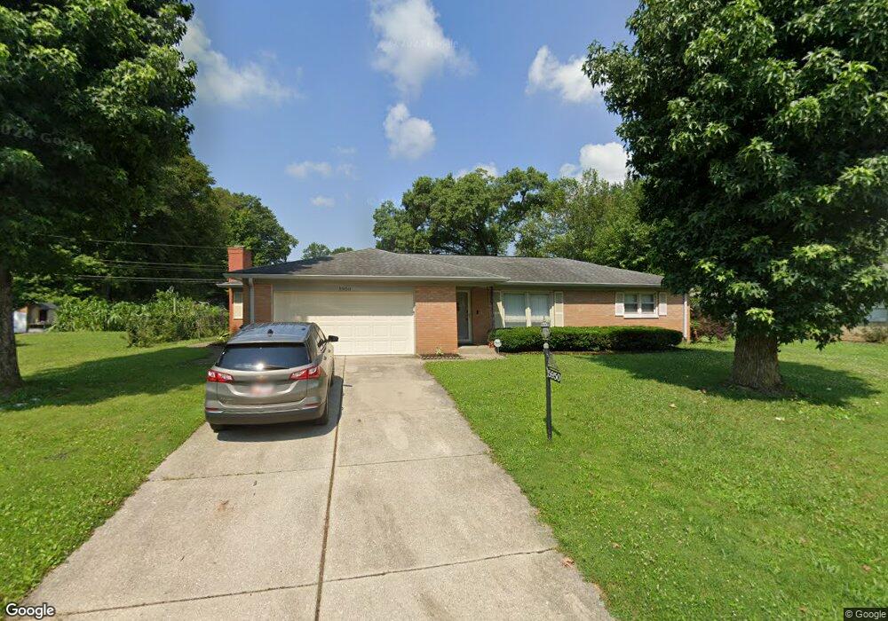
5950 Manning Rd Indianapolis, IN 46228
Snacks/Guion Creek NeighborhoodEstimated Value: $272,000 - $325,000
2
Beds
2
Baths
1,365
Sq Ft
$225/Sq Ft
Est. Value
About This Home
This home is located at 5950 Manning Rd, Indianapolis, IN 46228 and is currently estimated at $307,607, approximately $225 per square foot. 5950 Manning Rd is a home located in Marion County with nearby schools including Pike High School, The Children's House, and St. Monica Catholic School.
Ownership History
Date
Name
Owned For
Owner Type
Purchase Details
Closed on
Sep 12, 2006
Sold by
Mitchener Yvonne and Labudzik Jane M
Bought by
Rogers Jamie
Current Estimated Value
Home Financials for this Owner
Home Financials are based on the most recent Mortgage that was taken out on this home.
Original Mortgage
$99,500
Outstanding Balance
$59,460
Interest Rate
6.58%
Mortgage Type
New Conventional
Estimated Equity
$248,147
Create a Home Valuation Report for This Property
The Home Valuation Report is an in-depth analysis detailing your home's value as well as a comparison with similar homes in the area
Home Values in the Area
Average Home Value in this Area
Purchase History
| Date | Buyer | Sale Price | Title Company |
|---|---|---|---|
| Rogers Jamie | -- | None Available |
Source: Public Records
Mortgage History
| Date | Status | Borrower | Loan Amount |
|---|---|---|---|
| Open | Rogers Jamie | $99,500 |
Source: Public Records
Tax History Compared to Growth
Tax History
| Year | Tax Paid | Tax Assessment Tax Assessment Total Assessment is a certain percentage of the fair market value that is determined by local assessors to be the total taxable value of land and additions on the property. | Land | Improvement |
|---|---|---|---|---|
| 2024 | $1,540 | $249,700 | $29,000 | $220,700 |
| 2023 | $1,540 | $152,000 | $29,000 | $123,000 |
| 2022 | $1,402 | $147,100 | $29,000 | $118,100 |
| 2021 | $1,089 | $110,100 | $17,800 | $92,300 |
| 2020 | $1,315 | $124,300 | $17,800 | $106,500 |
| 2019 | $1,349 | $127,200 | $17,800 | $109,400 |
| 2018 | $1,114 | $111,600 | $17,800 | $93,800 |
| 2017 | $860 | $96,400 | $17,800 | $78,600 |
| 2016 | $860 | $96,400 | $17,800 | $78,600 |
| 2014 | $642 | $88,400 | $17,800 | $70,600 |
| 2013 | $534 | $88,400 | $17,800 | $70,600 |
Source: Public Records
Map
Nearby Homes
- 3304 W Northgate Dr
- 6063 Morning Dove Dr
- 3229 Weller Dr
- 3560 W 62nd St
- 3515 W 57th St
- 6038 Estate Ave
- 3155 W 57th St
- 6192 Morning Dove Dr
- 3420 Julie Ln
- 3153 Kelsey Cir
- 3714 Turfway Ct
- 6357 Hollingsworth Dr
- 6130 King Ave
- 6422 Hollingsworth Dr
- 5506 W Kessler Boulevard Dr N
- 6407 Kelsey Dr
- 3428 Ellyn Dr
- 2530 Lincoln Ln
- 3147 Waterloo Dr
- 3453 W 54th St
- 5940 Manning Rd
- 5960 Manning Rd
- 5959 Melbourne Rd
- 5947 Melbourne Rd
- 5943 Manning Rd
- 5970 Manning Rd
- 5953 Manning Rd
- 5924 Manning Rd
- 3442 Catalpa Ave
- 5967 Melbourne Rd
- 5963 Manning Rd
- 3416 Catalpa Ave
- 3452 Catalpa Ave
- 5980 Manning Rd
- 5977 Melbourne Rd
- 5973 Manning Rd
- 5948 N Alton Ave
- 5958 N Alton Ave
- 3514 Coachman Dr
- 3510 Catalpa Ave