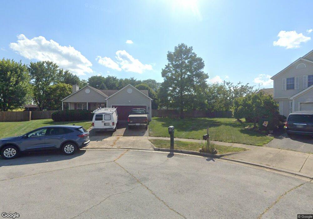
5957 Whitehaven Dr Galloway, OH 43119
Westchester-Green Countrie NeighborhoodEstimated Value: $290,000 - $318,000
3
Beds
2
Baths
1,496
Sq Ft
$204/Sq Ft
Est. Value
About This Home
This home is located at 5957 Whitehaven Dr, Galloway, OH 43119 and is currently estimated at $304,799, approximately $203 per square foot. 5957 Whitehaven Dr is a home located in Franklin County with nearby schools including Darby Woods Elementary School, Galloway Ridge Intermediate School, and Pleasant View Middle School.
Ownership History
Date
Name
Owned For
Owner Type
Purchase Details
Closed on
Oct 17, 2002
Sold by
Hud
Bought by
Riffe Thomas D and Riffe Judith H
Current Estimated Value
Purchase Details
Closed on
Jun 28, 2002
Sold by
Tawrosza John Frank and Chase Manhattan Mtg Corp
Bought by
Hud
Purchase Details
Closed on
Jul 23, 1997
Sold by
Dominion Homes Inc
Bought by
Tawrosza John Frank and Tawrosza Katherine Marie
Home Financials for this Owner
Home Financials are based on the most recent Mortgage that was taken out on this home.
Original Mortgage
$126,687
Interest Rate
7.81%
Mortgage Type
FHA
Create a Home Valuation Report for This Property
The Home Valuation Report is an in-depth analysis detailing your home's value as well as a comparison with similar homes in the area
Home Values in the Area
Average Home Value in this Area
Purchase History
| Date | Buyer | Sale Price | Title Company |
|---|---|---|---|
| Riffe Thomas D | $120,000 | Amerititle Agency Inc | |
| Hud | $105,000 | -- | |
| Tawrosza John Frank | $137,400 | Alliance Title |
Source: Public Records
Mortgage History
| Date | Status | Borrower | Loan Amount |
|---|---|---|---|
| Previous Owner | Tawrosza John Frank | $126,687 |
Source: Public Records
Tax History
| Year | Tax Paid | Tax Assessment Tax Assessment Total Assessment is a certain percentage of the fair market value that is determined by local assessors to be the total taxable value of land and additions on the property. | Land | Improvement |
|---|---|---|---|---|
| 2025 | $2,827 | $87,330 | $26,010 | $61,320 |
| 2024 | $2,827 | $87,330 | $26,010 | $61,320 |
| 2023 | $2,799 | $87,325 | $26,005 | $61,320 |
| 2022 | $2,277 | $55,410 | $9,240 | $46,170 |
| 2021 | $2,323 | $55,410 | $9,240 | $46,170 |
| 2020 | $2,310 | $55,410 | $9,240 | $46,170 |
| 2019 | $2,132 | $46,760 | $7,700 | $39,060 |
| 2018 | $2,293 | $46,760 | $7,700 | $39,060 |
| 2017 | $2,288 | $46,760 | $7,700 | $39,060 |
| 2016 | $2,463 | $49,460 | $11,380 | $38,080 |
| 2015 | $2,463 | $49,460 | $11,380 | $38,080 |
| 2014 | $2,465 | $49,460 | $11,380 | $38,080 |
| 2013 | $1,300 | $52,045 | $11,970 | $40,075 |
Source: Public Records
Map
Nearby Homes
- 859 Lescar Ln
- 813 Sumter St
- 765 Sumter St
- 706 Windy Hill Ln
- 6059 Chidley St
- 773 Rothrock Dr
- 815 Bledsoe Dr
- 6173 Streaming Ave Unit 192
- 813 Hurlock Ln
- 746 Hurlock Ln
- 569 Perilous Place Unit 22
- 569 Perilous Place
- 1083 Oak Bay Dr
- 6112 Early Light Dr
- 1086 Oak Bay Dr Unit 1086
- 5715 Oyster Bay Way
- 5584 Brackenridge Ave Unit R7
- 516 Pamlico St
- 631 Dlyn St Unit 12
- 1295 Hathersage Place
- 5951 Whitehaven Dr
- 5960 Whitehaven Dr
- 5945 Whitehaven Dr
- 6000 Hall Rd
- 5954 Whitehaven Dr
- 5940 Hall Rd
- 5948 Whitehaven Dr
- 5948 Whitehaven Dr Unit 428
- 5939 Whitehaven Dr
- 6010 Hall Rd
- 829 Sumter St
- 5942 Whitehaven Dr
- 5934 Hall Rd
- 5933 Whitehaven Dr
- 5936 Whitehaven Dr
- 822 Sumter St
- 821 Sumter St
- 848 Galloway Rd
- 5927 Whitehaven Dr
- 875 Lescar Ln