Estimated Value: $256,140 - $702,000
1
Bed
1
Bath
1,250
Sq Ft
$336/Sq Ft
Est. Value
About This Home
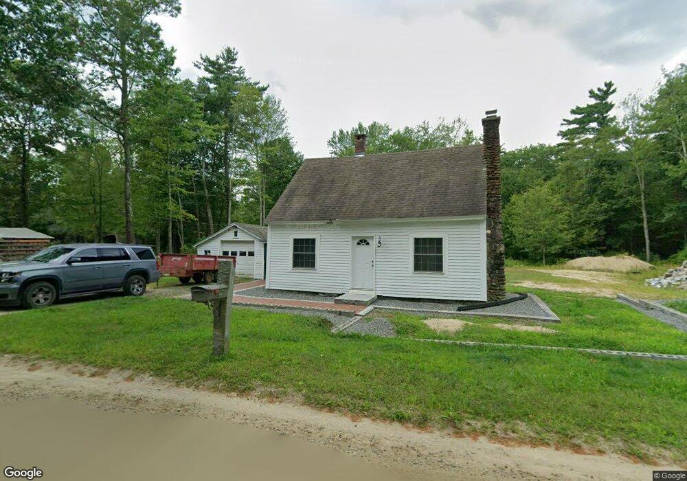
This home is located at 596 Hurricane Hill Rd, Mason, NH 03048 and is currently estimated at $420,535, approximately $336 per square foot. 596 Hurricane Hill Rd is a home.
Ownership History
Date
Name
Owned For
Owner Type
Purchase Details
Closed on
Apr 25, 1997
Sold by
Fraizer Stuart J and Fraizer Audrey L
Bought by
Messier Timothy R
Current Estimated Value
Home Financials for this Owner
Home Financials are based on the most recent Mortgage that was taken out on this home.
Original Mortgage
$74,700
Outstanding Balance
$10,028
Interest Rate
7.77%
Estimated Equity
$410,507
Create a Home Valuation Report for This Property
The Home Valuation Report is an in-depth analysis detailing your home's value as well as a comparison with similar homes in the area
Home Values in the Area
Average Home Value in this Area
Purchase History
| Date | Buyer | Sale Price | Title Company |
|---|---|---|---|
| Messier Timothy R | $83,000 | -- |
Source: Public Records
Mortgage History
| Date | Status | Borrower | Loan Amount |
|---|---|---|---|
| Open | Messier Timothy R | $30,000 | |
| Open | Messier Timothy R | $74,700 |
Source: Public Records
Tax History Compared to Growth
Tax History
| Year | Tax Paid | Tax Assessment Tax Assessment Total Assessment is a certain percentage of the fair market value that is determined by local assessors to be the total taxable value of land and additions on the property. | Land | Improvement |
|---|---|---|---|---|
| 2024 | $4,149 | $162,400 | $96,000 | $66,400 |
| 2023 | $3,852 | $162,400 | $96,000 | $66,400 |
| 2022 | $3,302 | $162,400 | $96,000 | $66,400 |
| 2021 | $3,222 | $162,400 | $96,000 | $66,400 |
| 2020 | $3,168 | $117,300 | $67,700 | $49,600 |
| 2019 | $3,183 | $121,300 | $67,700 | $53,600 |
| 2018 | $3,054 | $121,300 | $67,700 | $53,600 |
| 2017 | $3,051 | $121,300 | $67,700 | $53,600 |
| 2016 | $3,903 | $154,800 | $75,700 | $79,100 |
| 2015 | $3,101 | $130,400 | $55,600 | $74,800 |
| 2014 | $3,105 | $130,400 | $55,600 | $74,800 |
| 2013 | $3,247 | $130,400 | $55,600 | $74,800 |
Source: Public Records
Map
Nearby Homes
- 1235 Townsend Rd
- 1275 Valley Rd
- 9 Winterberry Rd
- 7 Winterberry Rd
- 59 Cleveland Hill Rd
- 18 Bridle Path
- 11 Fox Run
- 6 Laurelcrest Dr
- 75 Merriam Hill Rd
- 0 Brookline St
- 15 N End Rd
- 38 Countryside Dr
- 183 New Hillcrest Dr
- 39 Old Ashby Rd
- 3 Ben Farnsworth Rd
- 53 W Meadow Rd
- 104 N Mason Rd
- 87 Laurel Dr
- 1-65-C Barrett Rd
- 64 Meadow Rd
- 382 Briggs Rd
- 555 Hurricane Hill Rd
- 369 Briggs Rd
- 346 Briggs Rd
- 327 Briggs Rd
- 522 Hurricane Hill Rd
- 525 Hurricane Hill Rd
- 24 Campbell Mill Rd
- 650 Hurricane Hill Rd
- 50 Campbell Mill Rd
- 484 Hurricane Hill Rd
- 712 Hurricane Hill Rd
- 101 Campbell Mill Rd
- 497 Hurricane Hill Rd
- 278 Briggs Rd
- 717 Hurricane Hill Rd
- 748 Hurricane Hill Rd
- 246 Briggs Rd
- 251 Briggs Rd
- 220 Briggs Rd