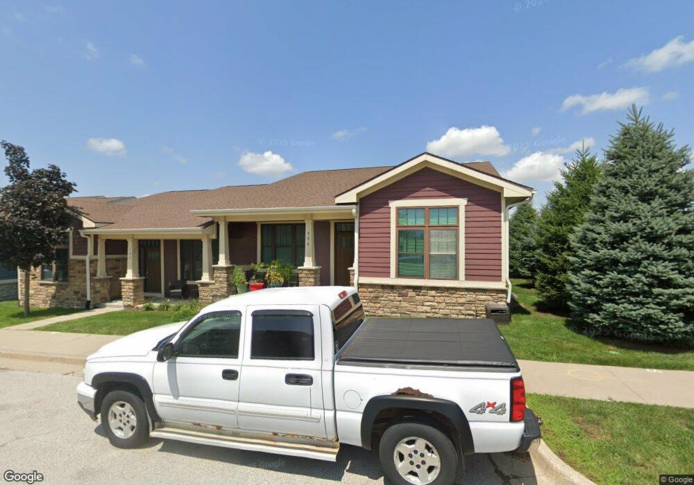
596 S Crescent Way Unit 6 West Des Moines, IA 50266
Estimated Value: $371,965 - $381,000
3
Beds
3
Baths
1,278
Sq Ft
$295/Sq Ft
Est. Value
About This Home
This home is located at 596 S Crescent Way Unit 6, West Des Moines, IA 50266 and is currently estimated at $376,491, approximately $294 per square foot. 596 S Crescent Way Unit 6 is a home located in Polk County with nearby schools including Westridge Elementary School, Valley Southwoods Freshman High School, and Indian Hills Junior High School.
Ownership History
Date
Name
Owned For
Owner Type
Purchase Details
Closed on
Sep 27, 2021
Sold by
Barnum Gregory and Barnum Breanne D
Bought by
Pleva Ariel S
Current Estimated Value
Home Financials for this Owner
Home Financials are based on the most recent Mortgage that was taken out on this home.
Original Mortgage
$310,650
Outstanding Balance
$282,052
Interest Rate
2.8%
Mortgage Type
New Conventional
Estimated Equity
$94,440
Purchase Details
Closed on
Sep 26, 2021
Sold by
Pleva Ariel
Bought by
Bentley Alan
Home Financials for this Owner
Home Financials are based on the most recent Mortgage that was taken out on this home.
Original Mortgage
$310,650
Outstanding Balance
$282,052
Interest Rate
2.8%
Mortgage Type
New Conventional
Estimated Equity
$94,440
Create a Home Valuation Report for This Property
The Home Valuation Report is an in-depth analysis detailing your home's value as well as a comparison with similar homes in the area
Home Values in the Area
Average Home Value in this Area
Purchase History
| Date | Buyer | Sale Price | Title Company |
|---|---|---|---|
| Pleva Ariel S | $35,000 | None Available | |
| Bentley Alan | $327,000 | None Available |
Source: Public Records
Mortgage History
| Date | Status | Borrower | Loan Amount |
|---|---|---|---|
| Open | Bentley Alan | $310,650 |
Source: Public Records
Tax History Compared to Growth
Tax History
| Year | Tax Paid | Tax Assessment Tax Assessment Total Assessment is a certain percentage of the fair market value that is determined by local assessors to be the total taxable value of land and additions on the property. | Land | Improvement |
|---|---|---|---|---|
| 2025 | $5,678 | $391,400 | $50,600 | $340,800 |
| 2024 | $5,678 | $358,200 | $45,600 | $312,600 |
| 2023 | $5,596 | $358,200 | $45,600 | $312,600 |
| 2022 | $5,530 | $289,800 | $38,500 | $251,300 |
| 2021 | $5,674 | $289,800 | $38,500 | $251,300 |
| 2020 | $5,674 | $287,200 | $40,500 | $246,700 |
| 2019 | $5,602 | $287,200 | $40,500 | $246,700 |
| 2018 | $5,616 | $273,500 | $41,500 | $232,000 |
| 2017 | $3,642 | $273,500 | $41,500 | $232,000 |
| 2016 | $3,160 | $172,300 | $35,600 | $136,700 |
Source: Public Records
Map
Nearby Homes
- 811 Burr Oaks Dr Unit 603
- 811 Burr Oaks Dr Unit 202
- 595 S 60th St Unit 403
- 595 S 60th St Unit 301
- 5930 Fairway Ct
- 3518 SW Indigo Ave
- 3788 SW Indigo Ave
- 720 S My Way
- 704 S My Way
- Balsam Plan at The Pines at Glen Oaks
- Hemlock Plan at The Pines at Glen Oaks
- Juniper Plan at The Pines at Glen Oaks
- 728 S My Way
- 813 S My Way
- 712 S My Way
- 787 S My Way
- 736 S My Way
- 771 S My Way
- 763 S My Way
- 805 S My Way
- 596 S Crescent Way
- 594 S Crescent Way Unit 7
- 594 S Crescent Way
- 590 S Crescent Way Unit 8
- 590 S Crescent Way
- 5686 Stagecoach Dr Unit 5
- 5692 Stagecoach Dr Unit 4
- 588 S Crescent Way Unit 9
- 588 S Crescent Way
- 5708 Stagecoach Dr Unit 3
- 584 S Crescent Way Unit 10
- 584 S Crescent Way
- 5712 Stagecoach Dr Unit 2
- 582 S Crescent Way Unit 11
- 582 S Crescent Way
- 576 S Crescent Way Unit 12
- 5724 Stagecoach Dr Unit 1
- 574 S Crescent Way Unit 13
- 574 S Crescent Way
- 570 S Crescent Way Unit 14