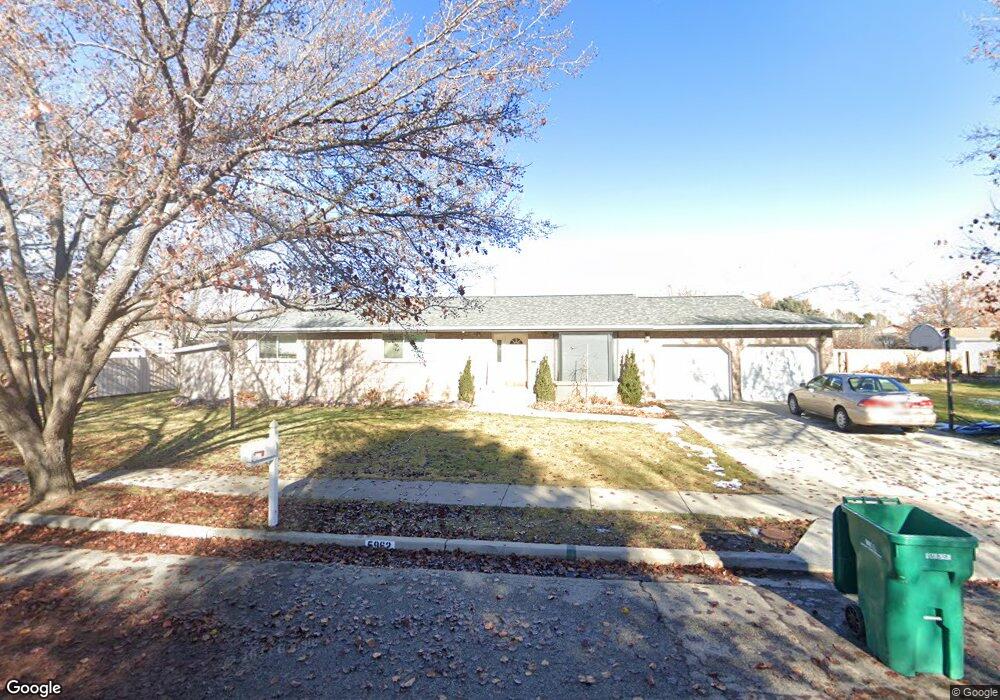
5962 W 10800 N Highland, UT 84003
Estimated Value: $579,000 - $819,000
3
Beds
2
Baths
3,096
Sq Ft
$227/Sq Ft
Est. Value
About This Home
This home is located at 5962 W 10800 N, Highland, UT 84003 and is currently estimated at $704,052, approximately $227 per square foot. 5962 W 10800 N is a home located in Utah County with nearby schools including Highland Elementary School, Mountain Ridge Junior High School, and Lone Peak High School.
Ownership History
Date
Name
Owned For
Owner Type
Purchase Details
Closed on
Jun 23, 2015
Sold by
Killpack Paul and Killpack Juliawna
Bought by
Killpack Paul D and Killpack Juliawna B
Current Estimated Value
Home Financials for this Owner
Home Financials are based on the most recent Mortgage that was taken out on this home.
Original Mortgage
$180,000
Outstanding Balance
$104,707
Interest Rate
3.81%
Mortgage Type
New Conventional
Estimated Equity
$599,345
Purchase Details
Closed on
Sep 6, 2001
Sold by
Gillman James B and Gillman Cristi Staheli
Bought by
Killpack Paul and Killpack Juliawna
Purchase Details
Closed on
Aug 13, 1998
Sold by
Staheli Gillman James B and Staheli Gillman Cristi
Bought by
Staheli Gillman James B and Staheli Gillman Cristi
Create a Home Valuation Report for This Property
The Home Valuation Report is an in-depth analysis detailing your home's value as well as a comparison with similar homes in the area
Home Values in the Area
Average Home Value in this Area
Purchase History
| Date | Buyer | Sale Price | Title Company |
|---|---|---|---|
| Killpack Paul D | -- | Meridian Title Co | |
| Killpack Paul | -- | Security Title & Abstract | |
| Staheli Gillman James B | -- | -- |
Source: Public Records
Mortgage History
| Date | Status | Borrower | Loan Amount |
|---|---|---|---|
| Open | Killpack Paul D | $180,000 |
Source: Public Records
Tax History Compared to Growth
Tax History
| Year | Tax Paid | Tax Assessment Tax Assessment Total Assessment is a certain percentage of the fair market value that is determined by local assessors to be the total taxable value of land and additions on the property. | Land | Improvement |
|---|---|---|---|---|
| 2025 | $2,568 | $321,145 | $303,300 | $280,600 |
| 2024 | $2,568 | $317,240 | $0 | $0 |
| 2023 | $2,440 | $325,105 | $0 | $0 |
| 2022 | $2,439 | $315,095 | $0 | $0 |
| 2021 | $2,102 | $404,600 | $172,000 | $232,600 |
| 2020 | $1,978 | $373,300 | $149,600 | $223,700 |
| 2019 | $1,743 | $344,100 | $149,600 | $194,500 |
| 2018 | $1,640 | $307,800 | $138,700 | $169,100 |
| 2017 | $1,449 | $145,090 | $0 | $0 |
| 2016 | $1,495 | $139,975 | $0 | $0 |
| 2015 | $1,510 | $133,980 | $0 | $0 |
| 2014 | $1,455 | $127,930 | $0 | $0 |
Source: Public Records
Map
Nearby Homes
- 10818 N 6000 W
- 6271 W 10830 St N
- 11124 N 6000 W
- 5538 W Naples Dr Unit 125
- 5538 W Turin Ln
- 5509 W Sicily Ln
- 10925 N Marsala Dr
- 11248 Hawkstone Way Unit 109
- 6024 Hawkstone Way Unit 108
- 11228 Hawkstone Way Unit 110
- 10905 N Vercelli Dr
- 6373 W 10500 N
- 10507 N 5470 W
- 11337 N 5950 W Unit 7
- 6372 W 10400 N
- 10434 N 6400 W
- 10763 N Dosh Ln
- Villa A Plan at TEN700
- Villa D Plan at TEN700
- Cottonwood Villa Plan at TEN700
- 5961 W 10800 St N
- 10805 N 5920 W
- 5984 W 10800 N
- 5975 W 10800 N
- 10817 N 5920 W
- 10786 N 6000 W
- 10783 N 5920 W
- 11306 N Brookline Dr
- 11324 N 4650 W Unit 10
- 11303 N 4650 W Unit 12
- 11302 N 4650 W Unit 11
- 8464 W 10800 St N
- 8330 W 10800 St N
- 7679 W 10800 St N
- 8418 W 10800 St N
- 10754 N 6000 W
- 10830 N 6000 W
- 961 S 1000 W Unit 775
- 979 S 1000 W Unit 313
- 10841 N 5920 W