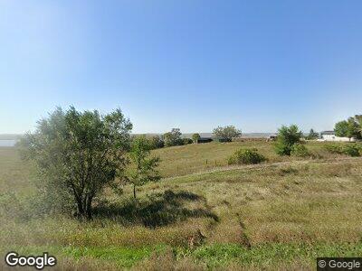
5963 Highway 1804 SW Unit US Hazelton, ND 58544
Estimated Value: $92,000
--
Bed
--
Bath
--
Sq Ft
6
Acres
About This Home
This home is located at 5963 Highway 1804 SW Unit US, Hazelton, ND 58544 and is currently estimated at $92,000. 5963 Highway 1804 SW Unit US is a home located in Emmons County with nearby schools including Hazelton-Moffit-Braddock Elementary School and Hazelton-Moffit-Braddock High School.
Ownership History
Date
Name
Owned For
Owner Type
Purchase Details
Closed on
Aug 5, 2016
Sold by
Horner Eugene J and Horner Janett
Bought by
Mealio Brett and Mealio Linda
Current Estimated Value
Home Financials for this Owner
Home Financials are based on the most recent Mortgage that was taken out on this home.
Original Mortgage
$90,897
Interest Rate
3.48%
Mortgage Type
Future Advance Clause Open End Mortgage
Create a Home Valuation Report for This Property
The Home Valuation Report is an in-depth analysis detailing your home's value as well as a comparison with similar homes in the area
Home Values in the Area
Average Home Value in this Area
Purchase History
| Date | Buyer | Sale Price | Title Company |
|---|---|---|---|
| Mealio Brett | -- | Nd Guaranty & Title Co |
Source: Public Records
Mortgage History
| Date | Status | Borrower | Loan Amount |
|---|---|---|---|
| Closed | Mealio Brett W | $85,096 | |
| Closed | Mealio Brett W | $225,078 | |
| Closed | Mealio Brett | $90,897 | |
| Previous Owner | Mealio Brett | $200,000 | |
| Previous Owner | Mealio Brett | $33,000 | |
| Previous Owner | Mealio Brett | $165,671 | |
| Previous Owner | Mealio Brett | $50,000 | |
| Previous Owner | Mealio Brett | $88,500 |
Source: Public Records
Tax History Compared to Growth
Tax History
| Year | Tax Paid | Tax Assessment Tax Assessment Total Assessment is a certain percentage of the fair market value that is determined by local assessors to be the total taxable value of land and additions on the property. | Land | Improvement |
|---|---|---|---|---|
| 2024 | $19 | $227,200 | $115,100 | $112,100 |
| 2023 | $1,767 | $228,200 | $115,100 | $113,100 |
| 2022 | $1,584 | $215,500 | $113,200 | $102,300 |
| 2021 | $1,537 | $215,500 | $113,200 | $102,300 |
| 2020 | $1,395 | $198,200 | $93,600 | $104,600 |
| 2019 | $1,362 | $188,600 | $93,600 | $95,000 |
| 2018 | $1,311 | $190,200 | $93,600 | $96,600 |
| 2017 | $1,322 | $95,100 | $46,800 | $48,300 |
| 2016 | $1,091 | $77,270 | $11,954 | $65,316 |
| 2015 | -- | $0 | $0 | $0 |
| 2014 | -- | $0 | $0 | $0 |
| 2013 | -- | $0 | $0 | $0 |
Source: Public Records
Map
Nearby Homes
- TBD Fort Rice Rd
- 798 Fort Rice St
- 795 Fort Rice St
- 6851 2nd Ave SW
- 10000 76th Ave SE
- 467 Cottage St
- 4400 Sagebrush Dr
- 5918 Kayley Dr
- 3701 Signal St
- 6600 55th Ave SE
- 8601 S Fork Jct
- 7013 Snappy Ln
- 000 48th Ave SE
- 9019 Briardale Dr
- 4605 Kendal Ct
- 2897 93rd St SE
- 9 Humbert Dr
- 4395 Pinewood Loop
- 2594 93rd St SE
- 63 Benteen Dr
