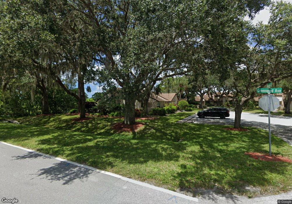
5965 Mashie Cir Unit 2 North Port, FL 34287
Estimated Value: $163,000 - $191,007
2
Beds
2
Baths
767
Sq Ft
$225/Sq Ft
Est. Value
About This Home
This home is located at 5965 Mashie Cir Unit 2, North Port, FL 34287 and is currently estimated at $172,502, approximately $224 per square foot. 5965 Mashie Cir Unit 2 is a home located in Sarasota County with nearby schools including North Port High School, Lamarque Elementary School, and Heron Creek Middle School.
Ownership History
Date
Name
Owned For
Owner Type
Purchase Details
Closed on
Jun 4, 2019
Sold by
Martin Edith B
Bought by
Graves Ganna and Graves Thomas G
Current Estimated Value
Purchase Details
Closed on
Aug 1, 2016
Bought by
Martin Edith B
Purchase Details
Closed on
Jul 7, 2003
Sold by
Skelton Wayne S
Bought by
Hall Mark
Home Financials for this Owner
Home Financials are based on the most recent Mortgage that was taken out on this home.
Original Mortgage
$81,900
Interest Rate
5.29%
Mortgage Type
Purchase Money Mortgage
Purchase Details
Closed on
Jun 28, 2001
Sold by
Colvin Robert E and Colvin Joan C
Bought by
Skelton Wayne S
Home Financials for this Owner
Home Financials are based on the most recent Mortgage that was taken out on this home.
Original Mortgage
$70,000
Interest Rate
7.17%
Purchase Details
Closed on
Feb 26, 1999
Sold by
Troilo Joseph A and Troilo Joseph A
Bought by
Colvin Robert E and Colvin Joan C
Create a Home Valuation Report for This Property
The Home Valuation Report is an in-depth analysis detailing your home's value as well as a comparison with similar homes in the area
Home Values in the Area
Average Home Value in this Area
Purchase History
| Date | Buyer | Sale Price | Title Company |
|---|---|---|---|
| Graves Ganna | $105,000 | Attorney | |
| Martin Edith B | $74,900 | -- | |
| Hall Mark | $82,000 | -- | |
| Skelton Wayne S | $73,700 | -- | |
| Colvin Robert E | $52,900 | -- |
Source: Public Records
Mortgage History
| Date | Status | Borrower | Loan Amount |
|---|---|---|---|
| Previous Owner | Hall Mark | $81,900 | |
| Previous Owner | Skelton Wayne S | $70,000 |
Source: Public Records
Tax History Compared to Growth
Tax History
| Year | Tax Paid | Tax Assessment Tax Assessment Total Assessment is a certain percentage of the fair market value that is determined by local assessors to be the total taxable value of land and additions on the property. | Land | Improvement |
|---|---|---|---|---|
| 2024 | $1,219 | $88,088 | -- | -- |
| 2023 | $1,219 | $85,522 | $0 | $0 |
| 2022 | $1,179 | $83,031 | $0 | $0 |
| 2021 | $1,165 | $80,613 | $0 | $0 |
| 2020 | $1,145 | $79,500 | $24,800 | $54,700 |
| 2019 | $966 | $60,968 | $0 | $0 |
| 2018 | $917 | $59,831 | $0 | $0 |
| 2017 | $906 | $58,600 | $13,400 | $45,200 |
| 2016 | $1,293 | $52,400 | $12,800 | $39,600 |
| 2015 | $1,245 | $47,700 | $17,100 | $30,600 |
Source: Public Records
Map
Nearby Homes
- 5948 Mashie Cir
- 5688 Mashie Cir
- 5143 Schubert Trail
- 5390 Brassy Loop
- 5860 Niblick Place
- 5156 Schubert Trail
- DUNDEE Plan at Central Parc
- FREEPORT II Plan at Central Parc
- 5107 Schubert Trail Unit 36397567
- ARIA Plan at Central Parc
- CALI Plan at Central Parc
- Carrington Plan at Central Parc
- 5231 Brassy Loop
- 5028 Schubert Trail
- 5800 Sabal Trace Dr Unit 1201
- 5800 Sabal Trace Dr Unit 1302
- 5800 Sabal Trace Dr Unit 301
- 5800 Sabal Trace Dr Unit 501
- 5051 Greenway Dr
- 4911 Schubert Trail
- 5965 Mashie Cir
- 5933 Mashie Cir
- 5997 Mashie Cir
- 5901 Mashie Cir
- 5996 Mashie Cir
- 5891 Mashie Cir
- 5891 Mashie Cir Unit 2
- 5980 Mashie Cir
- 5861 Mashie Cir
- 5831 Mashie Cir
- 5831 Mashie Cir Unit 5831
- 5964 Mashie Cir
- 5801 Mashie Cir Unit 5801
- 5801 Mashie Cir
- 5948 Mashie Cir Unit 5948
- 5932 Mashie Cir
- 5916 Mashie Cir
- 5900 Mashie Cir
- 5629 Mashie Cir
