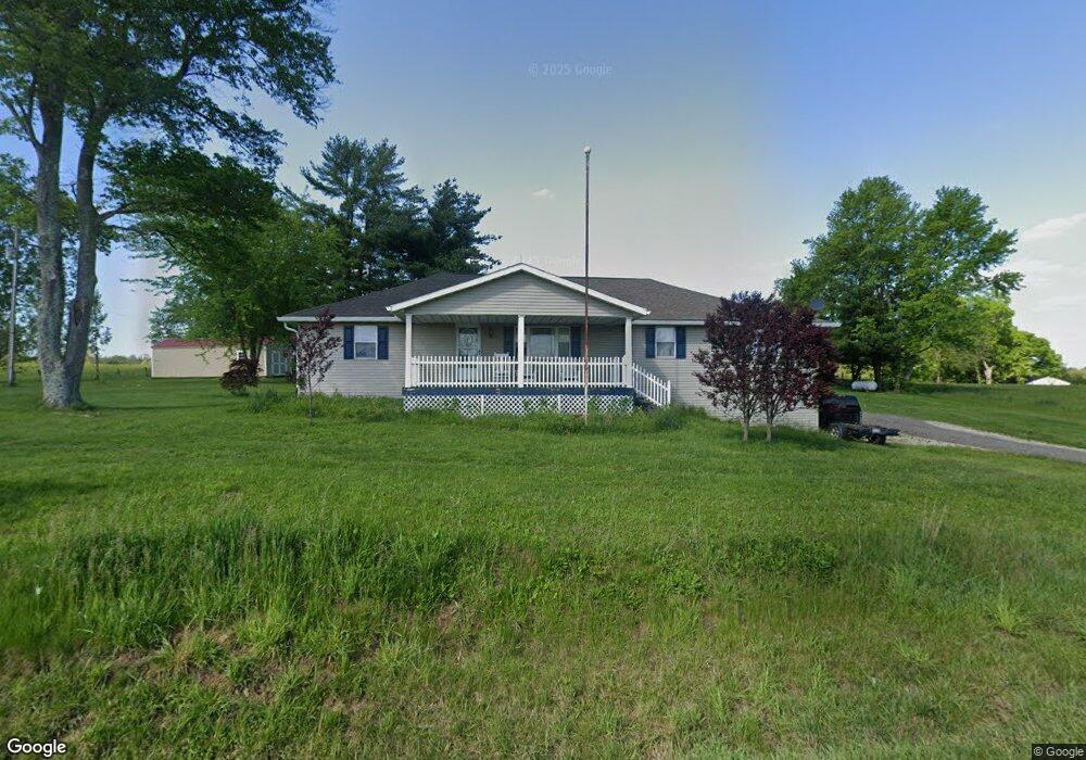
59652 West Rd New Concord, OH 43762
Estimated Value: $202,000 - $408,000
--
Bed
1
Bath
1,953
Sq Ft
$139/Sq Ft
Est. Value
About This Home
This home is located at 59652 West Rd, New Concord, OH 43762 and is currently estimated at $271,326, approximately $138 per square foot. 59652 West Rd is a home with nearby schools including New Concord Elementary School, East Muskingum Middle School, and Larry Miller Intermediate Elementary School.
Ownership History
Date
Name
Owned For
Owner Type
Purchase Details
Closed on
Sep 26, 2007
Sold by
Stillion Donale E and Stillion Nancy C
Bought by
Geary Justin M and Geary Tabatha S
Current Estimated Value
Home Financials for this Owner
Home Financials are based on the most recent Mortgage that was taken out on this home.
Original Mortgage
$43,701
Outstanding Balance
$27,922
Interest Rate
6.66%
Mortgage Type
New Conventional
Estimated Equity
$243,404
Create a Home Valuation Report for This Property
The Home Valuation Report is an in-depth analysis detailing your home's value as well as a comparison with similar homes in the area
Home Values in the Area
Average Home Value in this Area
Purchase History
| Date | Buyer | Sale Price | Title Company |
|---|---|---|---|
| Geary Justin M | $125,000 | -- |
Source: Public Records
Mortgage History
| Date | Status | Borrower | Loan Amount |
|---|---|---|---|
| Open | Geary Justin M | $43,701 |
Source: Public Records
Tax History Compared to Growth
Tax History
| Year | Tax Paid | Tax Assessment Tax Assessment Total Assessment is a certain percentage of the fair market value that is determined by local assessors to be the total taxable value of land and additions on the property. | Land | Improvement |
|---|---|---|---|---|
| 2024 | $1,949 | $49,770 | $12,036 | $37,734 |
| 2023 | $1,949 | $37,989 | $9,188 | $28,801 |
| 2022 | $1,631 | $37,990 | $9,190 | $28,800 |
| 2021 | $1,577 | $37,990 | $9,190 | $28,800 |
| 2020 | $1,448 | $35,060 | $7,550 | $27,510 |
| 2019 | $6 | $35,060 | $7,550 | $27,510 |
| 2018 | $1,464 | $35,060 | $7,550 | $27,510 |
| 2017 | $1,329 | $30,390 | $6,560 | $23,830 |
| 2016 | $1,202 | $30,390 | $6,560 | $23,830 |
| 2015 | $1,202 | $30,390 | $6,560 | $23,830 |
| 2014 | -- | $26,780 | $5,110 | $21,670 |
| 2013 | $1,074 | $26,780 | $5,110 | $21,670 |
Source: Public Records
Map
Nearby Homes
- 60040 Bliss Rd
- 0 Maple Ln
- 1420 Glenn Hwy
- 67 E Main St
- 110 Cherry Ln
- Lot 18 & 19 Greenbriar Dr
- 8 E Main St
- 0 Rix Mills Rd
- 61220 Kadon Dr
- 3278 Rough & Ready Rd
- 112 Thompson Ave
- 0 Homestead Dr Unit 11611647
- 0 Homestead Dr Unit 5174212
- 3029 Best Rd
- 12985 John Glenn School Rd
- 135 S Moose Eye Rd
- 3859 Mayfair Ln
- 4896 High Hill Rd
- 101 N Sundale Rd
- 2043 Southern Rd
- 59614 West Rd
- 59601 West Rd
- 59715 West Rd
- 59769 West Rd
- 59777 West Rd
- 59550 West Rd
- 59835 West Rd
- 59309 Fritter Rd
- 59285 Fritter Rd
- 60046 Stork Ln
- 59966 West Rd
- 60136 Cardinal Dr
- 770 S Friendship Dr
- 745 S Friendship Dr
- 60020 Stork Ln
- 60100 Cardinal Dr
- 59181 Fritter Rd
- 60120 Cardinal Dr
- 60004 Stork Ln
- 13820 Getz Ln