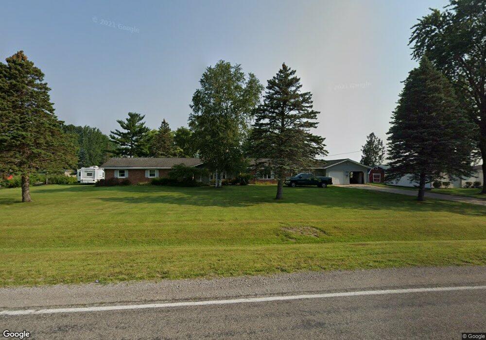
5967 Curtis Rd Bridgeport, MI 48722
Estimated Value: $306,000 - $353,000
4
Beds
3
Baths
2,706
Sq Ft
$122/Sq Ft
Est. Value
About This Home
This home is located at 5967 Curtis Rd, Bridgeport, MI 48722 and is currently estimated at $330,554, approximately $122 per square foot. 5967 Curtis Rd is a home located in Saginaw County with nearby schools including Thomas White School, Martin G. Atkins Elementary School, and Bridgeport High School.
Ownership History
Date
Name
Owned For
Owner Type
Purchase Details
Closed on
Jul 10, 2018
Sold by
Watt Robert G
Bought by
Watt Robert G and Watt Terry L
Current Estimated Value
Purchase Details
Closed on
Aug 23, 2002
Home Financials for this Owner
Home Financials are based on the most recent Mortgage that was taken out on this home.
Original Mortgage
$122,250
Interest Rate
6.32%
Create a Home Valuation Report for This Property
The Home Valuation Report is an in-depth analysis detailing your home's value as well as a comparison with similar homes in the area
Home Values in the Area
Average Home Value in this Area
Purchase History
| Date | Buyer | Sale Price | Title Company |
|---|---|---|---|
| Watt Robert G | -- | -- | |
| -- | $155,000 | -- | |
| Watt Robert G | $155,000 | -- |
Source: Public Records
Mortgage History
| Date | Status | Borrower | Loan Amount |
|---|---|---|---|
| Previous Owner | Watt Robert G | $122,250 | |
| Closed | Watt Robert G | $25,000 |
Source: Public Records
Tax History Compared to Growth
Tax History
| Year | Tax Paid | Tax Assessment Tax Assessment Total Assessment is a certain percentage of the fair market value that is determined by local assessors to be the total taxable value of land and additions on the property. | Land | Improvement |
|---|---|---|---|---|
| 2025 | $3,113 | $156,200 | $0 | $0 |
| 2024 | $861 | $151,000 | $0 | $0 |
| 2023 | $820 | $130,800 | $0 | $0 |
| 2022 | $2,547 | $114,400 | $0 | $0 |
| 2021 | $2,335 | $101,000 | $0 | $0 |
| 2020 | $3,395 | $92,100 | $0 | $0 |
| 2019 | $3,266 | $86,900 | $7,700 | $79,200 |
| 2018 | $673 | $74,900 | $0 | $0 |
| 2017 | $1,920 | $69,700 | $0 | $0 |
| 2016 | $2,085 | $68,300 | $0 | $0 |
| 2014 | -- | $58,500 | $0 | $50,900 |
| 2013 | -- | $58,000 | $0 | $0 |
Source: Public Records
Map
Nearby Homes
- 7720 Rookway Rd
- Parcel E W Rolling Hills Dr
- Parcel B W Rolling Hills Dr
- Parcel D W Rolling Hills Dr
- Parcel F W Rolling Hills Dr
- Parcel C W Rolling Hills Dr
- 7965 Dixie Hwy
- 7110 Townline Rd
- 5430 Busch Rd
- 6605 Bridgeport Hwy
- 4333 Riverview Dr
- 3875 Curtis Rd
- 8780 Dixie Hwy
- 5400 Maple Rd
- 5885 McGrandy Rd
- 6412 Tin Lizzy Ln
- VL Fort Rd
- 0 W Tuscola Rd Unit 50182343
- 9750 Marshall Rd
- 5205 Baker Rd
- 6015 Curtis Rd
- 6040 Curtis Rd
- 6020 Curtis Rd
- 3100 E Curtis Rd
- 0 E Curtis Rd
- 6082 Curtis Rd
- 6262 Curtis Rd
- 6262 Curtis Rd
- 7085 Moorish Rd
- 1385 E Curtis Rd
- 7105 Moorish Rd
- 5917 Curtis Rd
- 6180 Curtis Rd
- 7145 Moorish Rd
- 7165 Moorish Rd
- 6252 Curtis Rd
- 5799 Curtis Rd
- 5799 Curtis Rd
- 7225 Moorish Rd
- 6258 Curtis Rd