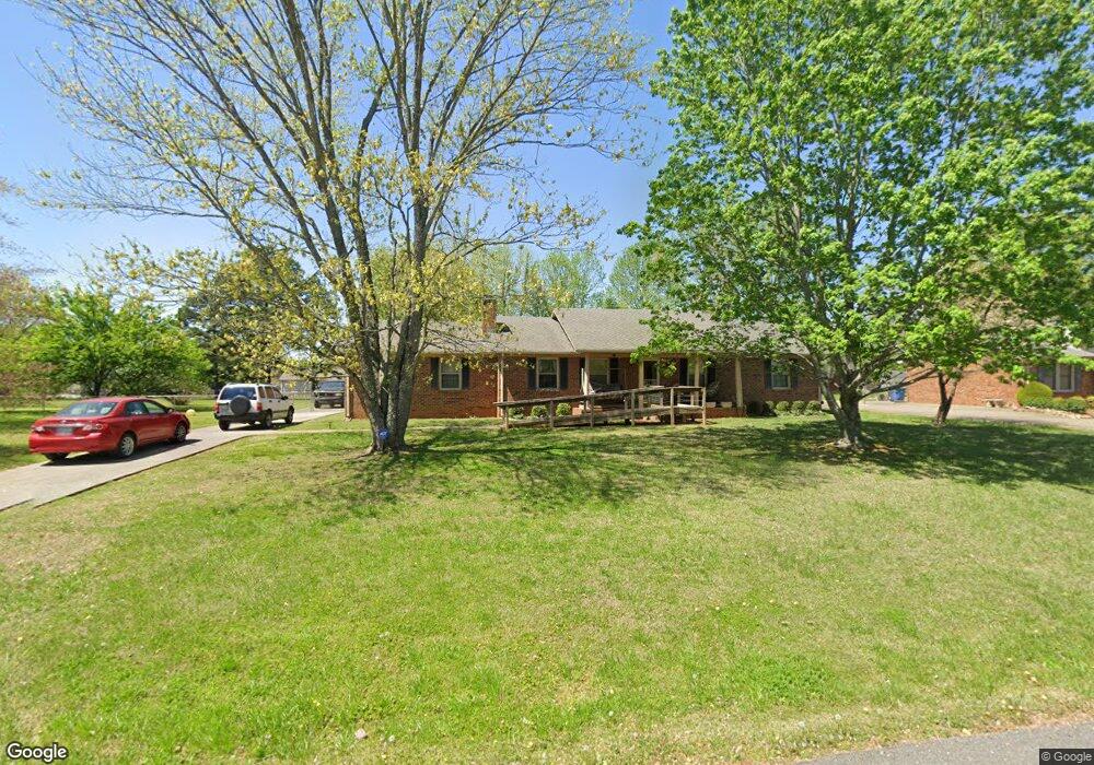
597 Foxfire Ct Murfreesboro, TN 37129
Estimated Value: $317,521 - $355,000
Studio
2
Baths
1,488
Sq Ft
$231/Sq Ft
Est. Value
About This Home
This home is located at 597 Foxfire Ct, Murfreesboro, TN 37129 and is currently estimated at $343,630, approximately $230 per square foot. 597 Foxfire Ct is a home located in Rutherford County with nearby schools including Blackman Elementary School, Blackman Middle School, and Blackman High School.
Ownership History
Date
Name
Owned For
Owner Type
Purchase Details
Closed on
Feb 24, 2026
Sold by
Ward Jeanna L
Bought by
Ward Jeanna L and Jeanna Ward Revocable Trust
Current Estimated Value
Purchase Details
Closed on
Apr 16, 2025
Sold by
Anthony Carolyn K
Bought by
Terry N Anthony And Carolyn Kay Anthony Tenan and Anthony
Purchase Details
Closed on
Mar 14, 2025
Sold by
Kimbrough Peggy L
Bought by
Ward Jeanna L and Kimbrough John C
Purchase Details
Closed on
Mar 28, 2003
Sold by
Kimbrough John C and Kimbrough Sheri L
Bought by
Kimbrough John R and Kimbrough Peggy L
Purchase Details
Closed on
Oct 17, 1994
Sold by
Carr Charles E
Bought by
Kimbrough John C
Create a Home Valuation Report for This Property
The Home Valuation Report is an in-depth analysis detailing your home's value as well as a comparison with similar homes in the area
Home Values in the Area
Average Home Value in this Area
Purchase History
| Date | Buyer | Sale Price | Title Company |
|---|---|---|---|
| Terry N Anthony And Carolyn Kay Anthony Tenan | -- | None Listed On Document | |
| Terry N Anthony And Carolyn Kay Anthony Tenan | -- | None Listed On Document | |
| Ward Jeanna L | -- | None Listed On Document | |
| Kimbrough John R | $105,000 | -- | |
| Kimbrough John C | -- | -- |
Source: Public Records
Tax History
| Year | Tax Paid | Tax Assessment Tax Assessment Total Assessment is a certain percentage of the fair market value that is determined by local assessors to be the total taxable value of land and additions on the property. | Land | Improvement |
|---|---|---|---|---|
| 2025 | $361 | $71,625 | $13,750 | $57,875 |
| 2024 | $0 | $71,625 | $13,750 | $57,875 |
| 2023 | $1,344 | $71,625 | $13,750 | $57,875 |
| 2022 | $1,158 | $71,625 | $13,750 | $57,875 |
| 2021 | $1,104 | $49,725 | $9,250 | $40,475 |
| 2020 | $1,104 | $49,725 | $9,250 | $40,475 |
| 2019 | $1,104 | $49,725 | $9,250 | $40,475 |
| 2018 | $1,044 | $49,725 | $0 | $0 |
| 2017 | $952 | $35,525 | $0 | $0 |
| 2016 | $952 | $35,525 | $0 | $0 |
| 2015 | $952 | $35,525 | $0 | $0 |
| 2014 | $883 | $35,525 | $0 | $0 |
| 2013 | -- | $31,450 | $0 | $0 |
Source: Public Records
Map
Nearby Homes
- 689 Doe Dr
- 452 Campfire Dr
- 701 Spike Trail
- 810 Staten Dr
- 411 Campfire Dr
- 3719 Red Willow Ct
- 2305 Braxton Bragg Dr
- 3741 Southbend Dr
- 1011 Maricopa Dr
- 876 Wolves Den Place
- 825 Kaylee Cir
- 1026 Wolves Den Place
- 1022 Sitting Bull Crossing
- 1038 Sitting Bull Crossing
- 510 Nightcap Ln
- 2301 Miranda Dr
- 1039 Sitting Bull Crossing
- 524 Gresham Ln
- 3437 Axelwood Dr
- 555 Gresham Ln Unit 2 D
- 603 Foxfire Ct
- 563 Foxfire Ct
- 598 Deerfield Dr
- 588 Deerfield Dr
- 617 Foxfire Ct
- 606 Deerfield Dr
- 598 Foxfire Ct
- 604 Foxfire Ct
- 578 Deerfield Dr
- 588 Foxfire Ct
- 620 Deerfield Dr
- 576 Foxfire Ct
- 637 Foxfire Ct
- 630 Deerfield Dr
- 624 Foxfire Ct
- 566 Deerfield Dr
- 597 Deerfield Dr
- 622 Joshua Ct
- 589 Deerfield Dr
- 560 Foxfire Ct
Your Personal Tour Guide
Ask me questions while you tour the home.