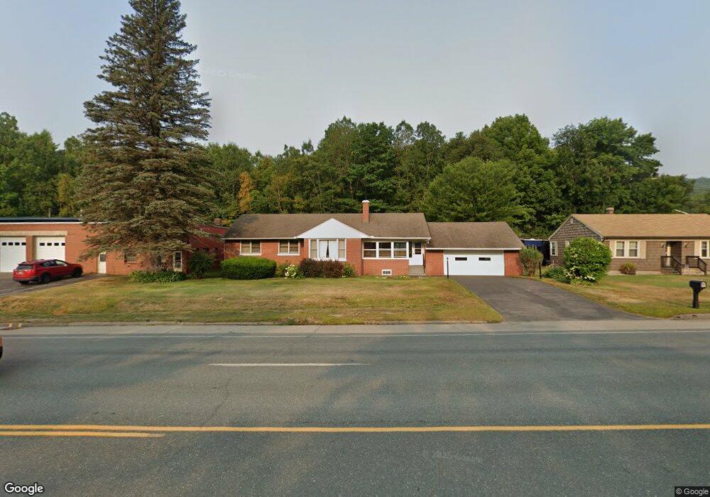
597 Main St Gorham, NH 03581
Estimated Value: $242,000 - $285,000
3
Beds
1
Bath
1,226
Sq Ft
$213/Sq Ft
Est. Value
About This Home
This home is located at 597 Main St, Gorham, NH 03581 and is currently estimated at $261,399, approximately $213 per square foot. 597 Main St is a home located in Coos County with nearby schools including Edward Fenn Elementary School, Gorham Middle School, and Gorham High School.
Ownership History
Date
Name
Owned For
Owner Type
Purchase Details
Closed on
Dec 13, 2019
Sold by
Willette Robert and Ballinger Diane W
Bought by
Willette Robert
Current Estimated Value
Purchase Details
Closed on
Feb 3, 2015
Sold by
Willette Robert
Bought by
Willette Robert and Ballinger Diane W
Purchase Details
Closed on
Jan 17, 2014
Sold by
Violet P Willette T and Clark Cecile
Bought by
Willette Robert
Create a Home Valuation Report for This Property
The Home Valuation Report is an in-depth analysis detailing your home's value as well as a comparison with similar homes in the area
Home Values in the Area
Average Home Value in this Area
Purchase History
| Date | Buyer | Sale Price | Title Company |
|---|---|---|---|
| Willette Robert | -- | None Available | |
| Willette Robert | -- | -- | |
| Willette Robert | $81,800 | -- |
Source: Public Records
Mortgage History
| Date | Status | Borrower | Loan Amount |
|---|---|---|---|
| Previous Owner | Willette Robert | $60,000 |
Source: Public Records
Tax History Compared to Growth
Tax History
| Year | Tax Paid | Tax Assessment Tax Assessment Total Assessment is a certain percentage of the fair market value that is determined by local assessors to be the total taxable value of land and additions on the property. | Land | Improvement |
|---|---|---|---|---|
| 2024 | $6,555 | $231,700 | $35,700 | $196,000 |
| 2023 | $5,688 | $231,700 | $35,700 | $196,000 |
| 2022 | $5,619 | $231,700 | $35,700 | $196,000 |
| 2021 | $4,464 | $125,400 | $16,900 | $108,500 |
| 2020 | $3,994 | $125,400 | $16,900 | $108,500 |
| 2019 | $4,235 | $125,400 | $16,900 | $108,500 |
| 2018 | $4,578 | $125,400 | $16,900 | $108,500 |
| 2017 | $4,257 | $125,400 | $16,900 | $108,500 |
| 2014 | $3,884 | $126,600 | $24,100 | $102,500 |
| 2010 | $4,153 | $173,400 | $26,600 | $146,800 |
Source: Public Records
Map
Nearby Homes
- 46 Cascade Flats
- 500 Main St Unit TRLR 4
- 13 2nd St
- 536 Old Glen Ave
- 518 Western Ave
- 569 Western Ave
- 23 Pine St
- 342 1st Ave
- 166 Glen Ave
- 433 2nd Ave
- 437 2nd Ave
- 761 Western Ave
- 141 Lancaster Rd Unit 28
- 141 Lancaster Rd Unit 14
- 141 Lancaster Rd
- Lot 2 Hillsboro St
- 25 Laurel St
- 0 Hillsboro St Unit 5036784
- 0 Hillsboro St Unit 5046211
- 507 First Ave