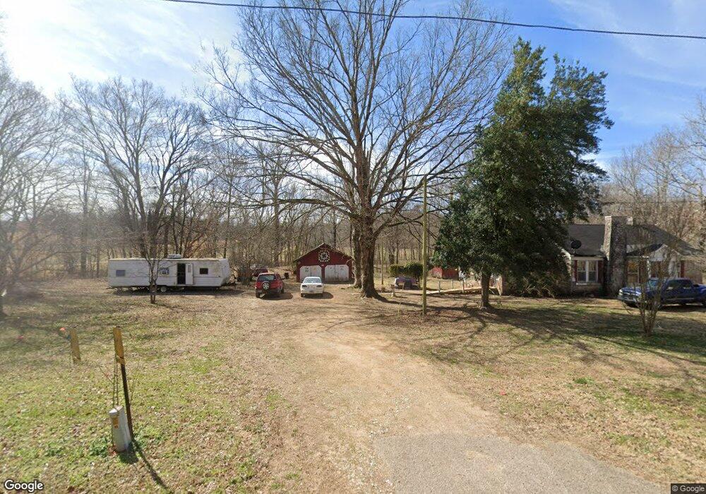
5970 Highway 203 Savannah, TN 38372
Estimated Value: $87,519 - $153,000
--
Bed
1
Bath
1,179
Sq Ft
$101/Sq Ft
Est. Value
About This Home
This home is located at 5970 Highway 203, Savannah, TN 38372 and is currently estimated at $119,130, approximately $101 per square foot. 5970 Highway 203 is a home located in Hardin County with nearby schools including Hardin County High School.
Ownership History
Date
Name
Owned For
Owner Type
Purchase Details
Closed on
Jun 17, 2025
Sold by
Malone Johnny Anthony
Bought by
Caywood Monica
Current Estimated Value
Purchase Details
Closed on
Jun 21, 2011
Sold by
Malone Hazel
Bought by
Malone Johnny Anthony
Purchase Details
Closed on
Sep 9, 1999
Sold by
Malone William L
Bought by
John Malone
Purchase Details
Closed on
Jul 26, 1996
Sold by
Malone William L
Bought by
Ricky Neill and Ricky Ella M
Purchase Details
Closed on
Jun 30, 1993
Bought by
Malone William L and Malone Hazel
Purchase Details
Closed on
Mar 22, 1979
Bought by
Hall Ella Frances
Create a Home Valuation Report for This Property
The Home Valuation Report is an in-depth analysis detailing your home's value as well as a comparison with similar homes in the area
Home Values in the Area
Average Home Value in this Area
Purchase History
| Date | Buyer | Sale Price | Title Company |
|---|---|---|---|
| Caywood Monica | -- | None Listed On Document | |
| Caywood Monica | -- | None Listed On Document | |
| Malone Johnny Anthony | $34,800 | -- | |
| John Malone | $500 | -- | |
| Ricky Neill | $1,000 | -- | |
| Malone William L | $18,000 | -- | |
| Hall Ella Frances | -- | -- |
Source: Public Records
Tax History Compared to Growth
Tax History
| Year | Tax Paid | Tax Assessment Tax Assessment Total Assessment is a certain percentage of the fair market value that is determined by local assessors to be the total taxable value of land and additions on the property. | Land | Improvement |
|---|---|---|---|---|
| 2024 | $298 | $17,000 | $2,375 | $14,625 |
| 2023 | $298 | $17,000 | $2,375 | $14,625 |
| 2022 | $204 | $9,900 | $1,700 | $8,200 |
| 2021 | $204 | $9,900 | $1,700 | $8,200 |
| 2020 | $204 | $9,900 | $1,700 | $8,200 |
| 2019 | $204 | $9,900 | $1,700 | $8,200 |
| 2018 | $197 | $9,900 | $1,700 | $8,200 |
| 2017 | $187 | $8,975 | $1,700 | $7,275 |
| 2016 | $187 | $8,975 | $1,700 | $7,275 |
| 2015 | $163 | $8,975 | $1,700 | $7,275 |
| 2014 | $163 | $8,975 | $1,700 | $7,275 |
Source: Public Records
Map
Nearby Homes
- 1020 Jade Rd
- 29 Choate Creek Rd
- 4190 County Home Rd
- 102 Teal Ln
- CAVE HOLLOW Ln
- 14 Hawthorne Ln
- 13 Hawthorne Ln
- 12 Hawthorne Ln
- LOT 223 Ridgeview Cove
- 0 Hwy 69 Hwy Unit RTC2885639
- LOT 80 River Breeze Rd
- 0 Hwy 69 Hwy Unit 21357409
- LOT 5 Dalton Cove
- 0 Hwy 69 Hwy Unit RTC2697897
- LOT 4 Beauvoir Cove
- LOTS 6,7,8 Bobcat Cove
- 0 Pioneer Trail Unit 10162803
- LOT 85 Pioneer Trail
- 19200 Clifton Rd
- 95 Ali Grace Ln
- 5930 Highway 203
- 6035 Highway 203
- 5735 Highway 203
- 6000 Highway 203
- 6040 Highway 203
- 6230 Highway 203
- 3885 Sutton Hollow Rd
- 3980 Sutton Hollow Rd Unit 203
- 5510 Highway 203
- 5460 Highway 203
- 3710 Sutton Hollow Rd
- 5365 Highway 203
- 185 Nannys Ln
- 3810 Sutton Hollow Rd
- 200 Nannys Ln
- 180 Nannys Ln
- 1335 Dude Dr
- 1315 Dude Dr
- 1025 Dude Dr
- 1285 Dude Dr