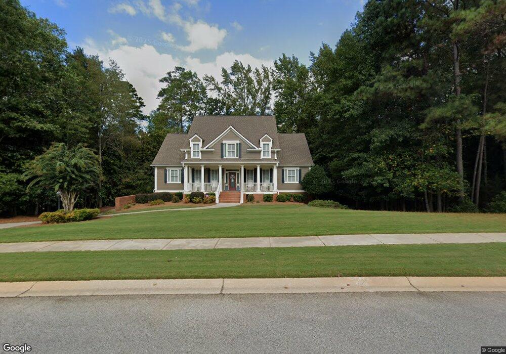
598 Mcdade St Tyrone, GA 30290
Estimated Value: $652,103 - $793,000
Studio
--
Bath
3,469
Sq Ft
$217/Sq Ft
Est. Value
About This Home
This home is located at 598 Mcdade St, Tyrone, GA 30290 and is currently estimated at $754,276, approximately $217 per square foot. 598 Mcdade St is a home located in Fayette County with nearby schools including Crabapple Lane Elementary School, Flat Rock Middle School, and Sandy Creek High School.
Ownership History
Date
Name
Owned For
Owner Type
Purchase Details
Closed on
Aug 20, 2003
Sold by
Alpha Vi Inc
Bought by
Walls William G and Walls Celeste
Current Estimated Value
Home Financials for this Owner
Home Financials are based on the most recent Mortgage that was taken out on this home.
Original Mortgage
$423,500
Outstanding Balance
$185,133
Interest Rate
5.52%
Mortgage Type
New Conventional
Estimated Equity
$569,143
Create a Home Valuation Report for This Property
The Home Valuation Report is an in-depth analysis detailing your home's value as well as a comparison with similar homes in the area
Home Values in the Area
Average Home Value in this Area
Purchase History
| Date | Buyer | Sale Price | Title Company |
|---|---|---|---|
| Walls William G | $470,600 | -- |
Source: Public Records
Mortgage History
| Date | Status | Borrower | Loan Amount |
|---|---|---|---|
| Open | Walls William G | $423,500 |
Source: Public Records
Tax History Compared to Growth
Tax History
| Year | Tax Paid | Tax Assessment Tax Assessment Total Assessment is a certain percentage of the fair market value that is determined by local assessors to be the total taxable value of land and additions on the property. | Land | Improvement |
|---|---|---|---|---|
| 2024 | $3,096 | $300,416 | $42,000 | $258,416 |
| 2023 | $2,706 | $287,680 | $42,000 | $245,680 |
Source: Public Records
Map
Nearby Homes
- 2230 Castle Lake Dr
- 2185 Castle Lake Dr
- 130 Windchime Way Unit 9
- 150 Kylemore Pass
- 104 Ashland Trail
- 100 Clydesdale Ct
- 110 Kylemore Pass
- 200 Chaparral Trace
- 108 Tullamore Trail
- 121 Northwoods Rd
- 113 Creggan Hill Ct
- 100 Leisure Trail
- 321 Cottonwood Cir
- 152 Ardenlee Dr
- 105 Laurel Forest Dr
- 320 Dalston Way
- 231 Clifton Ln
- 308 Dalston Way
- 100 Sycamore Way
- 208 Silver Maple Ct
- 402 Wicklow St Unit 64
- 402 Wicklow St
- 595 Mcdade St
- 365 Ashland Trail
- 597 Mcdade St
- 403 Wicklow St Unit 74
- 403 Wicklow St
- 401 Wicklow St
- 404 Wicklow St Unit 65
- 404 Wicklow St
- 404 Wicklow St Unit N/
- 593 Mcdade St
- 599 Mcdade St
- 345 Ashland Trail
- 405 Wicklow St Unit 73
- 591 Mcdade St
- 406 Wicklow St
- 594 Mcdade St
- 350 Ashland Trail
- 906 Dogwood Trail Unit 45