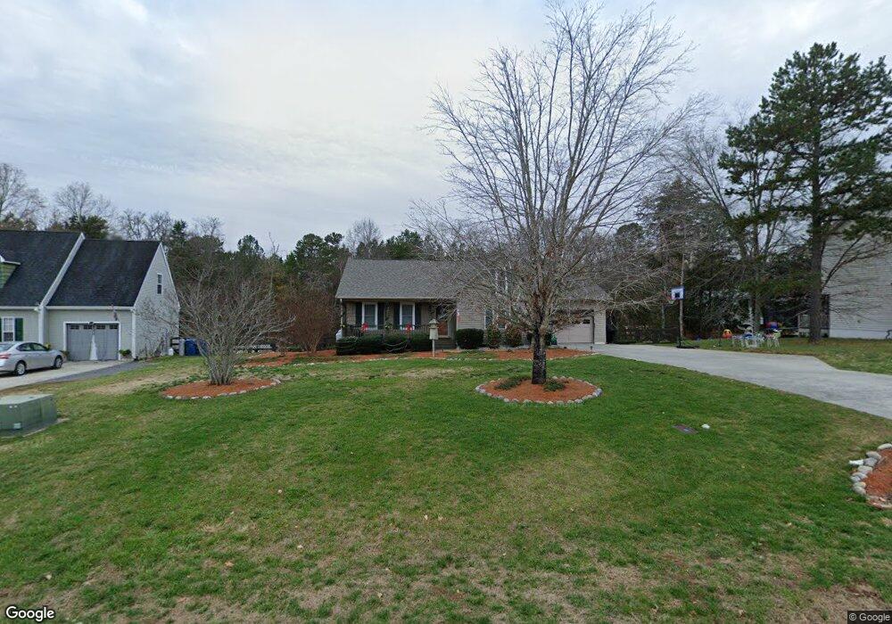
598 Whitney Rd Mocksville, NC 27028
Estimated Value: $237,000 - $255,000
3
Beds
2
Baths
1,471
Sq Ft
$166/Sq Ft
Est. Value
About This Home
This home is located at 598 Whitney Rd, Mocksville, NC 27028 and is currently estimated at $244,349, approximately $166 per square foot. 598 Whitney Rd is a home located in Davie County with nearby schools including Cornatzer Elementary School, William Ellis Middle School, and Davie County High School.
Ownership History
Date
Name
Owned For
Owner Type
Purchase Details
Closed on
Sep 13, 2007
Sold by
Arbogast Matthew M and Arbogast Sherene
Bought by
Monk Alice S
Current Estimated Value
Home Financials for this Owner
Home Financials are based on the most recent Mortgage that was taken out on this home.
Original Mortgage
$50,000
Interest Rate
6.62%
Mortgage Type
New Conventional
Purchase Details
Closed on
Jun 1, 2004
Purchase Details
Closed on
Nov 1, 2001
Create a Home Valuation Report for This Property
The Home Valuation Report is an in-depth analysis detailing your home's value as well as a comparison with similar homes in the area
Home Values in the Area
Average Home Value in this Area
Purchase History
| Date | Buyer | Sale Price | Title Company |
|---|---|---|---|
| Monk Alice S | $128,000 | None Available | |
| -- | $110,000 | -- | |
| -- | $1,000 | -- |
Source: Public Records
Mortgage History
| Date | Status | Borrower | Loan Amount |
|---|---|---|---|
| Closed | Monk Alice S | $50,000 |
Source: Public Records
Tax History
| Year | Tax Paid | Tax Assessment Tax Assessment Total Assessment is a certain percentage of the fair market value that is determined by local assessors to be the total taxable value of land and additions on the property. | Land | Improvement |
|---|---|---|---|---|
| 2025 | $2,100 | $214,580 | $35,000 | $179,580 |
| 2024 | $1,437 | $135,180 | $16,000 | $119,180 |
| 2023 | $1,437 | $135,180 | $16,000 | $119,180 |
| 2022 | $1,437 | $135,180 | $16,000 | $119,180 |
| 2021 | $1,437 | $135,180 | $16,000 | $119,180 |
| 2020 | $1,251 | $117,180 | $10,000 | $107,180 |
| 2019 | $1,251 | $117,180 | $10,000 | $107,180 |
| 2018 | $1,251 | $117,180 | $10,000 | $107,180 |
| 2017 | $1,242 | $117,180 | $0 | $0 |
| 2016 | $1,270 | $119,860 | $0 | $0 |
| 2015 | $1,270 | $119,860 | $0 | $0 |
| 2014 | $1,141 | $119,860 | $0 | $0 |
| 2013 | -- | $119,860 | $0 | $0 |
Source: Public Records
Map
Nearby Homes
- 126 Blue Bonnet Ct
- 148 Windsong Rd
- 150 Ariel Ct
- 168 Chessie Rd
- 176 Big Laurel Dr
- 196 Elisha Creek Dr
- 107 Big Laurel Dr
- 104 Nickel Plate Dr
- 112 W Carmel Cove Dr
- 158 John Crotts Rd
- 109 Marbrook Dr
- 0 Milling Rd
- 313 Dogwood Ln
- 159 S Madera Dr
- 125 Drayton Ct
- 138 S Madera Dr
- 157 Matthias Ct
- 127 Arbor Hill Ave
- 117 Chandler Dr
- 235 Spring St
- 592 Whitney Rd
- 604 Whitney Rd
- 117 Foxdale Ct
- 586 Whitney Rd
- 610 Whitney Rd
- 119 Foxdale Ct
- 119 Foxdale Ct Unit 59
- 595 Whitney Rd
- 589 Whitney Rd
- 611 Whitney Rd
- 616 Whitney Rd
- 570 Whitney Rd
- 583 Whitney Rd
- 118 Foxdale Ct
- 116 Foxdale Ct
- 619 Whitney Rd
- 562 Whitney Rd
- 624 Whitney Rd
- 121 Heather Ct
- 120 Heather Ct
Your Personal Tour Guide
Ask me questions while you tour the home.