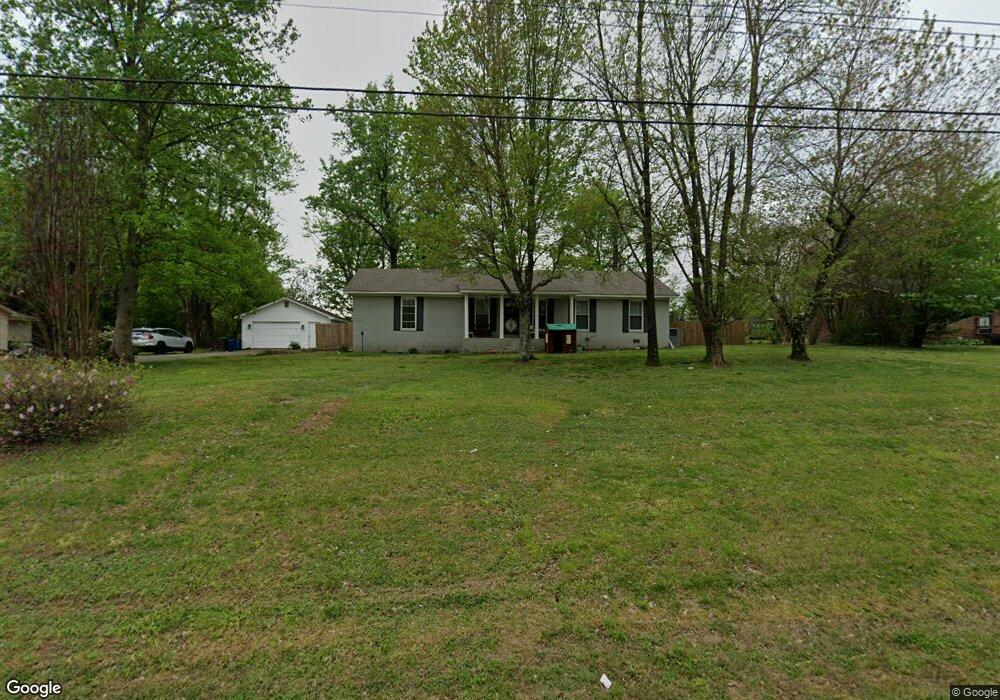
5981 Highway 59 W Covington, TN 38019
Estimated Value: $236,000 - $279,000
--
Bed
1
Bath
1,280
Sq Ft
$196/Sq Ft
Est. Value
About This Home
This home is located at 5981 Highway 59 W, Covington, TN 38019 and is currently estimated at $250,268, approximately $195 per square foot. 5981 Highway 59 W is a home located in Tipton County with nearby schools including Crestview Elementary School, Crestview Middle School, and Covington High School.
Ownership History
Date
Name
Owned For
Owner Type
Purchase Details
Closed on
May 15, 2025
Sold by
Max Donald J
Bought by
Short Chance Augustus
Current Estimated Value
Home Financials for this Owner
Home Financials are based on the most recent Mortgage that was taken out on this home.
Original Mortgage
$240,028
Outstanding Balance
$239,176
Interest Rate
6.64%
Mortgage Type
New Conventional
Estimated Equity
$11,092
Purchase Details
Closed on
Oct 15, 2021
Sold by
Keating Kevin and Keating Shawnee E
Bought by
Max Donald J
Home Financials for this Owner
Home Financials are based on the most recent Mortgage that was taken out on this home.
Original Mortgage
$202,268
Interest Rate
2.8%
Mortgage Type
New Conventional
Purchase Details
Closed on
Oct 17, 2019
Sold by
Blankenship Alfred
Bought by
Keating Kevin and Keating Shawnee E
Home Financials for this Owner
Home Financials are based on the most recent Mortgage that was taken out on this home.
Original Mortgage
$158,230
Interest Rate
3.7%
Mortgage Type
VA
Purchase Details
Closed on
Sep 1, 2019
Sold by
Blankenship Alfred
Bought by
Blankenship Alfred and Blankenship Debbie
Home Financials for this Owner
Home Financials are based on the most recent Mortgage that was taken out on this home.
Original Mortgage
$158,230
Interest Rate
3.7%
Mortgage Type
VA
Purchase Details
Closed on
Jan 26, 2019
Sold by
Montgomery Steve
Bought by
Blankenship Alfred and Blankenship Debbie
Purchase Details
Closed on
Aug 7, 2000
Sold by
Darrell Whitson
Bought by
Rose Whitson
Purchase Details
Closed on
Sep 15, 1995
Bought by
Whitson Darrell and Whitson Rose
Purchase Details
Closed on
Aug 21, 1984
Bought by
Smith James R and Smith Zilphia A
Purchase Details
Closed on
Apr 23, 1981
Purchase Details
Closed on
Sep 1, 1954
Create a Home Valuation Report for This Property
The Home Valuation Report is an in-depth analysis detailing your home's value as well as a comparison with similar homes in the area
Home Values in the Area
Average Home Value in this Area
Purchase History
| Date | Buyer | Sale Price | Title Company |
|---|---|---|---|
| Short Chance Augustus | $245,000 | None Listed On Document | |
| Short Chance Augustus | $245,000 | None Listed On Document | |
| Max Donald J | $206,000 | None Available | |
| Keating Kevin | $154,900 | -- | |
| Blankenship Alfred | -- | -- | |
| Blankenship Alfred | $82,000 | -- | |
| Rose Whitson | -- | -- | |
| Whitson Darrell | $64,000 | -- | |
| Smith James R | -- | -- | |
| -- | -- | -- | |
| -- | -- | -- |
Source: Public Records
Mortgage History
| Date | Status | Borrower | Loan Amount |
|---|---|---|---|
| Open | Short Chance Augustus | $240,028 | |
| Closed | Short Chance Augustus | $240,028 | |
| Previous Owner | Max Donald J | $202,268 | |
| Previous Owner | Keating Kevin | $158,230 |
Source: Public Records
Tax History Compared to Growth
Tax History
| Year | Tax Paid | Tax Assessment Tax Assessment Total Assessment is a certain percentage of the fair market value that is determined by local assessors to be the total taxable value of land and additions on the property. | Land | Improvement |
|---|---|---|---|---|
| 2024 | $0 | $47,550 | $3,700 | $43,850 |
| 2023 | $724 | $47,550 | $3,700 | $43,850 |
| 2022 | $683 | $33,500 | $2,725 | $30,775 |
| 2021 | $683 | $33,500 | $2,725 | $30,775 |
| 2020 | $683 | $33,500 | $2,725 | $30,775 |
| 2019 | $513 | $21,200 | $2,300 | $18,900 |
| 2018 | $513 | $21,200 | $2,300 | $18,900 |
| 2017 | $513 | $21,200 | $2,300 | $18,900 |
| 2016 | $513 | $21,200 | $2,300 | $18,900 |
| 2015 | $512 | $21,200 | $2,300 | $18,900 |
| 2014 | $510 | $21,118 | $0 | $0 |
Source: Public Records
Map
Nearby Homes
- 73 Mcwilliams Rd
- 7218 Tennessee 59
- 0 Hawkins Rd
- 0 Mcwilliams Rd
- 1524 Garland Dr
- 101 Sivil Cir
- 10448 Route 59
- 8249 Highway 59 W
- 0 Lavelle Rd
- 1288 Walnut Grove Rd
- 272 Stephens Rd
- 2930 Indian Creek Rd
- 0 Elm Grove Rd
- 65 Paulette Cir
- 1202 Bucksnort Rd
- 2847 Holly Grove Rd
- 2356 Indian Creek Rd
- 181 Deen Rd
- 273 Daniel Dr
- 0 Montgomery Rd
- 5981 Tennessee 59
- 5965 Highway 59 W
- 6005 Highway 59 W
- 6010 Highway 59 W
- 5955 Highway 59 W
- 6037 Highway 59 W
- 6028 Highway 59 W
- 6055 Highway 59 W
- 6055 Highway 59 W
- 6048 Highway 59 W
- 5933 Highway 59 W
- 5909 Highway 59 W
- 6113 Highway 59 W
- 5841 Highway 59 W
- 5890 Highway 59 W
- 5881 Highway 59 W
- 6153 Highway 59 W
- 6070 Highway 59 W
- 5807 Highway 59 W
- 43 Mcwilliams Rd