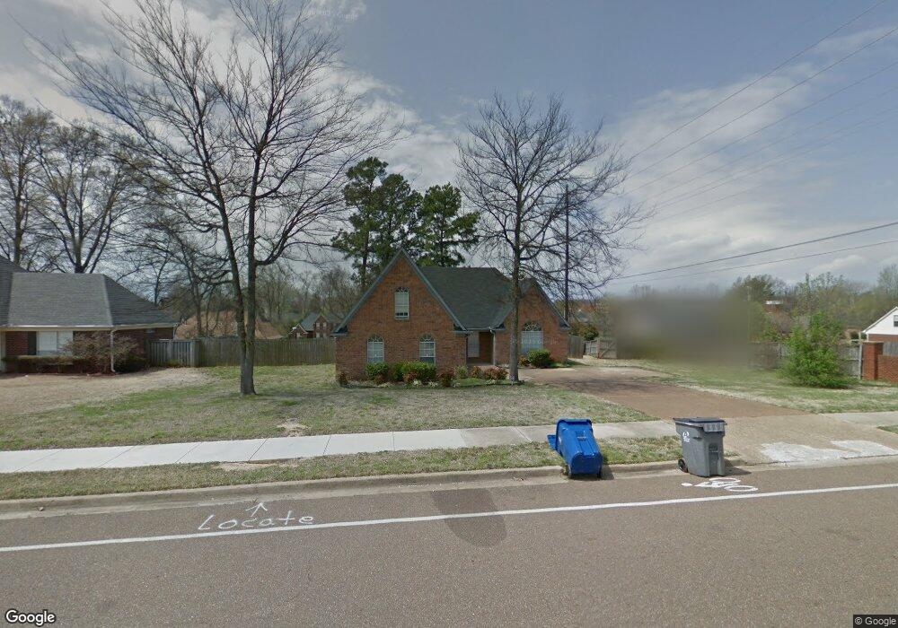
5983 Michaelson Dr Olive Branch, MS 38654
Estimated Value: $280,068 - $293,000
3
Beds
--
Bath
2,159
Sq Ft
$132/Sq Ft
Est. Value
About This Home
This home is located at 5983 Michaelson Dr, Olive Branch, MS 38654 and is currently estimated at $284,767, approximately $131 per square foot. 5983 Michaelson Dr is a home located in DeSoto County with nearby schools including Olive Branch Elementary School, Chickasaw Elementary School, and Olive Branch Middle School.
Ownership History
Date
Name
Owned For
Owner Type
Purchase Details
Closed on
Jan 21, 2022
Sold by
Wring Virginia A
Bought by
Glass Cedra S
Current Estimated Value
Purchase Details
Closed on
Aug 30, 2021
Sold by
Affordable Management Llc
Bought by
Glass Cedra S
Home Financials for this Owner
Home Financials are based on the most recent Mortgage that was taken out on this home.
Original Mortgage
$148,154
Interest Rate
2.1%
Mortgage Type
FHA
Purchase Details
Closed on
Oct 23, 2020
Sold by
Wring Aubrey Bruce
Bought by
Affordable Management Llc
Create a Home Valuation Report for This Property
The Home Valuation Report is an in-depth analysis detailing your home's value as well as a comparison with similar homes in the area
Home Values in the Area
Average Home Value in this Area
Purchase History
| Date | Buyer | Sale Price | Title Company |
|---|---|---|---|
| Glass Cedra S | -- | Sure Title | |
| Glass Cedra S | -- | Sure Title Company Llc | |
| Affordable Management Llc | -- | Sure Title Company Llc |
Source: Public Records
Mortgage History
| Date | Status | Borrower | Loan Amount |
|---|---|---|---|
| Previous Owner | Glass Cedra S | $148,154 |
Source: Public Records
Tax History Compared to Growth
Tax History
| Year | Tax Paid | Tax Assessment Tax Assessment Total Assessment is a certain percentage of the fair market value that is determined by local assessors to be the total taxable value of land and additions on the property. | Land | Improvement |
|---|---|---|---|---|
| 2024 | $1,563 | $13,650 | $2,500 | $11,150 |
| 2023 | $1,563 | $13,650 | $0 | $0 |
| 2022 | $1,563 | $13,650 | $2,500 | $11,150 |
| 2021 | $2,794 | $20,475 | $3,750 | $16,725 |
| 2020 | $2,611 | $19,130 | $3,750 | $15,380 |
| 2019 | $2,611 | $19,130 | $3,750 | $15,380 |
| 2017 | $2,554 | $33,484 | $18,617 | $14,867 |
| 2016 | $2,667 | $19,442 | $3,750 | $15,692 |
| 2015 | $2,667 | $35,134 | $19,442 | $15,692 |
| 2014 | $2,667 | $19,442 | $0 | $0 |
| 2013 | $2,590 | $19,442 | $0 | $0 |
Source: Public Records
Map
Nearby Homes
- 6041 Allen Pkwy W
- 5676 Southbend Ln
- 9821 Morgan Manor Dr
- 5648 Blocker St
- 5841 Blocker St
- 9800 Cherokee Dr
- 5295 Blocker St
- 9759 Pigeon Roost Park Cir
- 10082 Lacey Dr
- 2914 Cypress Lake Dr S
- 9919 Adina Cove
- 9113 Rue Orleans Ln
- 9598 Nielsen Dr
- 6180 Rd
- 5195 Mary Ln N
- 9270 College St
- 10227 Williford Dr
- 6748 Cockrum Rd
- 9745 Riggan Dr
- 10475 Courtney Cove
- 5969 Michaelson Dr
- 5984 Eagleston Dr
- 5970 Eagleston Dr
- 5955 Michaelson Dr
- 9640 E Sandidge Rd
- 6040 Choctaw Trail
- 5968 Michaelson Dr
- 5956 Eagleston Dr
- 9654 E Sandidge Rd
- 5941 Michaelson Dr
- 9668 E Sandidge Rd
- 5942 Eagleston Dr
- 6027 Choctaw Trail
- 9684 Shelby Ln
- 9647 Seminole Dr
- 5981 Eagleston Dr
- 5927 Michaelson Dr
- 5934 Michaelson Dr
- 6031 Choctaw Trail
- 9682 E Sandidge Rd