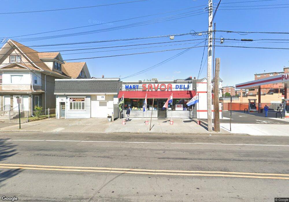
599 Washington Ave Bridge Port, CT 06604
The Hollow NeighborhoodEstimated Value: $384,226
--
Bed
--
Bath
1,600
Sq Ft
$240/Sq Ft
Est. Value
About This Home
This home is located at 599 Washington Ave, Bridge Port, CT 06604 and is currently estimated at $384,226, approximately $240 per square foot. 599 Washington Ave is a home located in Fairfield County with nearby schools including Geraldine Johnson School, Bassick High School, and Catholic Academy of Bridgeport-St. Raphael Academy.
Ownership History
Date
Name
Owned For
Owner Type
Purchase Details
Closed on
May 10, 2018
Sold by
Collazo Carlos
Bought by
Nyct Management Llc
Current Estimated Value
Purchase Details
Closed on
Jan 23, 1998
Sold by
Evangelical Baptist
Bought by
Collazo Carlos A
Purchase Details
Closed on
Feb 3, 1995
Sold by
Alliance Mtg Co
Bought by
Evangelical Baptist Ch
Create a Home Valuation Report for This Property
The Home Valuation Report is an in-depth analysis detailing your home's value as well as a comparison with similar homes in the area
Home Values in the Area
Average Home Value in this Area
Purchase History
| Date | Buyer | Sale Price | Title Company |
|---|---|---|---|
| Nyct Management Llc | $225,000 | -- | |
| Nyct Management Llc | $225,000 | -- | |
| Collazo Carlos A | $18,000 | -- | |
| Collazo Carlos A | $18,000 | -- | |
| Evangelical Baptist Ch | $20,000 | -- | |
| Evangelical Baptist Ch | $20,000 | -- |
Source: Public Records
Tax History Compared to Growth
Tax History
| Year | Tax Paid | Tax Assessment Tax Assessment Total Assessment is a certain percentage of the fair market value that is determined by local assessors to be the total taxable value of land and additions on the property. | Land | Improvement |
|---|---|---|---|---|
| 2025 | $7,191 | $165,490 | $67,980 | $97,510 |
| 2024 | $7,191 | $165,490 | $67,980 | $97,510 |
| 2023 | $7,191 | $165,490 | $67,980 | $97,510 |
| 2022 | $7,191 | $165,490 | $67,980 | $97,510 |
| 2021 | $7,191 | $165,490 | $67,980 | $97,510 |
| 2020 | $7,642 | $141,550 | $55,670 | $85,880 |
| 2019 | $7,642 | $141,550 | $55,670 | $85,880 |
| 2018 | $7,696 | $141,550 | $55,670 | $85,880 |
| 2017 | $7,696 | $141,550 | $55,670 | $85,880 |
| 2016 | $7,696 | $141,550 | $55,670 | $85,880 |
| 2015 | $6,444 | $152,690 | $66,810 | $85,880 |
| 2014 | $6,444 | $152,690 | $66,810 | $85,880 |
Source: Public Records
Map
Nearby Homes
- 75 Sanford Ave
- 139 Highland Ave Unit 143
- 120 Milne St Unit 122
- 113 Milne St Unit 115
- 183 Calhoun Ave
- 200 Harral Ave
- 213 Harral Ave Unit 215
- 318 Center St
- 309 Pequonnock St
- 191 Oak St
- 79 William St
- 1373 Iranistan Ave
- 1199 Iranistan Ave Unit 1201
- 592 Norman St Unit 594
- 881 Lafayette Blvd Unit 5K
- 881 Lafayette Blvd Unit 1A
- 289 Harriet St
- 826 Norman St
- 100 Lorraine St
- 78 Fairmount Ave
- 621 Washington Ave
- 585 Washington Ave Unit 3
- 585 Washington Ave
- 22 Sanford Ave
- 35-37 Highland Ave
- 35 Highland Ave Unit 37
- 32 Sanford
- 23 Sanford Ave
- 559 Washington Ave
- 55 Highland Ave
- 33 Sanford Ave Unit 35
- 59 Highland Ave Unit 63
- 58 Sanford Ave
- 58 Sanford Ave Unit 2
- 43 Sanford Ave
- 62 Sanford Ave
- 53 Sanford Ave
- 53 Sanford Ave Unit 1ST
- 79 Highland Ave Unit 83