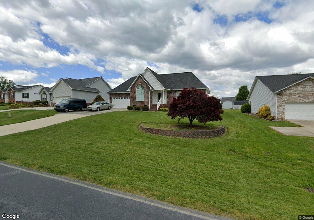
5991 Weant Rd High Point, NC 27263
Estimated Value: $132,000 - $331,000
Studio
2
Baths
1,672
Sq Ft
$161/Sq Ft
Est. Value
About This Home
This home is located at 5991 Weant Rd, High Point, NC 27263 and is currently estimated at $269,642, approximately $161 per square foot. 5991 Weant Rd is a home located in Randolph County with nearby schools including John R. Lawrence Elementary School, Wheatmore Middle School, and Trinity High School.
Ownership History
Date
Name
Owned For
Owner Type
Purchase Details
Closed on
Jun 26, 2025
Sold by
Brown Brian K and Brown Kimberly G
Bought by
Gates Juanita B and Gates Juanita Ti
Current Estimated Value
Purchase Details
Closed on
Sep 4, 1998
Bought by
Brown Brian K Brown Kimberly G
Purchase Details
Closed on
Apr 14, 1998
Bought by
Brown Brian K Brown Kimberly G
Create a Home Valuation Report for This Property
The Home Valuation Report is an in-depth analysis detailing your home's value as well as a comparison with similar homes in the area
Home Values in the Area
Average Home Value in this Area
Purchase History
| Date | Buyer | Sale Price | Title Company |
|---|---|---|---|
| Gates Juanita B | $133,000 | None Listed On Document | |
| Gates Juanita B | $133,000 | None Listed On Document | |
| Brown Brian K Brown Kimberly G | $138,000 | -- | |
| Brown Brian K Brown Kimberly G | $22,900 | -- |
Source: Public Records
Tax History
| Year | Tax Paid | Tax Assessment Tax Assessment Total Assessment is a certain percentage of the fair market value that is determined by local assessors to be the total taxable value of land and additions on the property. | Land | Improvement |
|---|---|---|---|---|
| 2025 | $2,521 | $242,320 | $55,820 | $186,500 |
| 2024 | $2,497 | $242,320 | $55,820 | $186,500 |
| 2023 | $2,497 | $242,320 | $55,820 | $186,500 |
| 2022 | $1,887 | $159,280 | $26,730 | $132,550 |
| 2021 | $1,887 | $159,280 | $26,730 | $132,550 |
| 2020 | $1,844 | $159,280 | $26,730 | $132,550 |
| 2019 | $1,844 | $159,280 | $26,730 | $132,550 |
| 2018 | $1,585 | $133,460 | $26,610 | $106,850 |
| 2016 | $1,554 | $133,464 | $26,610 | $106,854 |
| 2015 | $1,557 | $133,464 | $26,610 | $106,854 |
| 2014 | -- | $133,464 | $26,610 | $106,854 |
Source: Public Records
Map
Nearby Homes
- 100 Lindsay Dr
- 115 Lindsay Dr
- 6071 Weant Rd
- 6047 Suits Rd
- 308 Belgian Dr
- 9622 Us Highway 311
- 0 Suits Rd
- 0-C Us Highway 311
- 5005 Country Ln
- 309 Alison Ln
- 5136 Country Ln
- 0-B Us Highway 311
- 9256 Us Highway 311
- 220 Alison Ln
- 0-A Us Highway 311
- 0 Sprucewood Ct
- 108 Sprucewood Ct
- 107 Autumn Hill Ct
- 110 Billy Ave
- 206 Ridge Creek Dr
Your Personal Tour Guide
Ask me questions while you tour the home.