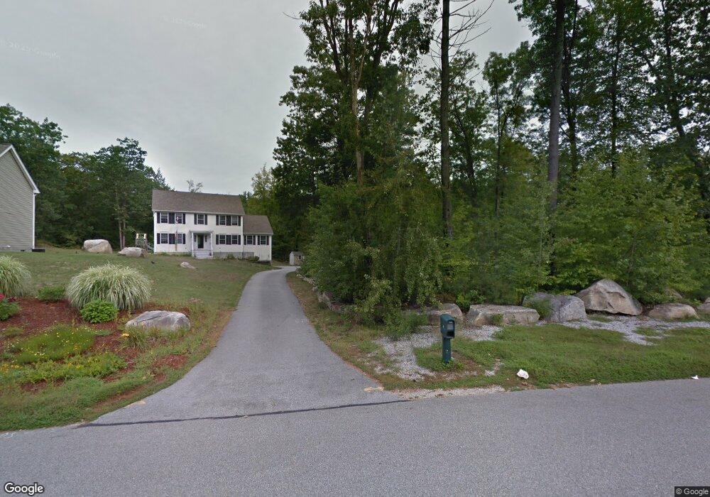
6 Avon Rd Hooksett, NH 03106
Estimated Value: $676,000 - $884,000
3
Beds
3
Baths
2,936
Sq Ft
$253/Sq Ft
Est. Value
About This Home
This home is located at 6 Avon Rd, Hooksett, NH 03106 and is currently estimated at $741,748, approximately $252 per square foot. 6 Avon Rd is a home located in Merrimack County with nearby schools including Fred C. Underhill School, Hooksett Memorial School, and David R. Cawley Middle School.
Ownership History
Date
Name
Owned For
Owner Type
Purchase Details
Closed on
May 17, 2010
Sold by
Gehris Brian W and Gehris Eileen G
Bought by
Lama Lok B and Lama Sumitra D
Current Estimated Value
Home Financials for this Owner
Home Financials are based on the most recent Mortgage that was taken out on this home.
Original Mortgage
$294,566
Interest Rate
5.11%
Mortgage Type
Purchase Money Mortgage
Purchase Details
Closed on
Oct 2, 2007
Sold by
Rigdon Gerald T
Bought by
Gehris Brian W and Gehris Eileen G
Create a Home Valuation Report for This Property
The Home Valuation Report is an in-depth analysis detailing your home's value as well as a comparison with similar homes in the area
Home Values in the Area
Average Home Value in this Area
Purchase History
| Date | Buyer | Sale Price | Title Company |
|---|---|---|---|
| Lama Lok B | $300,000 | -- | |
| Gehris Brian W | $630,000 | -- | |
| Lama Lok B | $300,000 | -- | |
| Gehris Brian W | $630,000 | -- |
Source: Public Records
Mortgage History
| Date | Status | Borrower | Loan Amount |
|---|---|---|---|
| Open | Gehris Brian W | $180,000 | |
| Closed | Gehris Brian W | $259,000 | |
| Closed | Gehris Brian W | $294,566 |
Source: Public Records
Tax History
| Year | Tax Paid | Tax Assessment Tax Assessment Total Assessment is a certain percentage of the fair market value that is determined by local assessors to be the total taxable value of land and additions on the property. | Land | Improvement |
|---|---|---|---|---|
| 2024 | $9,942 | $586,200 | $161,000 | $425,200 |
| 2023 | $9,367 | $586,200 | $161,000 | $425,200 |
| 2022 | $8,050 | $334,700 | $107,600 | $227,100 |
| 2021 | $7,437 | $334,700 | $107,600 | $227,100 |
| 2020 | $7,534 | $334,700 | $107,600 | $227,100 |
| 2019 | $7,213 | $334,700 | $107,600 | $227,100 |
| 2018 | $7,404 | $334,700 | $107,600 | $227,100 |
| 2017 | $7,463 | $279,100 | $91,600 | $187,500 |
| 2016 | $7,365 | $279,100 | $91,600 | $187,500 |
| 2015 | $6,899 | $279,100 | $91,600 | $187,500 |
| 2014 | $6,930 | $279,100 | $91,600 | $187,500 |
| 2013 | $6,530 | $278,100 | $91,600 | $186,500 |
Source: Public Records
Map
Nearby Homes
- 1465 Hooksett Rd Unit 418
- 1465 Hooksett Rd Unit 183
- 1465 Hooksett Rd Unit 390
- 1465 Hooksett Rd Unit 41
- 1601 Hooksett Rd
- 8 Short Ave
- 5 Cross Rd
- 245 W River Rd
- 32 Lindsay Rd
- 5 Thistle Ln
- 12 Chase St
- 1821 Hooksett Rd
- 59 Post Rd
- 0 Chester Turnpike Unit 18
- 117 Merrimack St
- 131 Merrimack St
- 9 Berry Hill Rd
- 199 Whitehall Rd
- 197-199 Whitehall Rd
- 197 Whitehall Rd
Your Personal Tour Guide
Ask me questions while you tour the home.