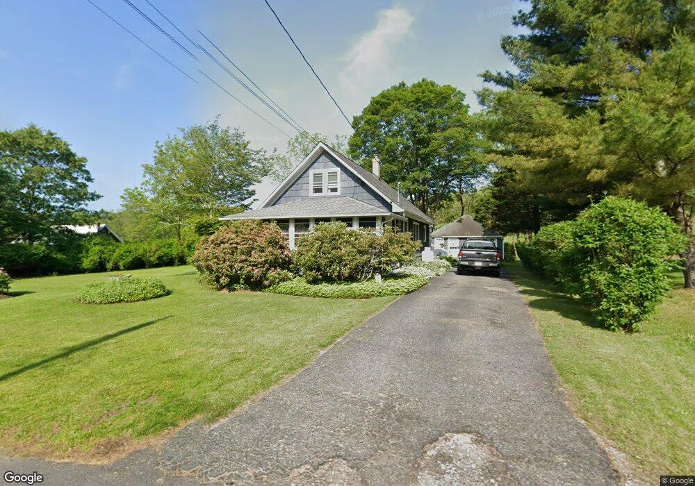
6 Bevans Rd Layton, NJ 07851
Estimated Value: $284,783 - $427,000
--
Bed
--
Bath
1,569
Sq Ft
$232/Sq Ft
Est. Value
About This Home
This home is located at 6 Bevans Rd, Layton, NJ 07851 and is currently estimated at $363,946, approximately $231 per square foot. 6 Bevans Rd is a home located in Sussex County with nearby schools including Sandyston-Walpack Consolidated School and Kittatinny Regional High School.
Ownership History
Date
Name
Owned For
Owner Type
Purchase Details
Closed on
Oct 11, 2022
Sold by
Stevens Douglas R
Bought by
Stevens Douglas R and Stevens Karen A
Current Estimated Value
Purchase Details
Closed on
Feb 3, 1989
Bought by
Stevens Douglas R
Create a Home Valuation Report for This Property
The Home Valuation Report is an in-depth analysis detailing your home's value as well as a comparison with similar homes in the area
Home Values in the Area
Average Home Value in this Area
Purchase History
| Date | Buyer | Sale Price | Title Company |
|---|---|---|---|
| Stevens Douglas R | -- | -- | |
| Stevens Douglas R | -- | None Listed On Document | |
| Stevens Douglas R | $111,000 | -- |
Source: Public Records
Tax History Compared to Growth
Tax History
| Year | Tax Paid | Tax Assessment Tax Assessment Total Assessment is a certain percentage of the fair market value that is determined by local assessors to be the total taxable value of land and additions on the property. | Land | Improvement |
|---|---|---|---|---|
| 2025 | $5,148 | $162,900 | $57,200 | $105,700 |
| 2024 | $4,991 | $162,900 | $57,200 | $105,700 |
| 2023 | $4,991 | $162,900 | $57,200 | $105,700 |
| 2022 | $4,770 | $162,900 | $57,200 | $105,700 |
| 2021 | $4,621 | $162,900 | $57,200 | $105,700 |
| 2020 | $4,429 | $162,900 | $57,200 | $105,700 |
| 2019 | $4,237 | $162,900 | $57,200 | $105,700 |
| 2018 | $4,211 | $162,900 | $57,200 | $105,700 |
| 2017 | $4,139 | $162,900 | $57,200 | $105,700 |
| 2016 | $4,159 | $162,900 | $57,200 | $105,700 |
| 2015 | $4,015 | $162,900 | $57,200 | $105,700 |
| 2014 | $3,997 | $194,700 | $74,600 | $120,100 |
Source: Public Records
Map
Nearby Homes
- 119 Rte 560
- 113 County Road 560
- 113 Rt560
- 12 Old Dingman Rd
- 155 Route560
- 4 Butternut Ln
- 0 Lot85a Unit 755921
- 11 Hirams Grove Rd
- 13 Sunrise Trail
- 111 County Road 645
- 9 Woods Rd
- 95 Woods Rd
- 4 Lake Path 1
- 13 U S 206
- 27 Mountain Trail
- 57 E Shore Trail
- 461 U S Highway 206
- 1 South Trail
- 161A County Road 645
- 00 Devita Rd