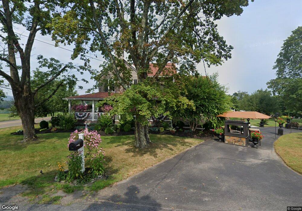
6 Camp David Rd Wapwallopen, PA 18660
Estimated Value: $317,902 - $593,000
4
Beds
4
Baths
2,957
Sq Ft
$141/Sq Ft
Est. Value
About This Home
This home is located at 6 Camp David Rd, Wapwallopen, PA 18660 and is currently estimated at $415,476, approximately $140 per square foot. 6 Camp David Rd is a home located in Luzerne County with nearby schools including Crestwood Secondary Campus (Crestwood High School).
Ownership History
Date
Name
Owned For
Owner Type
Purchase Details
Closed on
Jul 14, 2016
Sold by
Swiech Thomas D and Swiech Kerry
Bought by
Bradley Bonita L
Current Estimated Value
Purchase Details
Closed on
Feb 26, 2009
Sold by
Swiech Thomas D
Bought by
Swiech Thomas D and Swiech Kerry
Home Financials for this Owner
Home Financials are based on the most recent Mortgage that was taken out on this home.
Original Mortgage
$324,000
Interest Rate
5.14%
Mortgage Type
New Conventional
Create a Home Valuation Report for This Property
The Home Valuation Report is an in-depth analysis detailing your home's value as well as a comparison with similar homes in the area
Home Values in the Area
Average Home Value in this Area
Purchase History
| Date | Buyer | Sale Price | Title Company |
|---|---|---|---|
| Bradley Bonita L | $300,000 | None Available | |
| Swiech Thomas D | -- | None Available |
Source: Public Records
Mortgage History
| Date | Status | Borrower | Loan Amount |
|---|---|---|---|
| Previous Owner | Swiech Thomas D | $324,000 |
Source: Public Records
Tax History
| Year | Tax Paid | Tax Assessment Tax Assessment Total Assessment is a certain percentage of the fair market value that is determined by local assessors to be the total taxable value of land and additions on the property. | Land | Improvement |
|---|---|---|---|---|
| 2026 | $3,354 | $173,200 | $40,000 | $133,200 |
| 2025 | $3,290 | $173,200 | $40,000 | $133,200 |
| 2024 | $3,247 | $173,200 | $40,000 | $133,200 |
| 2023 | $3,136 | $173,200 | $40,000 | $133,200 |
| 2022 | $3,104 | $173,200 | $40,000 | $133,200 |
| 2021 | $3,031 | $173,200 | $40,000 | $133,200 |
| 2020 | $2,983 | $173,200 | $40,000 | $133,200 |
| 2019 | $2,834 | $173,200 | $40,000 | $133,200 |
| 2018 | $2,741 | $173,200 | $40,000 | $133,200 |
| 2017 | $2,532 | $160,000 | $40,000 | $120,000 |
| 2016 | -- | $160,000 | $40,000 | $120,000 |
| 2015 | -- | $160,000 | $40,000 | $120,000 |
| 2014 | -- | $160,000 | $40,000 | $120,000 |
Source: Public Records
Map
Nearby Homes
- 1161 Blue Ridge Trail
- 18 Circle Ave
- 18 Shady Oak Ln
- 2.19 acres Saint Marys Rd
- 3 Skapura Ln
- 371 Pond Hill Mountain Rd
- 0 Stairville Rd
- 300 Vandermark Rd
- 30 Coal St
- 28 Coal St
- 86 E Main St
- 81 W Main St
- 598 Old Newport St
- 46 Arch St
- 34 Arch St
- 81 W Enterprise St
- 21 E Enterprise St
- 141 Estates Drive (Lot 16)
- Hemlock St Hemlock St
- 180 Estates Drive (Lot 6)
- 1362 Slocum Rd
- 7 Camp David Rd
- 1344 Slocum Rd
- 1343 Slocum Rd
- 1408 Slocum Rd
- 1407 Slocum Rd
- 1358 Slocum Rd
- 1331 Slocum Rd
- 3153 Camp David Rd
- 3223 Slocum Rd
- 1326 Slocum Rd
- 304 Slocum Rd
- 13 Schmid Rd
- 1317 Slocum Rd
- 25 Camp David Rd
- 19 Schmid Rd
- 1311 Slocum Rd
- 1436 Slocum Rd
- 17 Camp David Rd
- 1305 Slocum Rd
Your Personal Tour Guide
Ask me questions while you tour the home.