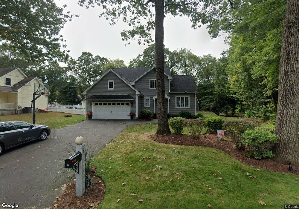
6 Carol Ann Dr South Hadley, MA 01075
Estimated Value: $491,000 - $549,000
3
Beds
3
Baths
2,172
Sq Ft
$238/Sq Ft
Est. Value
About This Home
This home is located at 6 Carol Ann Dr, South Hadley, MA 01075 and is currently estimated at $516,949, approximately $238 per square foot. 6 Carol Ann Dr is a home located in Hampshire County with nearby schools including Plains Elementary School, Mosier Elementary School, and Michael E. Smith Middle School.
Ownership History
Date
Name
Owned For
Owner Type
Purchase Details
Closed on
Mar 22, 2007
Sold by
Cote Joyce C and Cote Wayne F
Bought by
Roy Amy M and Roy Darryn N
Current Estimated Value
Home Financials for this Owner
Home Financials are based on the most recent Mortgage that was taken out on this home.
Original Mortgage
$200,000
Outstanding Balance
$121,520
Interest Rate
6.33%
Mortgage Type
Purchase Money Mortgage
Estimated Equity
$395,429
Create a Home Valuation Report for This Property
The Home Valuation Report is an in-depth analysis detailing your home's value as well as a comparison with similar homes in the area
Home Values in the Area
Average Home Value in this Area
Purchase History
| Date | Buyer | Sale Price | Title Company |
|---|---|---|---|
| Roy Amy M | $345,000 | -- |
Source: Public Records
Mortgage History
| Date | Status | Borrower | Loan Amount |
|---|---|---|---|
| Open | Roy Amy M | $200,000 |
Source: Public Records
Tax History Compared to Growth
Tax History
| Year | Tax Paid | Tax Assessment Tax Assessment Total Assessment is a certain percentage of the fair market value that is determined by local assessors to be the total taxable value of land and additions on the property. | Land | Improvement |
|---|---|---|---|---|
| 2025 | $6,899 | $433,100 | $119,000 | $314,100 |
| 2024 | $6,727 | $404,000 | $111,000 | $293,000 |
| 2023 | $6,655 | $379,200 | $101,100 | $278,100 |
| 2022 | $6,283 | $340,000 | $101,100 | $238,900 |
| 2021 | $6,194 | $318,300 | $94,100 | $224,200 |
| 2020 | $6,006 | $301,200 | $94,100 | $207,100 |
| 2019 | $6,377 | $316,500 | $89,700 | $226,800 |
| 2018 | $5,670 | $284,500 | $87,100 | $197,400 |
| 2017 | $5,438 | $270,300 | $87,100 | $183,200 |
| 2016 | $5,508 | $277,500 | $87,100 | $190,400 |
| 2015 | $5,198 | $268,200 | $84,700 | $183,500 |
Source: Public Records
Map
Nearby Homes
- 30 Yale St
- 0 Granby Rd
- 25 Noel St
- 15 Karen Dr
- 63 Washington Ave
- 133 Granby Rd
- 30 Pine Grove Dr
- 70 Pine Grove Dr Unit 70
- 73 Pine Grove Dr
- 18 Susan Ave
- 318 Newton St
- 34 Hildreth Ave
- 540 Granby Rd Unit 62
- 540 Granby Rd Unit 72A
- 540 Granby Rd Unit 109
- 19 Hildreth Ave
- 586 Granby Rd
- 32 North St
- 200 East St
- 3 Ralph Ave
- 5 Carol Ann Dr
- 8 Carol Ann Dr
- 4 Carol Ann Dr
- 9 Carol Ann Dr
- 10 Carol Ann Dr
- 1 Carol Ann Dr
- 30 Old Lyman Rd
- 30 Old Lyman Rd
- 0 Old Lyman Rd Unit 71023164
- 0 Old Lyman Rd Unit 71077883
- 0 Old Lyman Rd Unit 71363147
- 0 Old Lyman Rd Unit 71441451
- 11 Carol Ann Dr
- 6 Lyman Terrace
- 12 Oak Ave
- 15 Carol Ann Dr
- 280 Granby Rd
- 10 Oak Ave
- 12 Yale St
- 296 Granby Rd