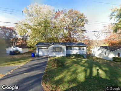
6 Circle Dr Decatur, IL 62521
Bayview NeighborhoodEstimated Value: $100,095 - $146,000
3
Beds
1
Bath
1,088
Sq Ft
$116/Sq Ft
Est. Value
About This Home
This home is located at 6 Circle Dr, Decatur, IL 62521 and is currently estimated at $126,024, approximately $115 per square foot. 6 Circle Dr is a home located in Macon County with nearby schools including Michael E. Baum Elementary School, Stephen Decatur Middle School, and Robertson Charter School.
Ownership History
Date
Name
Owned For
Owner Type
Purchase Details
Closed on
Oct 10, 2019
Sold by
Wilderman Timothy D and Wilderman Christy D
Bought by
Wilderman Timothy D and Wilderman Christy D
Current Estimated Value
Home Financials for this Owner
Home Financials are based on the most recent Mortgage that was taken out on this home.
Original Mortgage
$65,250
Outstanding Balance
$57,788
Interest Rate
3.5%
Mortgage Type
New Conventional
Estimated Equity
$68,236
Purchase Details
Closed on
Mar 7, 2014
Sold by
Kondaur Capital Corp
Bought by
Wilderman Timothy D
Purchase Details
Closed on
Jan 2, 2014
Sold by
Gray Andrew D
Bought by
Kondaur Capital Corporation
Purchase Details
Closed on
Jun 13, 2008
Sold by
Gilbert Robert W and Gilbert Nora E
Bought by
Graw Andrew D
Home Financials for this Owner
Home Financials are based on the most recent Mortgage that was taken out on this home.
Original Mortgage
$69,375
Interest Rate
6.09%
Mortgage Type
FHA
Create a Home Valuation Report for This Property
The Home Valuation Report is an in-depth analysis detailing your home's value as well as a comparison with similar homes in the area
Home Values in the Area
Average Home Value in this Area
Purchase History
| Date | Buyer | Sale Price | Title Company |
|---|---|---|---|
| Wilderman Timothy D | -- | National Title Solutions | |
| Wilderman Timothy D | $32,500 | None Available | |
| Kondaur Capital Corporation | -- | None Available | |
| Graw Andrew D | $70,000 | None Available |
Source: Public Records
Mortgage History
| Date | Status | Borrower | Loan Amount |
|---|---|---|---|
| Open | Wilderman Timothy D | $65,250 | |
| Previous Owner | Gray Andrew D | $70,390 | |
| Previous Owner | Graw Andrew D | $69,375 |
Source: Public Records
Tax History Compared to Growth
Tax History
| Year | Tax Paid | Tax Assessment Tax Assessment Total Assessment is a certain percentage of the fair market value that is determined by local assessors to be the total taxable value of land and additions on the property. | Land | Improvement |
|---|---|---|---|---|
| 2023 | $2,934 | $29,430 | $6,143 | $23,287 |
| 2022 | $2,819 | $27,671 | $5,776 | $21,895 |
| 2021 | $2,685 | $26,233 | $5,476 | $20,757 |
| 2020 | $2,651 | $25,072 | $5,234 | $19,838 |
| 2019 | $2,651 | $25,072 | $5,234 | $19,838 |
| 2018 | $2,564 | $24,522 | $5,119 | $19,403 |
| 2017 | $2,539 | $24,219 | $5,056 | $19,163 |
| 2016 | $2,754 | $26,181 | $5,053 | $21,128 |
| 2015 | $2,628 | $25,845 | $4,988 | $20,857 |
| 2014 | $1,892 | $25,845 | $4,988 | $20,857 |
| 2013 | $1,885 | $25,845 | $4,988 | $20,857 |
Source: Public Records
Map
Nearby Homes
- 13 Circle Dr
- 993 S Cedar Hill Dr
- 53 Norwood Dr
- 3319 E Oakwood Ave
- 3506 E Leafdale Ave
- 3223 E Oakwood Ave
- 3254 E Fulton Ave
- 3234 E Fulton Ave
- 4422 Mount Vernon Place
- 1827 S Albany Ct
- 1172 Buckeye Ln
- 1745 S 44th St
- 2839 E Wood St
- 360 N 34th St
- 1968 S Baltimore Ave
- 4904 E Baker Woods Ln
- 4907 E Hayden Dr
- 737 S Airport Rd
- 2007 S Windsor Rd
- 203 S 25th St