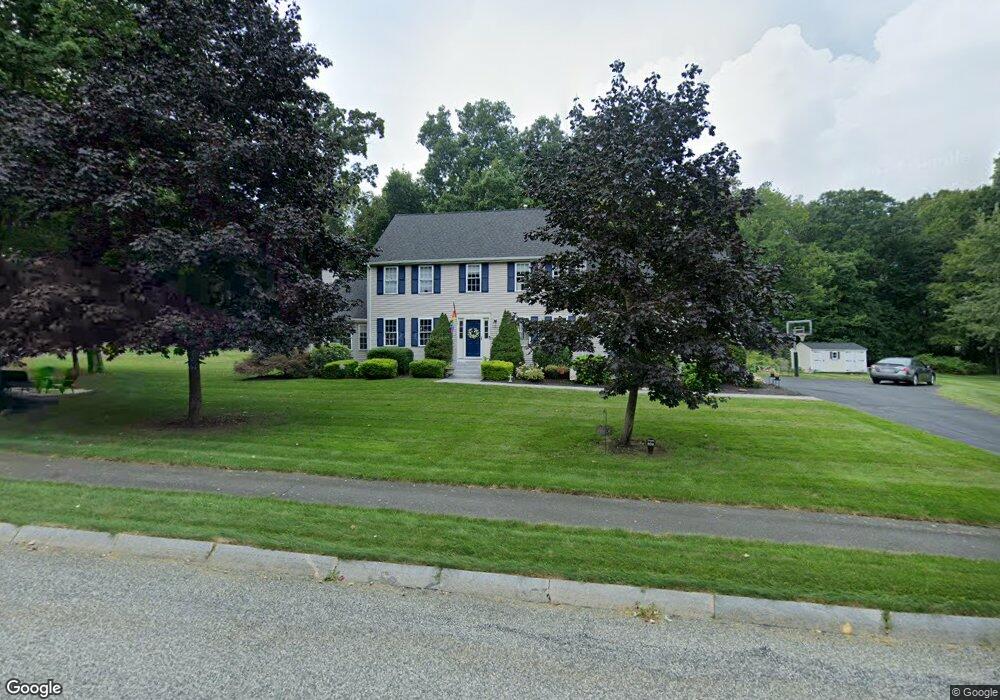
6 Cooper Dr Franklin, MA 02038
Estimated Value: $867,765 - $1,059,000
4
Beds
4
Baths
2,625
Sq Ft
$360/Sq Ft
Est. Value
About This Home
This home is located at 6 Cooper Dr, Franklin, MA 02038 and is currently estimated at $946,191, approximately $360 per square foot. 6 Cooper Dr is a home located in Norfolk County with nearby schools including Helen Keller Elementary School, Annie Sullivan Middle School, and Franklin High School.
Ownership History
Date
Name
Owned For
Owner Type
Purchase Details
Closed on
Feb 28, 1997
Sold by
Cobblestone Bldrs Inc
Bought by
Taylor Kenneth J and Taylor Celia M
Current Estimated Value
Home Financials for this Owner
Home Financials are based on the most recent Mortgage that was taken out on this home.
Original Mortgage
$206,000
Outstanding Balance
$25,069
Interest Rate
7.78%
Mortgage Type
Purchase Money Mortgage
Estimated Equity
$921,122
Purchase Details
Closed on
Aug 19, 1996
Sold by
Mechanics Place Rt
Bought by
Cobblestone Bldrs Inc
Home Financials for this Owner
Home Financials are based on the most recent Mortgage that was taken out on this home.
Original Mortgage
$147,000
Interest Rate
8.08%
Mortgage Type
Purchase Money Mortgage
Create a Home Valuation Report for This Property
The Home Valuation Report is an in-depth analysis detailing your home's value as well as a comparison with similar homes in the area
Home Values in the Area
Average Home Value in this Area
Purchase History
| Date | Buyer | Sale Price | Title Company |
|---|---|---|---|
| Taylor Kenneth J | $242,400 | -- | |
| Cobblestone Bldrs Inc | $50,000 | -- |
Source: Public Records
Mortgage History
| Date | Status | Borrower | Loan Amount |
|---|---|---|---|
| Open | Cobblestone Bldrs Inc | $206,000 | |
| Previous Owner | Cobblestone Bldrs Inc | $147,000 | |
| Closed | Cobblestone Bldrs Inc | $50,000 |
Source: Public Records
Tax History Compared to Growth
Tax History
| Year | Tax Paid | Tax Assessment Tax Assessment Total Assessment is a certain percentage of the fair market value that is determined by local assessors to be the total taxable value of land and additions on the property. | Land | Improvement |
|---|---|---|---|---|
| 2025 | $8,540 | $734,900 | $334,200 | $400,700 |
| 2024 | $8,491 | $720,200 | $334,200 | $386,000 |
| 2023 | $7,959 | $632,700 | $284,900 | $347,800 |
| 2022 | $7,494 | $533,400 | $224,300 | $309,100 |
| 2021 | $7,929 | $541,200 | $251,900 | $289,300 |
| 2020 | $7,512 | $517,700 | $241,600 | $276,100 |
| 2019 | $7,440 | $507,500 | $231,300 | $276,200 |
| 2018 | $6,927 | $472,800 | $223,000 | $249,800 |
| 2017 | $6,653 | $456,300 | $206,500 | $249,800 |
| 2016 | $6,860 | $473,100 | $221,300 | $251,800 |
| 2015 | $6,858 | $462,100 | $210,300 | $251,800 |
| 2014 | $6,303 | $436,200 | $184,400 | $251,800 |
Source: Public Records
Map
Nearby Homes
- 56 Fuller Place
- 2 Skyline Dr
- 24 Shayne Rd Unit 219
- 732 Lincoln St
- 841 Lincoln St
- 48 Leanne Way Unit 48
- 83 Oliver Pond Cir Unit 7
- 91 Oliver Pond Cir Unit 3
- 7 Gloucester Dr
- 312 Eagles Nest Way Unit 312
- 10 Populatic Street Extension
- 9 Sanford St
- 14 Sanford St Unit 15
- 10 Silver Fox Rd
- 99 Leland Rd
- 0 Elm St
- 20 Broad St Unit 6
- 20 Broad St Unit A
- 20 Broad St Unit 4
- 70 Daniels St
- 5 Emily Dr
- 10 Lot 10 Cooper Dr
- 10 Cooper Dr
- 0 Lot 1 Emily Dr Unit 50354347
- 0 Lot 3 Emily Dr Unit 50354341
- 7 Lot-Cooper Dr
- 11 Lot 11 Cooper Dr
- 0 Lot 2 Emily Dr Unit 50354346
- 4 Emily Dr
- 0 Lot 4 Emily Dr Unit 50354342
- 0 Lot 7 Emily Dr Unit 50354344
- 9 Cooper Dr
- 5 Cooper Dr
- 13 Cooper Dr
- 0 Lot 8 Emily Dr Unit 50354343
- 16 Cooper Dr
- 8 Emily Dr
- 3 Cloverleaf Ln
- 3 Cloverleaf Ln
- 34 Charles Dr