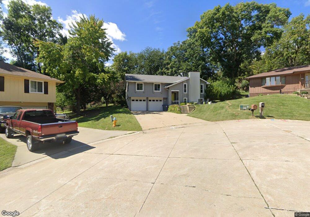
6 Decatur Cir Council Bluffs, IA 51503
Sherwood NeighborhoodEstimated Value: $306,355 - $339,000
3
Beds
3
Baths
1,861
Sq Ft
$175/Sq Ft
Est. Value
About This Home
This home is located at 6 Decatur Cir, Council Bluffs, IA 51503 and is currently estimated at $325,339, approximately $174 per square foot. 6 Decatur Cir is a home located in Pottawattamie County with nearby schools including College View Elementary School, Gerald W. Kirn Middle School, and Abraham Lincoln High School.
Ownership History
Date
Name
Owned For
Owner Type
Purchase Details
Closed on
Sep 29, 2010
Sold by
Pavik Nadine and Perry Betty
Bought by
Schulte Nicholas W and Schulte Meegan B
Current Estimated Value
Home Financials for this Owner
Home Financials are based on the most recent Mortgage that was taken out on this home.
Original Mortgage
$162,708
Outstanding Balance
$107,096
Interest Rate
4.3%
Mortgage Type
FHA
Estimated Equity
$218,243
Create a Home Valuation Report for This Property
The Home Valuation Report is an in-depth analysis detailing your home's value as well as a comparison with similar homes in the area
Home Values in the Area
Average Home Value in this Area
Purchase History
| Date | Buyer | Sale Price | Title Company |
|---|---|---|---|
| Schulte Nicholas W | $165,000 | None Available |
Source: Public Records
Mortgage History
| Date | Status | Borrower | Loan Amount |
|---|---|---|---|
| Open | Schulte Nicholas W | $162,708 |
Source: Public Records
Tax History Compared to Growth
Tax History
| Year | Tax Paid | Tax Assessment Tax Assessment Total Assessment is a certain percentage of the fair market value that is determined by local assessors to be the total taxable value of land and additions on the property. | Land | Improvement |
|---|---|---|---|---|
| 2025 | $4,810 | $279,500 | $49,400 | $230,100 |
| 2024 | $4,810 | $249,000 | $43,000 | $206,000 |
| 2023 | $4,756 | $249,000 | $43,000 | $206,000 |
| 2022 | $4,398 | $196,400 | $38,100 | $158,300 |
| 2021 | $6,743 | $196,400 | $38,100 | $158,300 |
| 2020 | $4,344 | $196,400 | $38,100 | $158,300 |
| 2019 | $4,504 | $183,700 | $32,900 | $150,800 |
| 2018 | $4,120 | $183,700 | $32,900 | $150,800 |
| 2017 | $4,170 | $172,035 | $29,576 | $142,459 |
| 2015 | $4,074 | $172,035 | $29,576 | $142,459 |
| 2014 | $4,108 | $172,035 | $29,576 | $142,459 |
Source: Public Records
Map
Nearby Homes
- 308 Arnold Ave
- 23 Wenwood Cir
- 1426 Mcpherson Ave
- 69 Wenwood Cir
- 37 Indian Hills Rd
- 28 Cooper Ave
- 176 Bennett Ave
- 180 Bennett Ave
- 206 Parkview Dr
- 305 Meadow Ln
- 16090 Crystal Ln
- 212 Woodcliff Cir
- 52 Gould Ave
- 200 Timber Dr
- 216 Morningside Ave
- 2526 Franklin Ave
- 310 Wildwood Rd
- 208 Red Bud Ln
- 1893 Hemlock St
- LOT 12 Mcpherson Ave