Estimated Value: $494,973 - $563,000
3
Beds
2
Baths
1,825
Sq Ft
$288/Sq Ft
Est. Value
About This Home
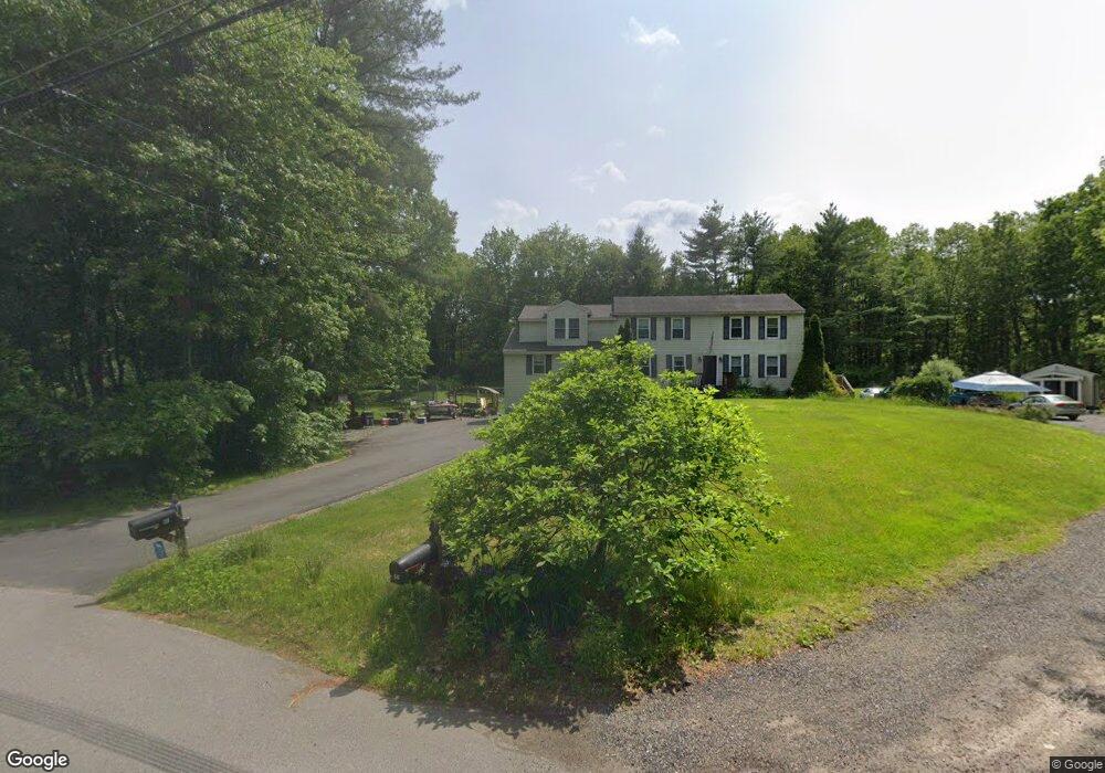
This home is located at 6 Desforge Ln Unit L, Derry, NH 03038 and is currently estimated at $526,493, approximately $288 per square foot. 6 Desforge Ln Unit L is a home located in Rockingham County with nearby schools including East Derry Memorial Elementary School, Gilbert H. Hood Middle School, and Pinkerton Academy.
Ownership History
Date
Name
Owned For
Owner Type
Purchase Details
Closed on
Oct 19, 2010
Sold by
Snyder Russ L and Snyder Annette A
Bought by
Durant Amanda and Mcmanus Jonathan
Current Estimated Value
Home Financials for this Owner
Home Financials are based on the most recent Mortgage that was taken out on this home.
Original Mortgage
$148,006
Outstanding Balance
$97,718
Interest Rate
4.36%
Mortgage Type
Purchase Money Mortgage
Estimated Equity
$428,775
Purchase Details
Closed on
Aug 5, 1996
Sold by
Evco Corp
Bought by
Snyder Russ L and Snyder Annette A
Home Financials for this Owner
Home Financials are based on the most recent Mortgage that was taken out on this home.
Original Mortgage
$109,900
Interest Rate
8.27%
Create a Home Valuation Report for This Property
The Home Valuation Report is an in-depth analysis detailing your home's value as well as a comparison with similar homes in the area
Home Values in the Area
Average Home Value in this Area
Purchase History
| Date | Buyer | Sale Price | Title Company |
|---|---|---|---|
| Durant Amanda | $150,000 | -- | |
| Snyder Russ L | $110,000 | -- |
Source: Public Records
Mortgage History
| Date | Status | Borrower | Loan Amount |
|---|---|---|---|
| Open | Snyder Russ L | $148,006 | |
| Previous Owner | Snyder Russ L | $109,900 |
Source: Public Records
Tax History Compared to Growth
Tax History
| Year | Tax Paid | Tax Assessment Tax Assessment Total Assessment is a certain percentage of the fair market value that is determined by local assessors to be the total taxable value of land and additions on the property. | Land | Improvement |
|---|---|---|---|---|
| 2024 | $7,300 | $390,600 | $0 | $390,600 |
| 2023 | $6,723 | $325,100 | $0 | $325,100 |
| 2022 | $6,190 | $325,100 | $0 | $325,100 |
| 2021 | $5,878 | $237,400 | $0 | $237,400 |
| 2020 | $5,778 | $237,400 | $0 | $237,400 |
| 2019 | $5,968 | $228,500 | $100,700 | $127,800 |
| 2018 | $5,948 | $228,500 | $100,700 | $127,800 |
| 2017 | $6,190 | $214,500 | $93,700 | $120,800 |
| 2016 | $5,396 | $199,400 | $93,700 | $105,700 |
| 2015 | $3,990 | $136,500 | $47,100 | $89,400 |
| 2014 | $4,016 | $136,500 | $47,100 | $89,400 |
| 2013 | $4,176 | $132,600 | $42,100 | $90,500 |
Source: Public Records
Map
Nearby Homes
- 7 Desforge Ln Unit R
- 4 Colony Brook Ln
- 12 Halls Village Rd
- 20 Richardson Dr Unit R
- 5 Sheldon Rd
- 45 Damren Rd
- 4 Sheldon Rd
- 2 Remington Ct
- 294.5 Hampstead Rd
- 648 Haverhill Rd
- 73 Drew Rd
- 37 Houstons Way
- 18 Lorri Rd
- 1 Cameron Ct Unit 1
- 3 Anna Cir
- 0 Jack Rd
- 12 Orchard Dr
- 87 Island Pond Rd
- 167 Chester Rd
- 183 Chester Rd
- 6 Desforge Ln Unit R
- 4 Desforge Ln
- 7 Desforge Ln Unit L
- 200 Hampstead Rd
- 5 Desforge Ln Unit R
- 5 Desforge Ln Unit L
- 5 Desforge Ln Unit 5L
- 5 Desforge Ln Unit Left
- 3 Desforge Ln
- 202 Hampstead Rd
- 204 Hampstead Rd
- 196 Hampstead Rd
- 2 Maurice Rd Unit R
- 2 Maurice Rd Unit L
- 2 Maurice Rd Unit 2L
- 2 Maurice Rd
- 4 Maurice Rd
- 1A Maurice Rd Unit 1A
- 1 Maurice Rd Unit R
- 1 Maurice Rd Unit L