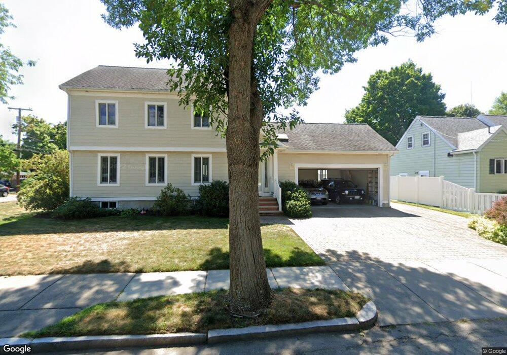
6 Elsworth Rd West Newton, MA 02465
West Newton NeighborhoodEstimated Value: $984,000 - $1,217,000
3
Beds
3
Baths
1,700
Sq Ft
$653/Sq Ft
Est. Value
About This Home
This home is located at 6 Elsworth Rd, West Newton, MA 02465 and is currently estimated at $1,110,712, approximately $653 per square foot. 6 Elsworth Rd is a home located in Middlesex County with nearby schools including Franklin Elementary School, F.A. Day Middle School, and Newton North High School.
Ownership History
Date
Name
Owned For
Owner Type
Purchase Details
Closed on
Jan 23, 2019
Sold by
Gutman Vadim and Goodman Vadim M
Bought by
Int Vadim M Goodman
Current Estimated Value
Purchase Details
Closed on
Apr 30, 1992
Sold by
Blouin David R
Bought by
Gutman Vadim and Gutman Louzhetskaia L
Purchase Details
Closed on
Jun 14, 1988
Sold by
Ransom Ft
Bought by
Blouin David R
Create a Home Valuation Report for This Property
The Home Valuation Report is an in-depth analysis detailing your home's value as well as a comparison with similar homes in the area
Home Values in the Area
Average Home Value in this Area
Purchase History
| Date | Buyer | Sale Price | Title Company |
|---|---|---|---|
| Int Vadim M Goodman | -- | -- | |
| Gutman Vadim | $148,000 | -- | |
| Blouin David R | $162,500 | -- |
Source: Public Records
Mortgage History
| Date | Status | Borrower | Loan Amount |
|---|---|---|---|
| Previous Owner | Blouin David R | $275,000 | |
| Previous Owner | Blouin David R | $280,000 |
Source: Public Records
Tax History Compared to Growth
Tax History
| Year | Tax Paid | Tax Assessment Tax Assessment Total Assessment is a certain percentage of the fair market value that is determined by local assessors to be the total taxable value of land and additions on the property. | Land | Improvement |
|---|---|---|---|---|
| 2025 | $10,280 | $1,049,000 | $753,800 | $295,200 |
| 2024 | $9,940 | $1,018,400 | $731,800 | $286,600 |
| 2023 | $9,479 | $931,100 | $550,900 | $380,200 |
| 2022 | $9,069 | $862,100 | $510,100 | $352,000 |
| 2021 | $8,751 | $813,300 | $481,200 | $332,100 |
| 2020 | $8,491 | $813,300 | $481,200 | $332,100 |
| 2019 | $8,251 | $789,600 | $467,200 | $322,400 |
| 2018 | $7,929 | $732,800 | $424,400 | $308,400 |
| 2017 | $7,687 | $691,300 | $400,400 | $290,900 |
| 2016 | $7,353 | $646,100 | $374,200 | $271,900 |
| 2015 | $7,010 | $603,800 | $349,700 | $254,100 |
Source: Public Records
Map
Nearby Homes
- 75 Cherry St
- 24 Tolman St Unit A
- 25 Tolman St Unit 2
- 162 Myrtle St Unit 1
- 76 Taft Ave Unit 1
- 76 Taft Ave
- 76 Taft Ave Unit 2
- 138 Myrtle St Unit 2
- 76 Harding St
- 56 Dearborn St
- 31-37 Washington Ave
- 308 Newton St Unit 1
- 44 Westland Ave
- 81 Alder St
- 39 Clinton St Unit 2
- 39 Clinton St Unit 1
- 287 Cherry St Unit 2
- 9 John St
- 41 Kilburn Rd
- 265-267 River St Unit 267
- 85 Falmouth Rd Unit no
- 85 Falmouth Rd
- 12 Elsworth Rd
- 73 Falmouth Rd
- 91 Falmouth Rd
- 9 Elsworth Rd
- 82 Falmouth Rd
- 16 Elsworth Rd
- 86 Falmouth Rd
- 69 Falmouth Rd
- 78 Falmouth Rd
- 11 Elsworth Rd
- 109 Falmouth Rd
- 101 Falmouth Rd
- 74 Falmouth Rd
- 94 Falmouth Rd
- 17 Elsworth Rd
- 20 Elsworth Rd
- 115 Falmouth Rd
- 70 Falmouth Rd