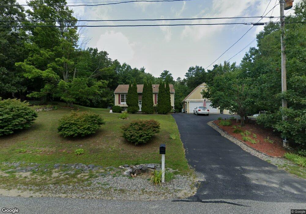
6 Feng Dr Raymond, NH 03077
Estimated Value: $448,000 - $509,000
2
Beds
3
Baths
858
Sq Ft
$543/Sq Ft
Est. Value
About This Home
This home is located at 6 Feng Dr, Raymond, NH 03077 and is currently estimated at $465,921, approximately $543 per square foot. 6 Feng Dr is a home located in Rockingham County with nearby schools including Lamprey River Elementary School, Iber Holmes Gove Middle School, and Raymond High School.
Ownership History
Date
Name
Owned For
Owner Type
Purchase Details
Closed on
Nov 18, 1996
Sold by
Fhlmc
Bought by
Bruscato David R and Bruscato Denise M
Current Estimated Value
Home Financials for this Owner
Home Financials are based on the most recent Mortgage that was taken out on this home.
Original Mortgage
$77,238
Interest Rate
7.99%
Purchase Details
Closed on
Jun 28, 1996
Sold by
Hopkins John W H
Bought by
Homeside Lending Inc
Create a Home Valuation Report for This Property
The Home Valuation Report is an in-depth analysis detailing your home's value as well as a comparison with similar homes in the area
Home Values in the Area
Average Home Value in this Area
Purchase History
| Date | Buyer | Sale Price | Title Company |
|---|---|---|---|
| Bruscato David R | $73,000 | -- | |
| Homeside Lending Inc | $79,000 | -- |
Source: Public Records
Mortgage History
| Date | Status | Borrower | Loan Amount |
|---|---|---|---|
| Open | Homeside Lending Inc | $220,000 | |
| Closed | Homeside Lending Inc | $77,238 |
Source: Public Records
Tax History Compared to Growth
Tax History
| Year | Tax Paid | Tax Assessment Tax Assessment Total Assessment is a certain percentage of the fair market value that is determined by local assessors to be the total taxable value of land and additions on the property. | Land | Improvement |
|---|---|---|---|---|
| 2024 | $6,623 | $302,300 | $119,800 | $182,500 |
| 2023 | $6,264 | $302,300 | $119,800 | $182,500 |
| 2022 | $5,529 | $302,300 | $119,800 | $182,500 |
| 2021 | $5,596 | $302,300 | $119,800 | $182,500 |
| 2020 | $8,655 | $226,300 | $86,300 | $140,000 |
| 2019 | $4,349 | $226,300 | $86,300 | $140,000 |
| 2018 | $5,528 | $226,300 | $86,300 | $140,000 |
| 2017 | $5,372 | $226,300 | $86,300 | $140,000 |
| 2016 | $5,372 | $226,300 | $86,300 | $140,000 |
| 2015 | $5,011 | $199,800 | $78,200 | $121,600 |
| 2014 | $4,861 | $199,800 | $78,200 | $121,600 |
| 2013 | $4,723 | $199,800 | $78,200 | $121,600 |
Source: Public Records
Map
Nearby Homes
- 24 Kendall Ln
- 15 Sargent Dr
- 28 Blackstone Dr
- 57 Blackstone Dr
- 16 Saddle Path Rd
- 8 Sherman Dr
- 0 Lane Rd Unit 39
- 7 Merrick Rd
- 15 Bald Hill Rd
- 7 Bald Hill Rd
- 19 Bald Hill Rd
- 40 Bald Hill Rd
- 0 Eastside Dr
- 29 Batchelder Rd
- 202 Route 27 Unit 36
- 189 Route 27
- 297 Crowley Rd
- 3 Lincoln Dr
- 3 Mica Dr Unit 1
- 53 Barberry Ln