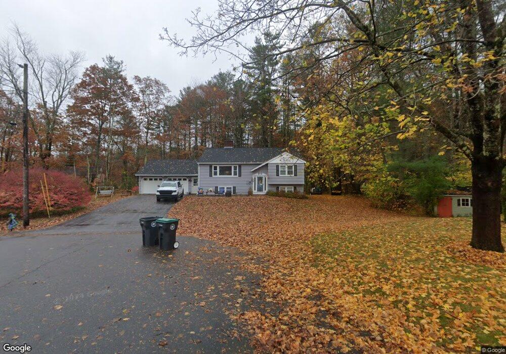
6 Forest Ln Kennebunk, ME 04043
Estimated Value: $414,000 - $517,000
3
Beds
2
Baths
1,204
Sq Ft
$400/Sq Ft
Est. Value
About This Home
This home is located at 6 Forest Ln, Kennebunk, ME 04043 and is currently estimated at $481,597, approximately $399 per square foot. 6 Forest Ln is a home located in York County with nearby schools including Kennebunk High School, School Around Us, and The New School.
Ownership History
Date
Name
Owned For
Owner Type
Purchase Details
Closed on
Mar 7, 2025
Sold by
Lepage Albert A and Lepage Diane M
Bought by
Lepage Peter A and Lepage Amy L
Current Estimated Value
Purchase Details
Closed on
Aug 4, 2023
Sold by
Porter Land Preserv Llc
Bought by
Guilford Matthew and Guilford Rayne
Purchase Details
Closed on
Jun 12, 2015
Sold by
Bennett Joan C
Bought by
Keville Nicolyn B and Bennett Susan M
Create a Home Valuation Report for This Property
The Home Valuation Report is an in-depth analysis detailing your home's value as well as a comparison with similar homes in the area
Home Values in the Area
Average Home Value in this Area
Purchase History
| Date | Buyer | Sale Price | Title Company |
|---|---|---|---|
| Lepage Peter A | -- | None Available | |
| Lepage Peter A | -- | None Available | |
| Lepage Peter A | -- | None Available | |
| Guilford Matthew | $290,000 | None Available | |
| Guilford Matthew | $290,000 | None Available | |
| Guilford Matthew | $290,000 | None Available | |
| Keville Nicolyn B | -- | -- | |
| Keville Nicolyn B | -- | -- |
Source: Public Records
Tax History
| Year | Tax Paid | Tax Assessment Tax Assessment Total Assessment is a certain percentage of the fair market value that is determined by local assessors to be the total taxable value of land and additions on the property. | Land | Improvement |
|---|---|---|---|---|
| 2024 | $4,877 | $287,700 | $92,100 | $195,600 |
| 2023 | $4,618 | $287,700 | $92,100 | $195,600 |
| 2022 | $4,200 | $287,700 | $92,100 | $195,600 |
| 2021 | $4,100 | $287,700 | $92,100 | $195,600 |
| 2020 | $4,071 | $287,700 | $92,100 | $195,600 |
| 2019 | $3,956 | $287,700 | $92,100 | $195,600 |
| 2018 | $368 | $215,800 | $69,100 | $146,700 |
| 2017 | $369 | $215,800 | $69,100 | $146,700 |
| 2016 | $3,431 | $215,800 | $69,100 | $146,700 |
| 2015 | $3,069 | $215,800 | $69,100 | $146,700 |
| 2014 | $2,989 | $215,800 | $69,100 | $146,700 |
Source: Public Records
Map
Nearby Homes
- 24 Cat Mousam Rd
- 2 Cross St
- 17 Legacy Ln
- 30 York St Unit 1
- 59 Plymouth Grove Unit 11
- 61 Fletcher St
- 15 Casey Ln
- 22 Winchester Ct
- 16 Oakwood Ln Unit 16
- Lot 2 Creekside Ct Unit 2
- 60 Brown St Unit 2
- 22 Oakwood Ln
- 17 Hampton Glen Dr Unit 5
- 14 Lawrence Ln
- 4 Cider Mill Ln
- 6 Dunnhill Dr Unit 28
- 23 Lilac Ln
- 4 Conservation Dr
- 18 Longwood Dr
- 10 Chickadee Ln
- 4 Forest Ln
- 5 Forest Ln
- 50 Cat Mousam Rd
- 2 Forest Ln
- 2 Forest Hill
- 1 Forest Ln
- 7 Forest Ln
- 56 Cat Mousam Rd
- Map 56 Lot Cat Mousam Rd
- 60 Cat Mousam Rd
- 2 Sylvan Cir
- 54 Cat Mousam Rd
- 8 Hidden Ln
- 48 Cat Mousam Rd
- 8 Sylvan Cir
- 5 Sylvan Cir
- 121 Cat Mousam Rd
- 30 Cat Mousam Rd
- 30-40 Cat Mousam Rd
- 5 Hidden Lane (Off Sylvan Cir
Your Personal Tour Guide
Ask me questions while you tour the home.