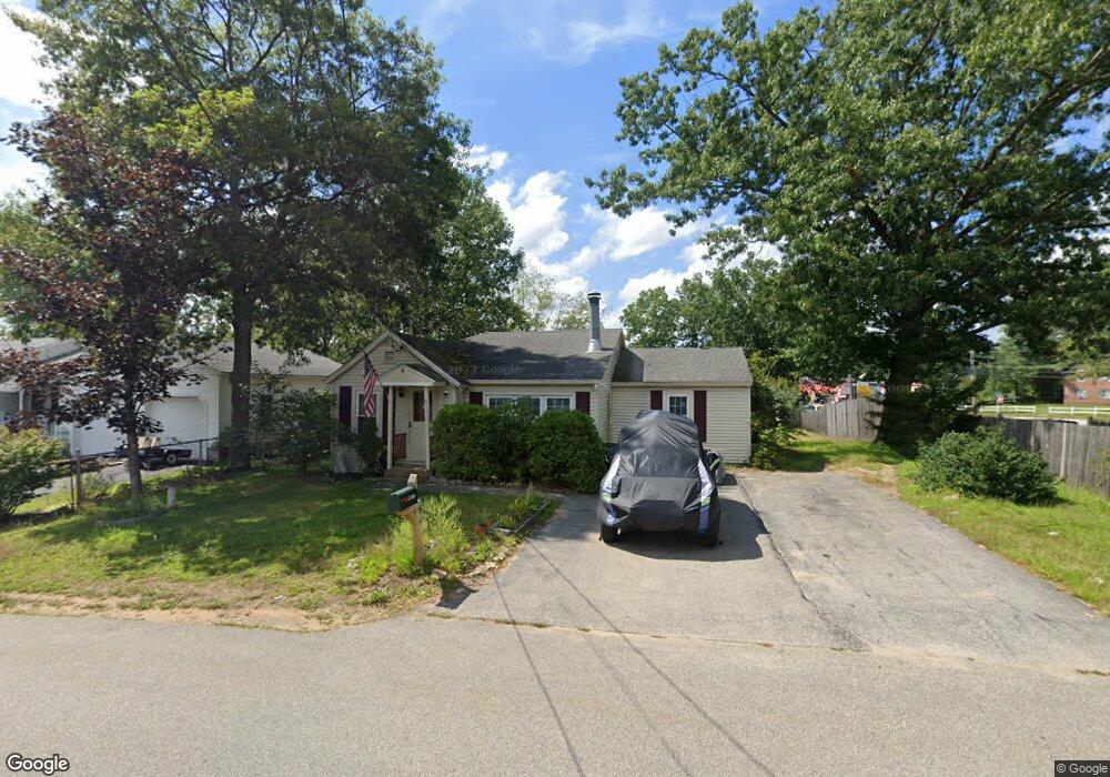
6 Gates St Concord, NH 03301
Concord Heights NeighborhoodEstimated Value: $371,000 - $542,000
2
Beds
1
Bath
1,132
Sq Ft
$388/Sq Ft
Est. Value
About This Home
This home is located at 6 Gates St, Concord, NH 03301 and is currently estimated at $439,439, approximately $388 per square foot. 6 Gates St is a home located in Merrimack County with nearby schools including Broken Ground School, Rundlett Middle School, and Concord High School.
Ownership History
Date
Name
Owned For
Owner Type
Purchase Details
Closed on
Oct 22, 2024
Sold by
Arnold Thomas D and Arnold Cynthia G
Bought by
Bad Af Llc
Current Estimated Value
Home Financials for this Owner
Home Financials are based on the most recent Mortgage that was taken out on this home.
Original Mortgage
$671,250
Outstanding Balance
$664,193
Interest Rate
6.35%
Mortgage Type
New Conventional
Estimated Equity
-$224,754
Purchase Details
Closed on
Nov 3, 2008
Sold by
Chamberlain Mark S
Bought by
Arnold Thomas D and Arnold Cynthia G
Home Financials for this Owner
Home Financials are based on the most recent Mortgage that was taken out on this home.
Original Mortgage
$116,250
Interest Rate
5.83%
Mortgage Type
Purchase Money Mortgage
Purchase Details
Closed on
Sep 19, 2001
Sold by
Hawks Carol J
Bought by
Chamberlain Mark S
Home Financials for this Owner
Home Financials are based on the most recent Mortgage that was taken out on this home.
Original Mortgage
$100,000
Interest Rate
6.98%
Mortgage Type
Purchase Money Mortgage
Create a Home Valuation Report for This Property
The Home Valuation Report is an in-depth analysis detailing your home's value as well as a comparison with similar homes in the area
Home Values in the Area
Average Home Value in this Area
Purchase History
| Date | Buyer | Sale Price | Title Company |
|---|---|---|---|
| Bad Af Llc | $545,000 | None Available | |
| Bad Af Llc | $545,000 | None Available | |
| Arnold Thomas D | $155,000 | -- | |
| Arnold Thomas D | $155,000 | -- | |
| Chamberlain Mark S | $105,000 | -- | |
| Chamberlain Mark S | $105,000 | -- |
Source: Public Records
Mortgage History
| Date | Status | Borrower | Loan Amount |
|---|---|---|---|
| Open | Bad Af Llc | $671,250 | |
| Closed | Bad Af Llc | $671,250 | |
| Previous Owner | Chamberlain Mark S | $116,250 | |
| Previous Owner | Chamberlain Mark S | $100,000 |
Source: Public Records
Tax History Compared to Growth
Tax History
| Year | Tax Paid | Tax Assessment Tax Assessment Total Assessment is a certain percentage of the fair market value that is determined by local assessors to be the total taxable value of land and additions on the property. | Land | Improvement |
|---|---|---|---|---|
| 2024 | $6,571 | $237,300 | $112,700 | $124,600 |
| 2023 | $6,374 | $237,300 | $112,700 | $124,600 |
| 2022 | $6,144 | $237,300 | $112,700 | $124,600 |
| 2021 | $5,961 | $237,300 | $112,700 | $124,600 |
| 2020 | $5,494 | $205,300 | $82,700 | $122,600 |
| 2019 | $5,434 | $195,600 | $81,400 | $114,200 |
| 2018 | $5,077 | $180,100 | $78,100 | $102,000 |
| 2017 | $4,606 | $163,100 | $74,700 | $88,400 |
| 2016 | $4,460 | $161,200 | $74,700 | $86,500 |
| 2015 | $4,123 | $151,000 | $74,700 | $76,300 |
| 2014 | $4,048 | $151,000 | $74,700 | $76,300 |
| 2013 | -- | $149,200 | $74,700 | $74,500 |
| 2012 | -- | $148,400 | $74,700 | $73,700 |
Source: Public Records
Map
Nearby Homes
- 13 Ellsworth St
- 12 E Side Dr Unit 4-13
- 43 Branch Turnpike
- 50 Branch Turnpike
- 32 E Side Dr
- 59 Branch Turnpike
- 17 Burns Ave Unit 2
- 24 Cricket Ln
- 1 Guay St
- 8 NE Village Rd
- 6 Heights Rd
- 4 Venne Cir
- 6 Lawrence Street Extension
- 294 Portsmouth St
- 19 Grappone Dr
- 33 Mulberry St Unit 2
- 15 Bridle Path Trail
- 9 Strawberry Ln
- 7 Highridge Trail
- 69 Manchester St Unit Lot 18
- 10 Gates St
- 5 Ellsworth St
- 12 Gates St
- 3 Gates St
- 7 Ellsworth St
- 11 Gates St
- 160 Loudon Rd
- 6 Ellsworth St
- 173 Loudon Rd Unit 61
- 173 Loudon Rd Unit 412
- 173 Loudon Rd Unit 411
- 173 Loudon Rd Unit 410
- 173 Loudon Rd Unit 49
- 173 Loudon Rd Unit 48
- 173 Loudon Rd Unit 47
- 173 Loudon Rd Unit 46
- 173 Loudon Rd Unit 45
- 173 Loudon Rd Unit 44
- 173 Loudon Rd Unit 43
- 173 Loudon Rd Unit 42