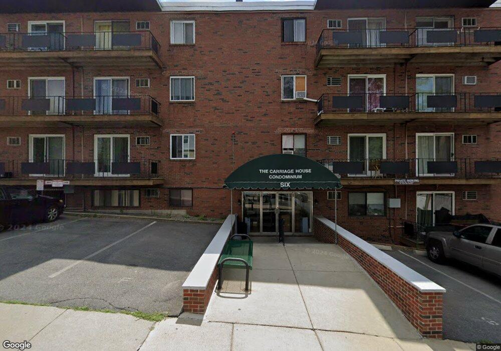
6 Hayes Rd Unit 12A Roslindale, MA 02131
Roslindale NeighborhoodEstimated Value: $290,937 - $410,000
1
Bed
1
Bath
695
Sq Ft
$478/Sq Ft
Est. Value
About This Home
This home is located at 6 Hayes Rd Unit 12A, Roslindale, MA 02131 and is currently estimated at $332,312, approximately $478 per square foot. 6 Hayes Rd Unit 12A is a home located in Suffolk County with nearby schools including Brooke Charter School Roslindale, Sacred Heart STEM School, and St. Clare High School.
Ownership History
Date
Name
Owned For
Owner Type
Purchase Details
Closed on
Oct 25, 2018
Sold by
Tsekeris James A
Bought by
Kazaka John M
Current Estimated Value
Purchase Details
Closed on
Jun 25, 1992
Sold by
Federal Home Loan Mortgage Corporation
Bought by
Tsekeris James A
Home Financials for this Owner
Home Financials are based on the most recent Mortgage that was taken out on this home.
Original Mortgage
$20,909
Interest Rate
8.57%
Mortgage Type
Purchase Money Mortgage
Purchase Details
Closed on
Feb 26, 1992
Sold by
Glezil Jean A
Bought by
Fhlmc
Create a Home Valuation Report for This Property
The Home Valuation Report is an in-depth analysis detailing your home's value as well as a comparison with similar homes in the area
Home Values in the Area
Average Home Value in this Area
Purchase History
| Date | Buyer | Sale Price | Title Company |
|---|---|---|---|
| Kazaka John M | $165,000 | -- | |
| Tsekeris James A | $29,870 | -- | |
| Fhlmc | $72,582 | -- |
Source: Public Records
Mortgage History
| Date | Status | Borrower | Loan Amount |
|---|---|---|---|
| Previous Owner | Fhlmc | $20,909 |
Source: Public Records
Tax History Compared to Growth
Tax History
| Year | Tax Paid | Tax Assessment Tax Assessment Total Assessment is a certain percentage of the fair market value that is determined by local assessors to be the total taxable value of land and additions on the property. | Land | Improvement |
|---|---|---|---|---|
| 2025 | $2,215 | $191,300 | $0 | $191,300 |
| 2024 | $2,355 | $216,100 | $0 | $216,100 |
| 2023 | $2,275 | $211,800 | $0 | $211,800 |
| 2022 | $2,975 | $273,400 | $0 | $273,400 |
| 2021 | $2,860 | $268,000 | $0 | $268,000 |
| 2020 | $1,701 | $161,100 | $0 | $161,100 |
| 2019 | $1,618 | $153,500 | $0 | $153,500 |
| 2018 | $1,532 | $146,200 | $0 | $146,200 |
| 2017 | $1,474 | $139,200 | $0 | $139,200 |
| 2016 | $1,405 | $127,700 | $0 | $127,700 |
| 2015 | $1,577 | $130,200 | $0 | $130,200 |
| 2014 | $1,618 | $128,600 | $0 | $128,600 |
Source: Public Records
Map
Nearby Homes
- 142 Birch St Unit 1
- 142 Birch St
- 142 Birch St Unit 2
- 112 Roslindale Ave Unit 2
- 80 Roslindale Ave Unit 3
- 55 Metropolitan Ave
- 0 Averton St
- 65 Birch St Unit 3
- 34 Averton St
- 46 Belgrade Ave Unit 2
- 17 Metcalf St
- 103 Belgrade Ave Unit 2
- 142 Metropolitan Ave Unit A
- 25 Crandall St
- 18 Robert St Unit 4
- 276 Cornell St
- 5 7 Hemman St
- 15 S Fairview St Unit 3
- 67 Cummins Hwy Unit 101
- 250 Poplar St Unit 1
- 6 Hayes Rd Unit 5a
- 6 Hayes Rd Unit 32
- 6 Hayes Rd Unit 31
- 6 Hayes Rd Unit 30
- 6 Hayes Rd Unit 29
- 6 Hayes Rd Unit 28
- 6 Hayes Rd Unit 27
- 6 Hayes Rd Unit 26
- 6 Hayes Rd Unit 25
- 6 Hayes Rd Unit 24
- 6 Hayes Rd Unit 23
- 6 Hayes Rd Unit 22
- 6 Hayes Rd Unit 21
- 6 Hayes Rd Unit 20
- 6 Hayes Rd Unit 19
- 6 Hayes Rd Unit 18
- 6 Hayes Rd Unit 17
- 6 Hayes Rd Unit 16
- 6 Hayes Rd Unit 15
- 6 Hayes Rd Unit 14