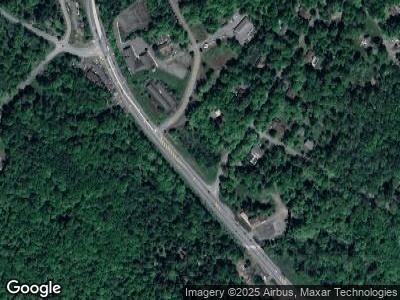
6 Hc 1 Scotrun, PA 18355
Estimated Value: $221,000 - $343,000
4
Beds
1
Bath
1,160
Sq Ft
$237/Sq Ft
Est. Value
About This Home
This home is located at 6 Hc 1, Scotrun, PA 18355 and is currently estimated at $274,407, approximately $236 per square foot. 6 Hc 1 is a home located in Monroe County with nearby schools including Swiftwater Interm School, Swiftwater Elementary Center, and Pocono Mountain East Junior High School.
Ownership History
Date
Name
Owned For
Owner Type
Purchase Details
Closed on
Feb 21, 2020
Sold by
Ortega Maria Elena Andrade
Bought by
Vinueza Jaime
Current Estimated Value
Purchase Details
Closed on
Apr 11, 2018
Sold by
Federal Home Loan Mortgage Corporation
Bought by
Ortega Maria Elena Andrade
Purchase Details
Closed on
Dec 28, 2017
Sold by
Pfeuffer Helen W
Bought by
Martin Todd A
Purchase Details
Closed on
Aug 23, 1995
Bought by
Pfeuffer Helen Widdoss
Create a Home Valuation Report for This Property
The Home Valuation Report is an in-depth analysis detailing your home's value as well as a comparison with similar homes in the area
Home Values in the Area
Average Home Value in this Area
Purchase History
| Date | Buyer | Sale Price | Title Company |
|---|---|---|---|
| Vinueza Jaime | $10,000 | Keystone Premier Setmnt Svcs | |
| Ortega Maria Elena Andrade | $39,000 | None Available | |
| Martin Todd A | $1,802 | None Available | |
| Pfeuffer Helen Widdoss | -- | -- |
Source: Public Records
Mortgage History
| Date | Status | Borrower | Loan Amount |
|---|---|---|---|
| Previous Owner | Skytop Lodge Corporation | $285,000 | |
| Previous Owner | Skytop Lodge Corporation | $3,700,000 |
Source: Public Records
Tax History Compared to Growth
Tax History
| Year | Tax Paid | Tax Assessment Tax Assessment Total Assessment is a certain percentage of the fair market value that is determined by local assessors to be the total taxable value of land and additions on the property. | Land | Improvement |
|---|---|---|---|---|
| 2024 | $1,079 | $138,410 | $28,280 | $110,130 |
| 2023 | $3,761 | $138,410 | $28,280 | $110,130 |
| 2022 | $3,561 | $138,410 | $28,280 | $110,130 |
| 2021 | $3,524 | $138,410 | $28,280 | $110,130 |
| 2020 | $3,552 | $138,410 | $28,280 | $110,130 |
| 2019 | $2,200 | $12,660 | $4,140 | $8,520 |
| 2018 | $2,200 | $12,660 | $4,140 | $8,520 |
| 2017 | $2,225 | $12,660 | $4,140 | $8,520 |
| 2016 | $487 | $12,660 | $4,140 | $8,520 |
| 2015 | -- | $12,660 | $4,140 | $8,520 |
| 2014 | -- | $12,660 | $4,140 | $8,520 |
Source: Public Records
Map
Nearby Homes
- 127 Pine Cone Trail
- 0 Big Hill Path
- 250 Big Hill Path
- 1474 Sullivan Trail
- 125 Clearview Dr
- 129 Dogwood Trail
- 226 Buck Fever Trail
- 9 Sky Hawk Trail
- 227 Image Dr
- 158 Buck Fever Trail
- 263 Buck Fever Trail
- 232 Image Dr
- 0 Sullivan Trail Unit PM-118582
- 143 T Bar Trail
- 0 Sky Hawk
- lot 11 Dyson Rd
- 3243 Birch Hill Dr
- 0 T 578 Unit PM-130218
- 0 T 578 Unit 753346
- 3422 Buck Run
